Click on each picture to enlarge it.
At the beginning of April, my travel plans were complete. I was ready to book a ten-day stay for the following week at the C&C Club at Devizes in Wiltshire. But then on the Friday afternoon – there was a phone call! – Could I come into hospital next Tuesday to have a new pacemaker fitted? Since a driving ban came with the new device, plans to go away had to be put on hold. However, towards the end of the month, I was feeling confident enough to pack up the caravan. My arrival date was the 23rd. The site was just over 100 miles away and as check-in was one hour after mid-day, there was no need for an early start.. Within eight miles of setting off, I’d reached the M25 and as expected for a Saturday out of the holiday season, the motorway was busy, but flowing well. Ten minutes later, and I arrived at the turn for the M3. The route followed the M3 for 33 miles when it continued along the A303. Just before Stonehenge, I arrived at Solstice Services with its Coop supermarket and filling station, plus several fast-food spots. As usual when driving this route, I pulled in for an early lunch. At the next roundabout, I left the A303 and took the A345/A342 across Salisbury Plain., arriving at the site after 30 miles. Payment and check-in had already been done online, so it was just a matter of receiving from the receptionist the barrier code and instructions to follow the warden’s bike to my designated pitch.
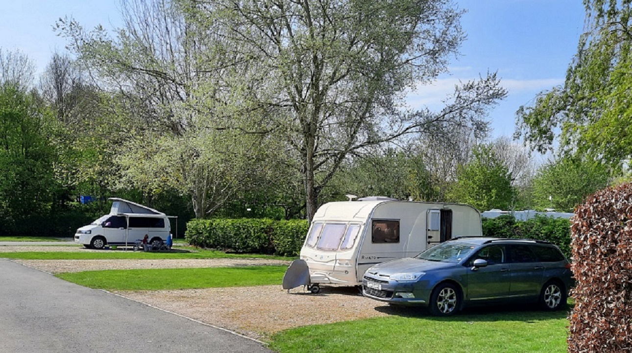
This was my pitch.
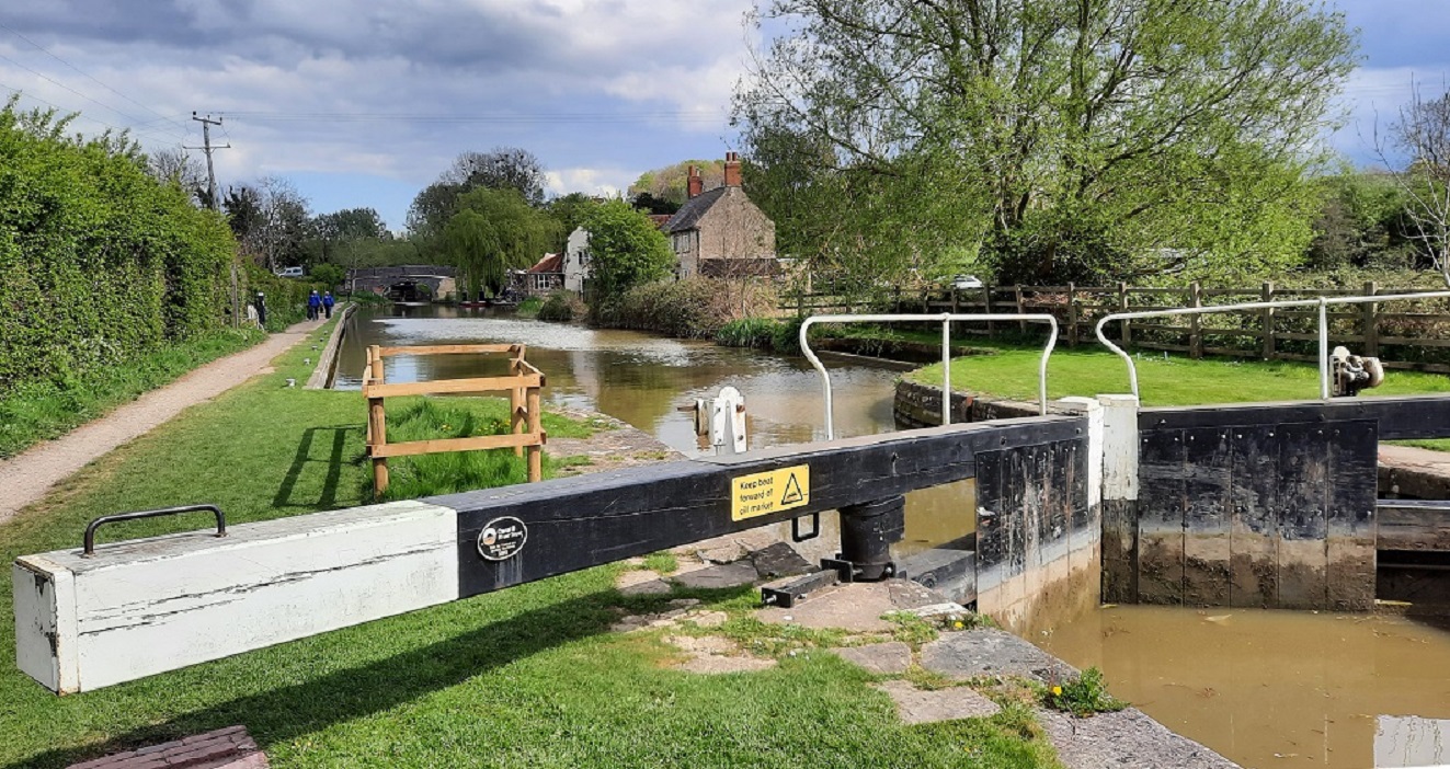
The site is a large one, made up of mainly hard standing pitches around the perimeter, whilst there are also pitches in groups of six or eight, surrounded by high hedges. Other pitches are on grass in more open spaces. There’s a choice of pitch with or without electricity. In spite of its size, there is only one toilet block, which is clean and modern and where also the chemical disposal is situated. Water points are more frequent, with rubbish disposal close to the entrance, in an enclosed area,. At reception, there’s a small shop stocking essentials and a notice telling of a visiting ‘chippie’ every Wednesday & Saturday nights.
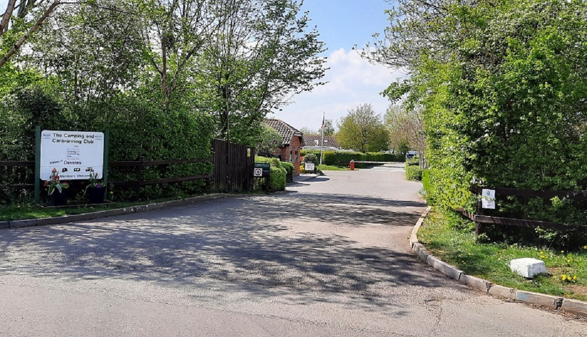
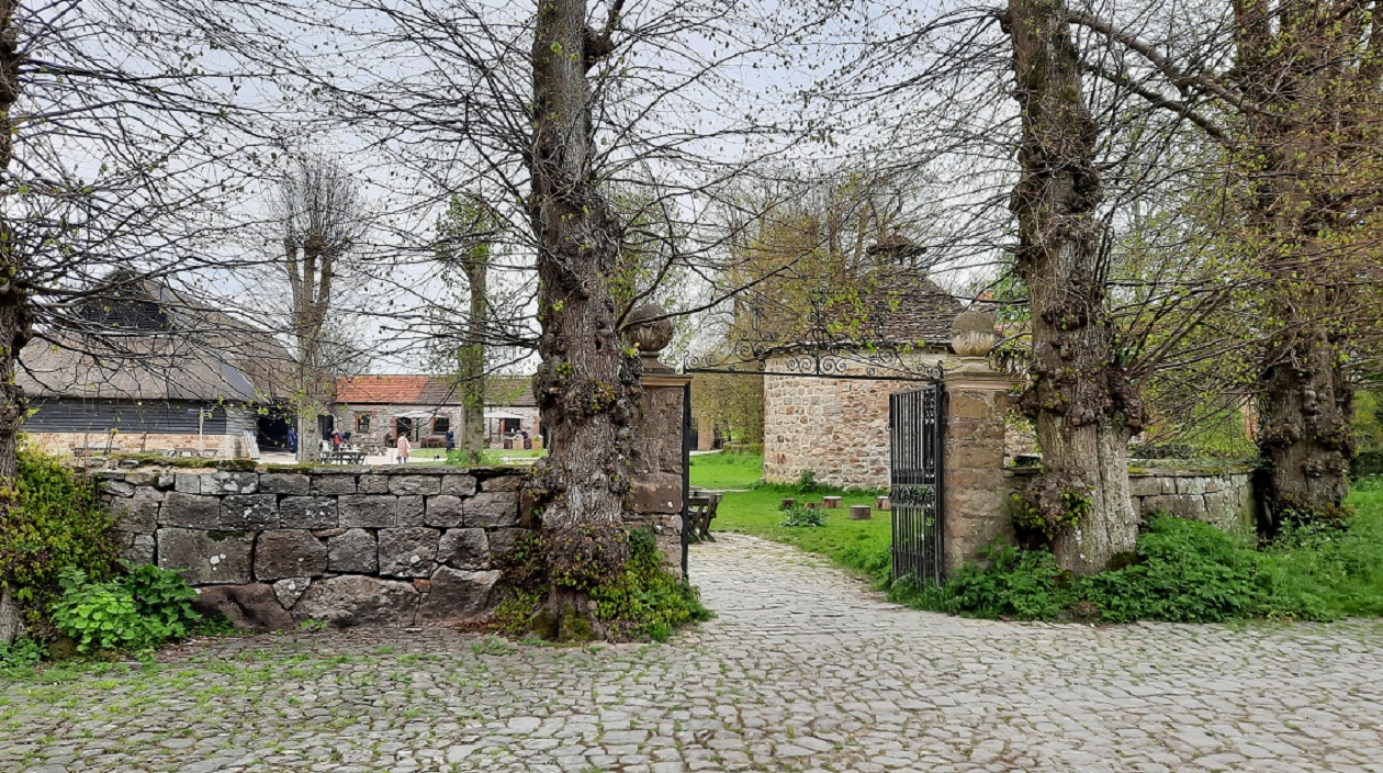
The entrance to the site.
The nearest town is Devizes which is some four miles distant where there is a Morrisons and a Sainsbury Supermarket. In the other direction is Melksham where there’s a Tesco, Asda and Sainsbury supermarket. A couple of hundred yards along the road is the attractive Three Magpies Inn. For me, the great attraction of the site was its position with the Kennet & Avon Canal just over the boundary hedge..
0-0-0-0-0-0-0-0-0-0-0-0-0-0-0
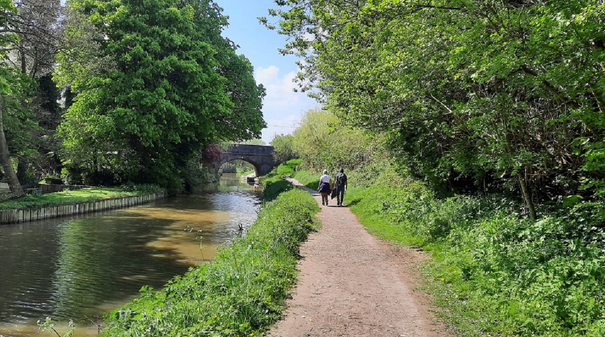
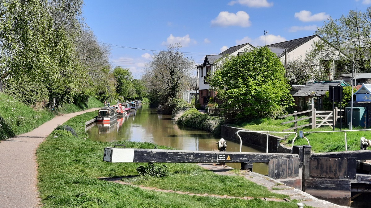
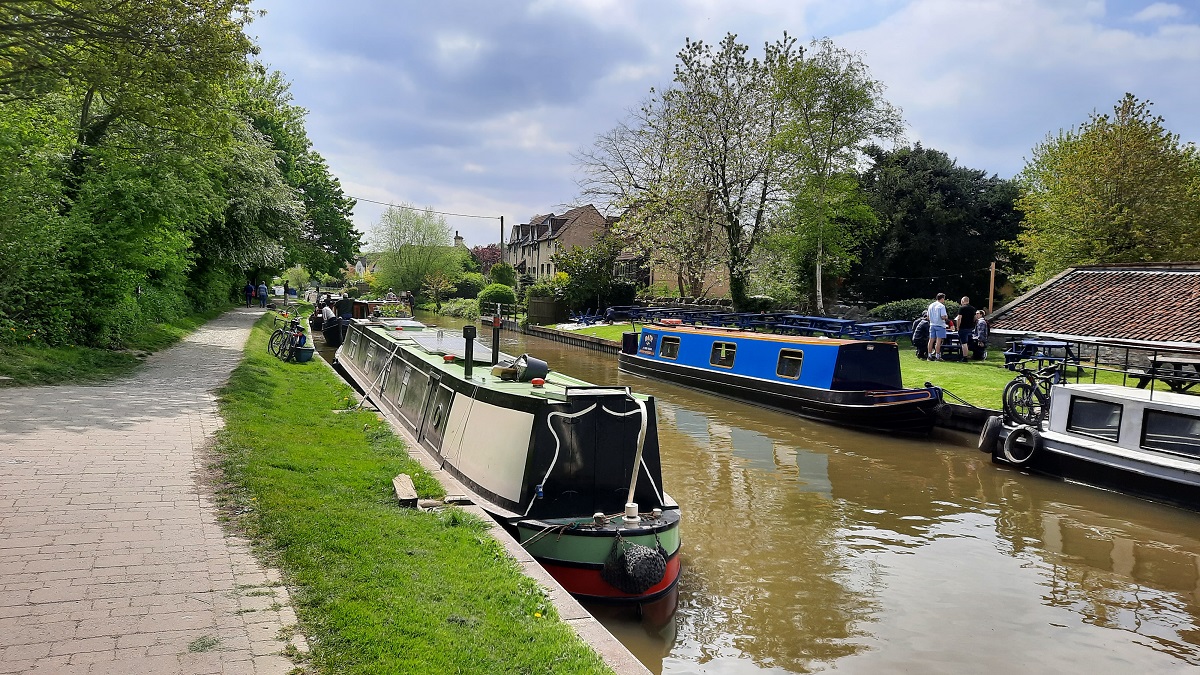
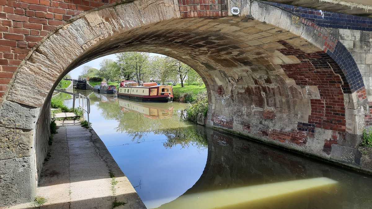
What a joy it was to see some sunshine and a blue sky on that first morning. After the usual jobs were completed, I prepared a packed lunch, unloaded my bike from the car and prepared to set off along the tow-path towards Devizes. The lie of the land is such that Devizes is 240 feet higher than the area around the site, consequently, there is a need for locks. In fact, there are twenty-nine of them over a four-mile stretch of canal. Fifteen of them are close together taking boats up the slope of Caen Hill. This stretch of canal was built during the early 1800s. What a tedious method of transporting goods it must have been. What is now an eight-minute drive by road, in the days of canal transport, the four miles took the better part of a day to complete. Locks are very extravagant with water. Several locks together can soon deplete the water supply further up the canal. Some means must be devised to return the water back to the higher ground. At Caen Hill, they rely on an electric pump. Since 2012 the pump has been mainly supplied by a bank of solar panels.
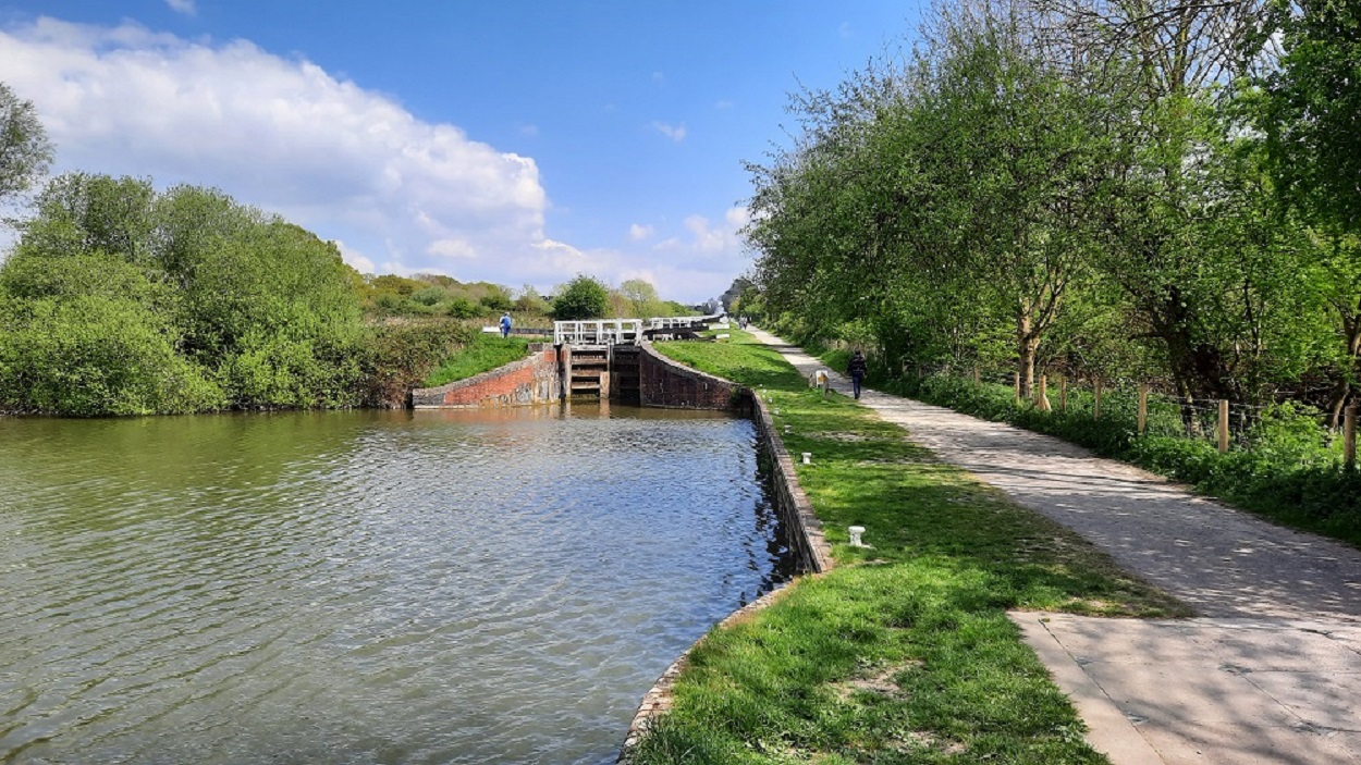
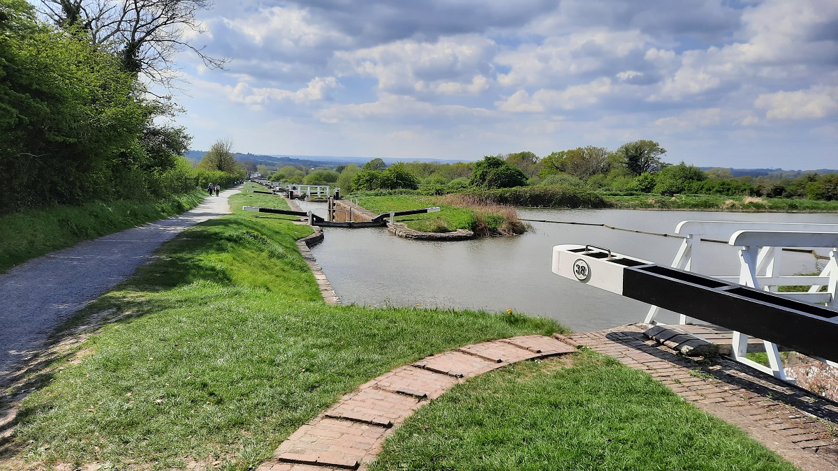
Views of the canal at Caen Locks.
With it being a beautiful Sunday afternoon, I expected the towpath to be busy with walkers. But not so! There were very few people about. Not until I reached the Caen flight did I meet the crowds making use of the adjacent car park and the Black Horse Inn where Sunday lunches were being served in the gardens on the canal banks. After spending a pleasant half-hour or so watching the boating activities, I retraced my route back to the site. I had ridden six miles.
0-0-0-0-0-0-0-0-0-0-0-0-0-0-0
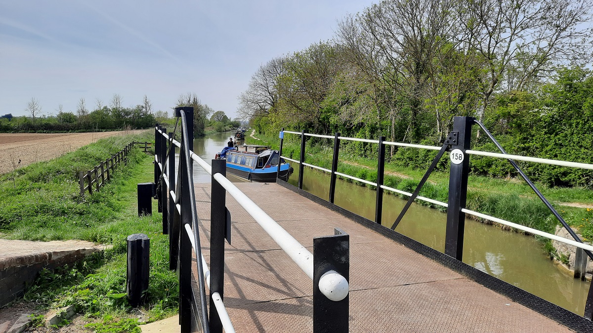
The good weather seemed set to continue, so from the site, I headed up to the canal bridge and got my bike down onto the tow path again. Today, I decided to take the tow path in the opposite direction. For the next three or four miles, the land was much flatter than yesterday’s ride, tor today, I passed just three sets of locks.
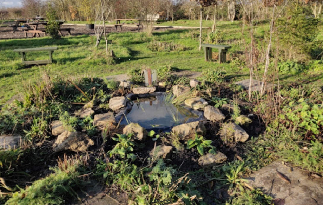
A peaceful spot built from a patch of scrubland by some kindly local residents.
After riding for three miles or so, I arrived at a swing bridge and footpath crossing the canal and heading towards a village that the Google map said was Bowerhill. Just behind the tow-path hedge, a group of local residents had volunteered their time to build, out of what had been a piece of scrubland, a lovely area laid out with picnic benches, shrubs, small ponds and trees where walkers and boaters could picnic and relax.
After enjoying the peaceful surroundings for a while, I returned along the tow path to the site. I’d ridden another six miles.
0-0-0-0-0-0-0-0-0-0-0-0-0-0-0
I spent the morning sitting out in the sunshine on a sun-lounger enjoying some Ken Follett. After lunch, I got on the bike. Again I cycled along the tow path to the first road bridge. From there, I took to the lovely, quiet country lanes, completing a circular ride, through the village and back to the site.
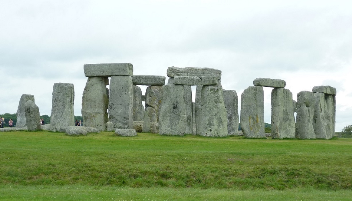
A change in the weather today! The blue skies of the last few days had disappeared; to be replaced by heavy cloud. Which was a pity; for I had made an online booking to visit Stonehenge. It was an eighteen-mile cross country route which got me to the visitors’ centre car park by 10.30. As soon as I stepped from the car, I realized I was wearing the wrong gear. There was a fierce, cold wind blowing across the Plain. I headed for the comparatively new visitor & information centre. Modern technology is uncovering more and more previously unknown facts about this site which has been in existence here for more than 5500 years. The car park and visitors’ centre is situated about a mile away from the monument.
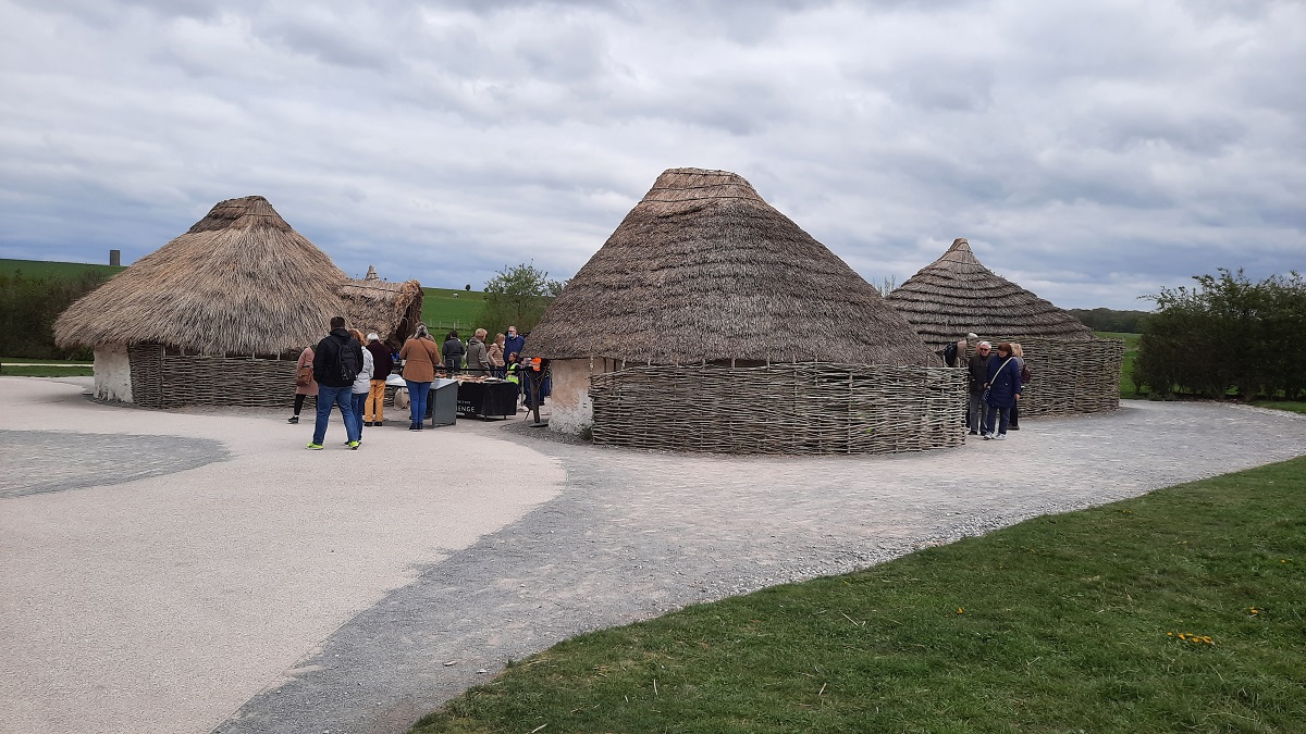
Some houses built in the style of the Bronze Age builders.
A view of the Stones at Stonehenge.
In view of today’s poor weather, I decided to abandon the rest of my itinerary, and replace it with a trip to the supermarket for some essential shopping.
0-0-0-0-0-0-0-0-0-0-0-0-0-0-0
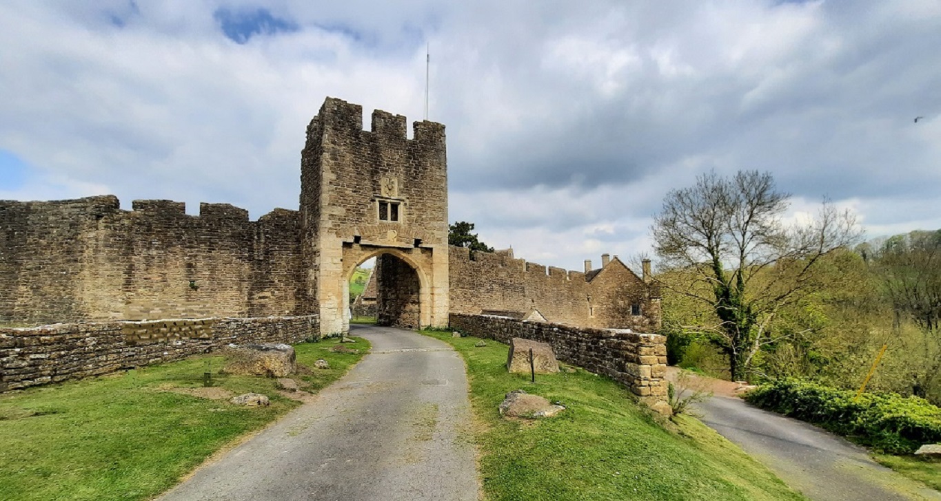
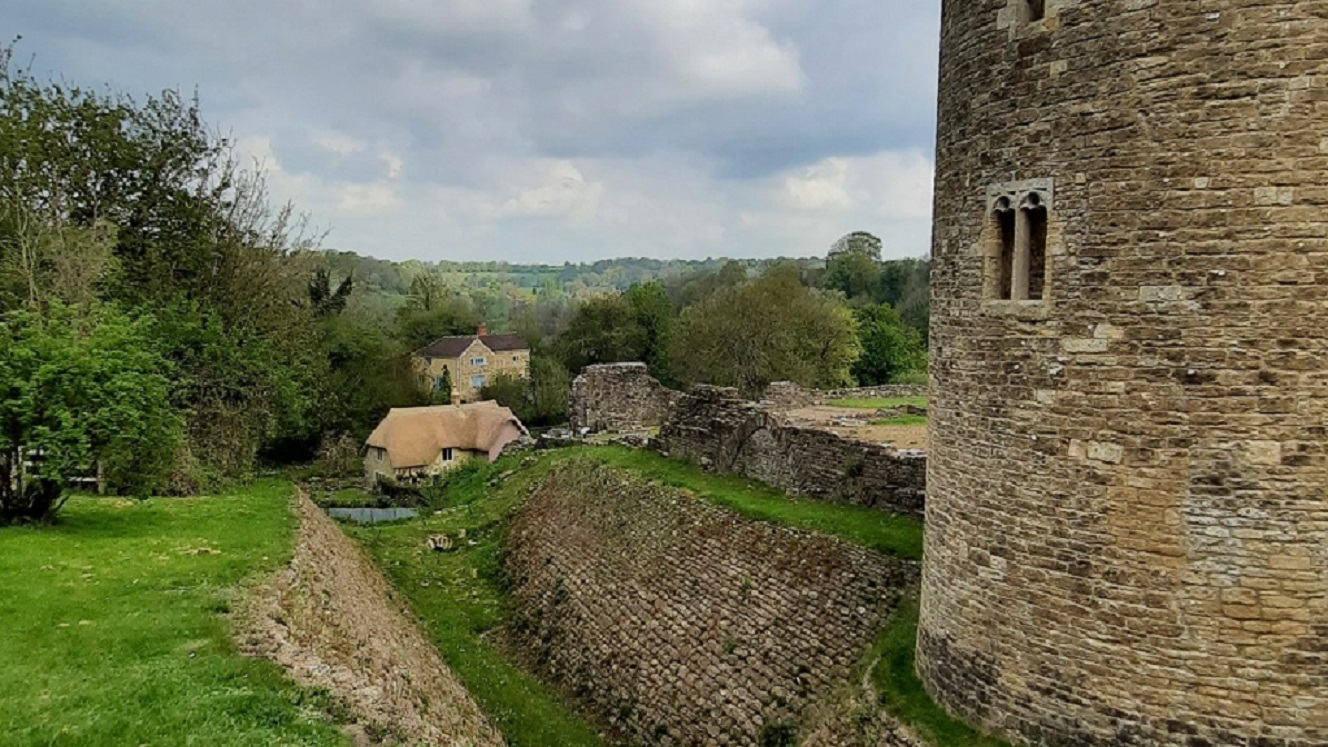
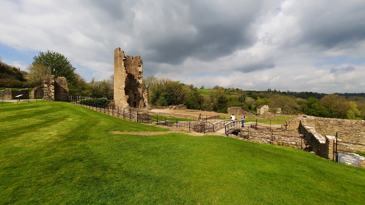
I had another English Heritage booking organized for today. I’d arranged to visit the Castle at Farleigh Hungerford – a drive of about twelve miles over the border into Somerset.
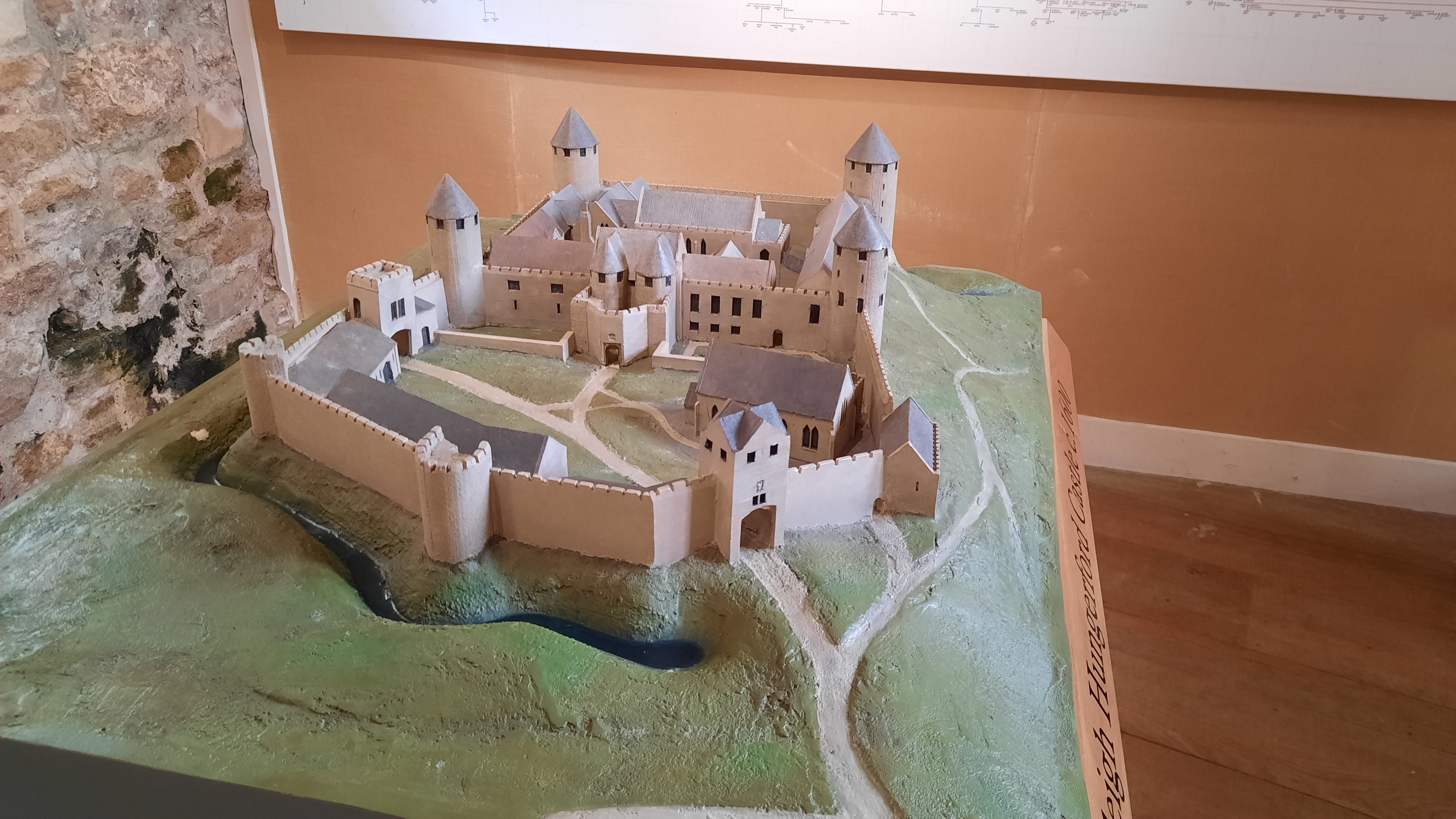
How the Castle might have looked during the time it was in use.
The building of the Castle commenced in the 14th Century and it was more fortified manor house than castle It remained in the Hungerford family for hundreds of years, gradually being added to. Giles Hungerford is mentioned in the list of knights taking part in the Battle of Crecy in 1346. Walter Hungerford fought alongside Henry V at Agincourt in 1415, becoming fabulously wealthy by the ransoming of French knights taken captive following the battle. The history of the Hungerfords stretch over several hundred years. Not all of it welcome. £10000 had to be paid to the French as the ransom for a Hungerford being captured at the Battle of Rouen. Another Hungerford met his end on Tower Hill by being hanged, drawn and quartered for treason. His execution took place on the same day and same scaffold where Thomas Cromwell also met his end.
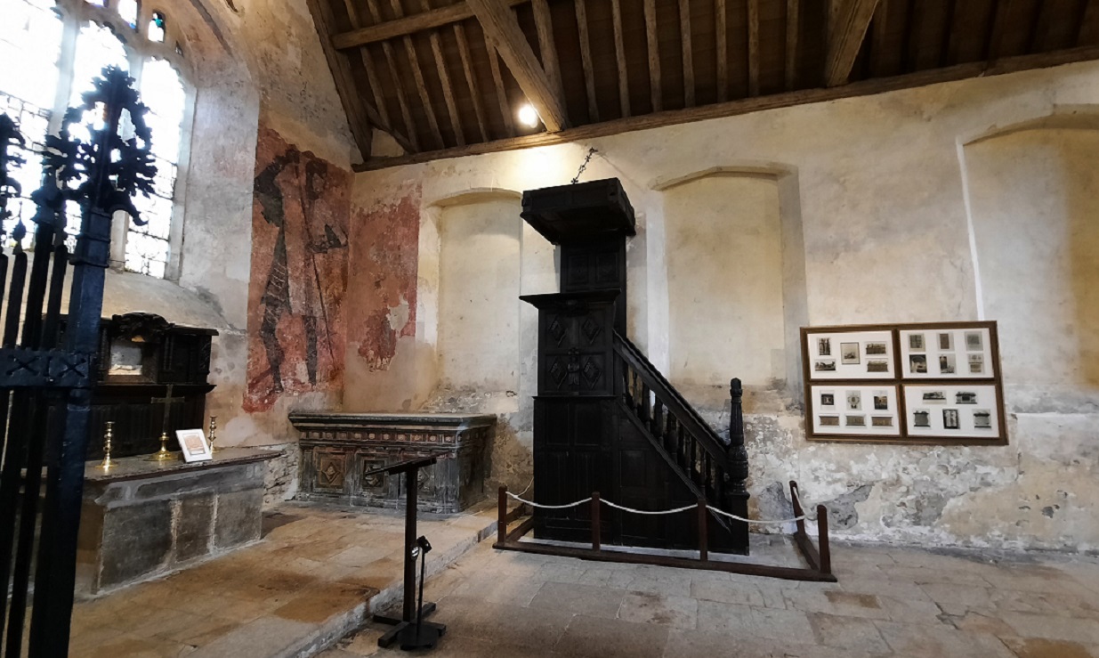
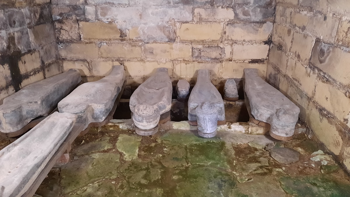
This is the original chapel of the Castle – still used as the parish church. Notice the remains of the medieval wall painting.
Most of the Castle is now a ruin with the exception of the Chapel and Priests House which was also used as the village church. In the crypt are several lead family coffins.
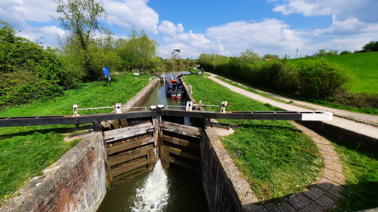
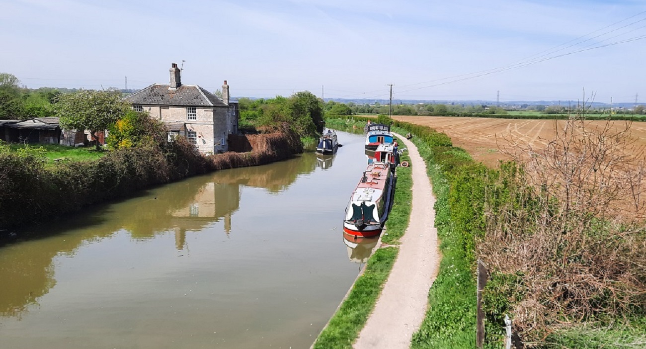
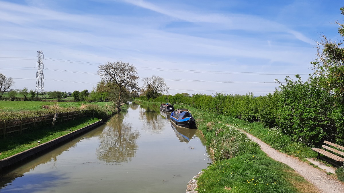
From Farleigh, I drove a further four miles and found a parking spot close to the canal at Bradford-on-Avon.
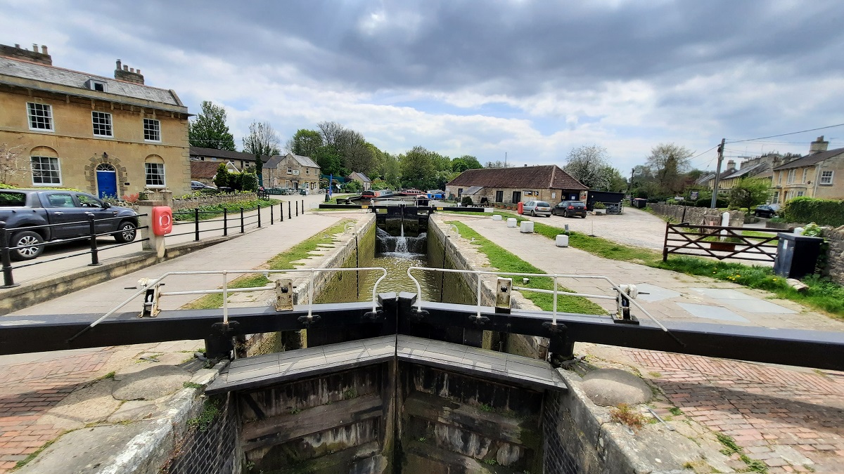
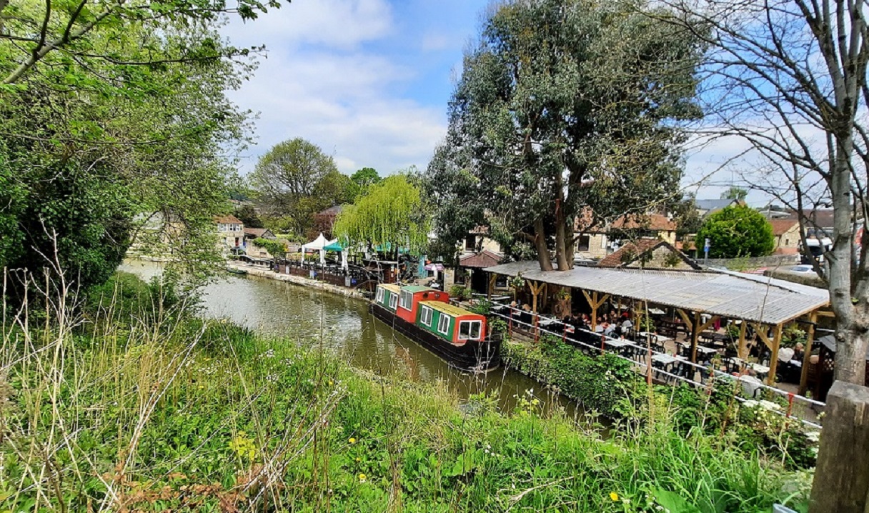
Views of the canal at Bradford on Avon.
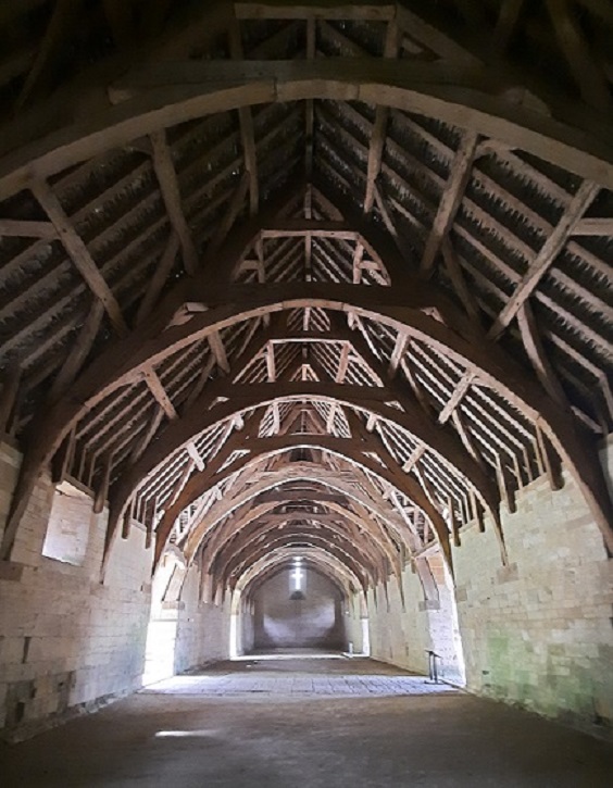
Here, I wanted to see the Tithe Barn. This is one of the oldest and largest medieval barns in the Country. It has what is known as a timber cruck roof and from end to end is 168 feet long.
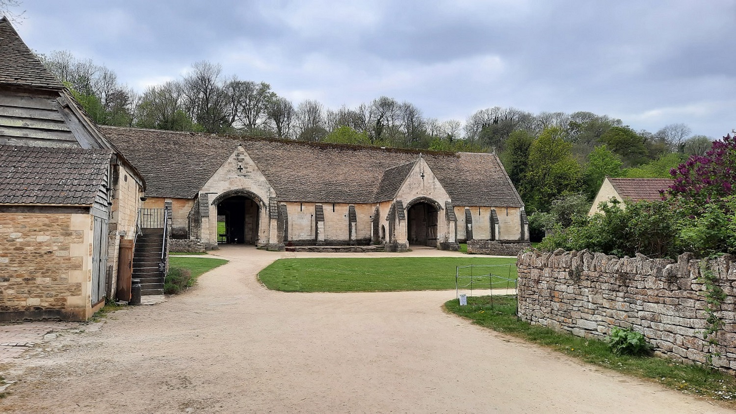
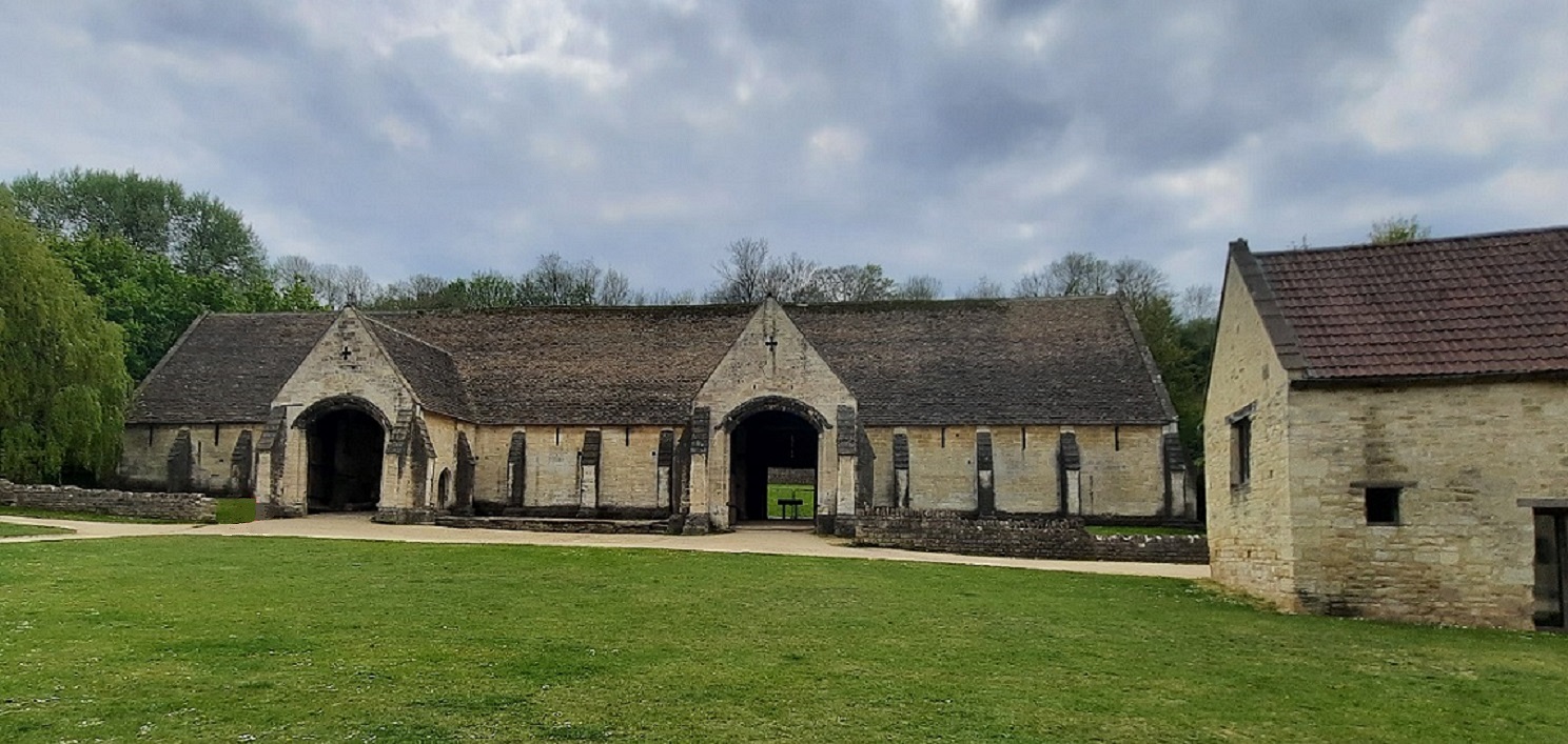
It was built in the mid-14th century as part of Barton Grange, a manor farm belonging to the nuns of Shaftesbury Abbey in Dorset, which in medieval times was the richest nunnery in the Country.. After Henry VIII dissolved the monasteries, the farm passed into private ownership where it continued as a working farm till 1971.
0-0-0-0-0-0-0-0-0-0-0-0-0-0-0
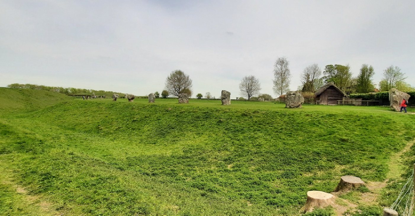
Today I headed over to Avebury, about twelve miles away from the site. A large National Trust car park is provided some distance away across the fields but I was fortunate in that I found a parking spot within the village. Avebury is at the centre of a World Heritage Neolithic and Bronze Age site. It consists of a circle of standing stones, positioned inside a circular ditch. What makes Avebury unique is that the circle of stones is almost a mile in circumference, with the ditch originally being around 30 feet deep.
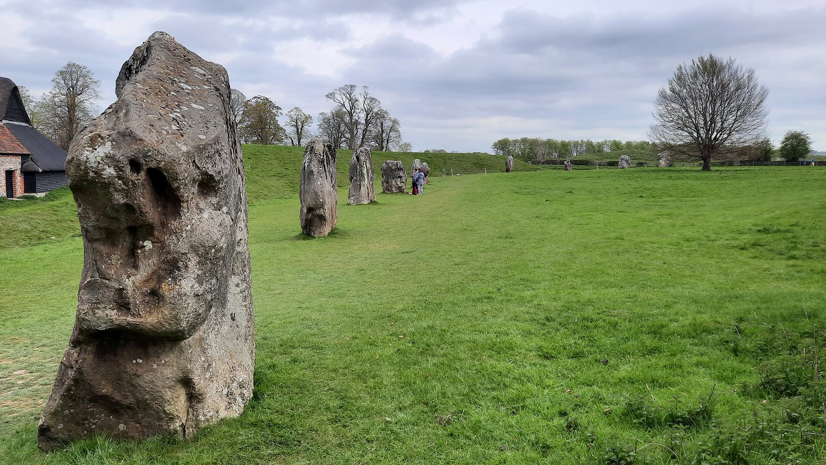
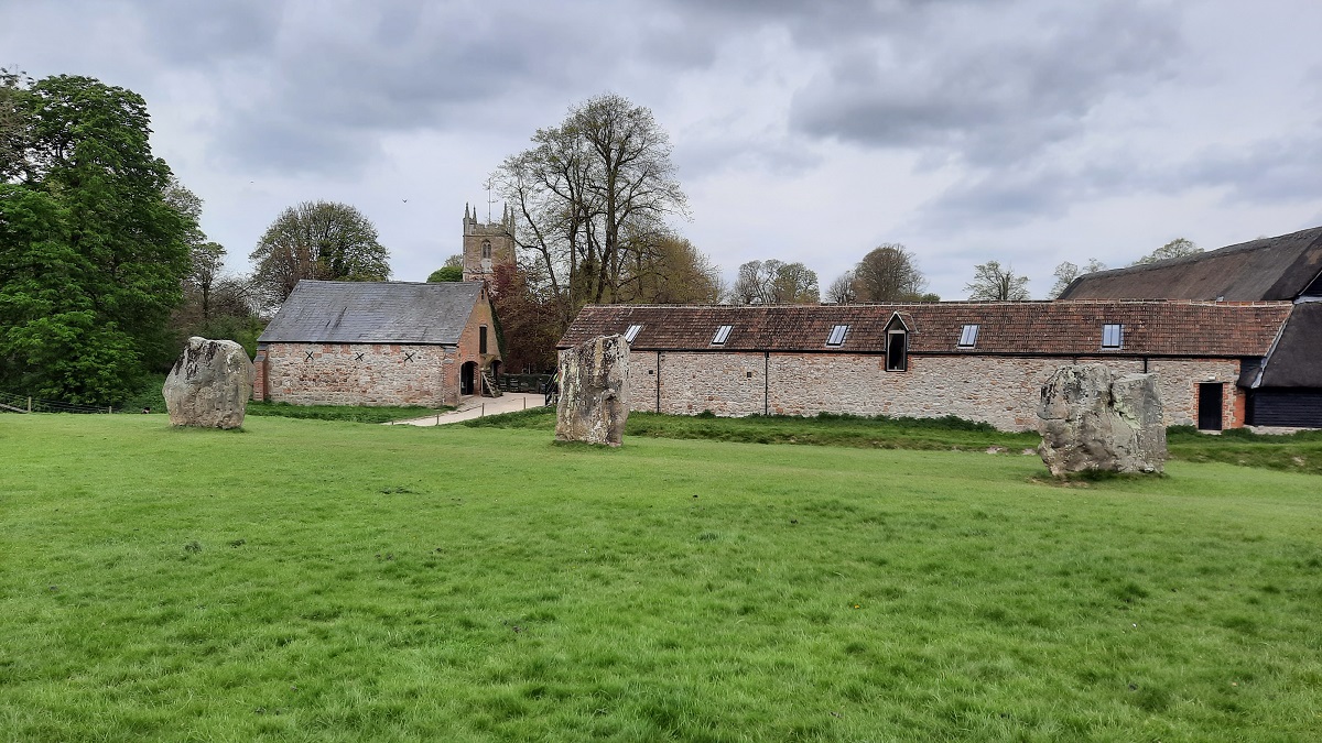
The ring of standing stones.
The manor farm buildings with the church in the background.
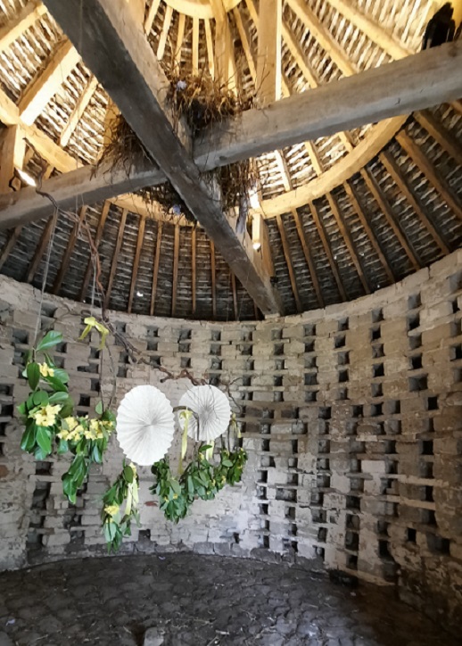
Inside the dovecote.
The manor farmyard with great barn to the left and dovecote on the right.
The village which dates from the Medieval period, and its crossroads, stand at the centre of the circle. Also in the village is the 16th Century manor house and gardens, now in the care of the National Trust. One of the buildings of the original manor farm is given over to a museum where there is displayed various bronze age tools and implements – stone axes, arrowheads, picks made from antlers and the skeletal remains of a child found buried at the bottom of one of the ditches.
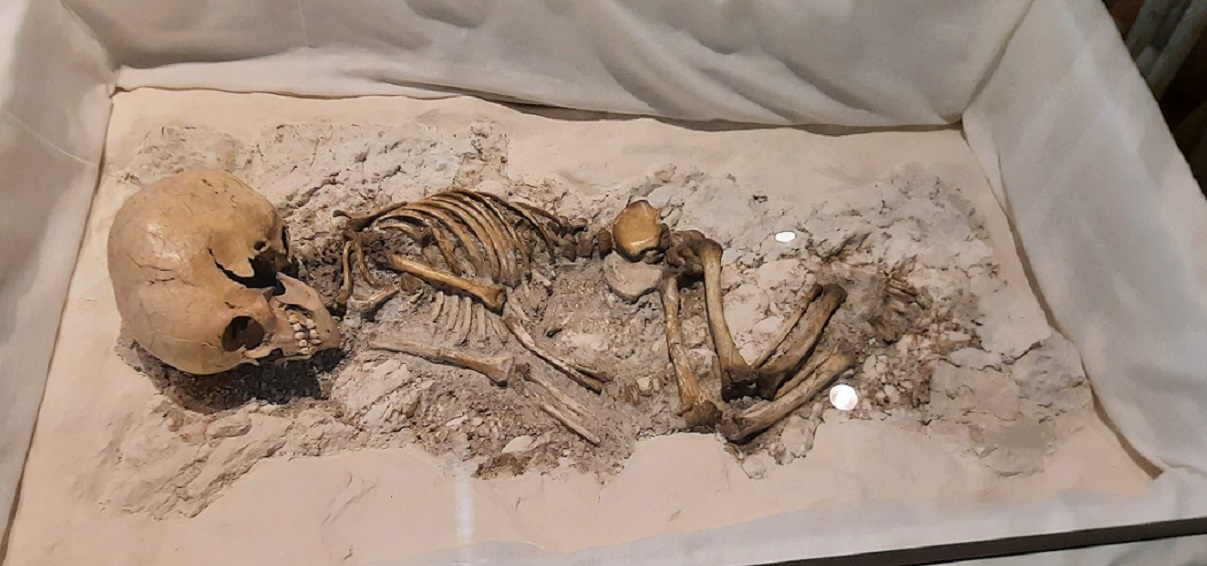
It’s more than 5500 years ago that this poor creature’s life ended. Still too young for the remains to indicate whether male or female.
Along side the museum is the farm’s great barn and dovecote, where birds were bred for the table.
A view inside the village church – and the entrance porch.
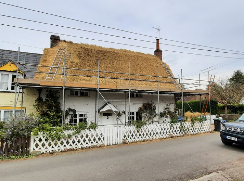
A village house having its thatched roof recovered.
Not too far away from Avebury are several other Neolithic sites. Some I wasn’t able to visit since it involves more walking than I can attempt. The next stop I made was only a mile down the road at Silbury Hill.
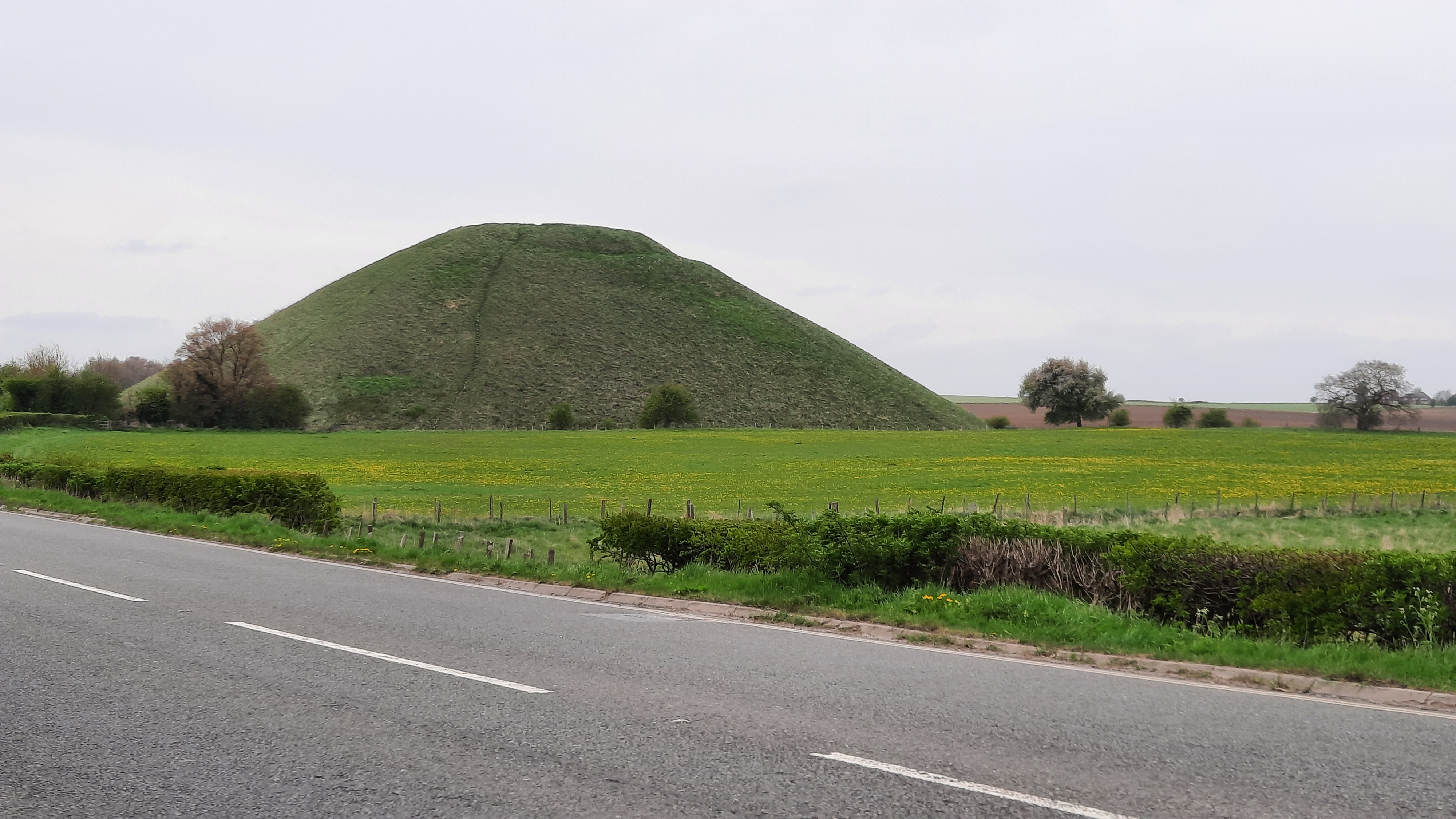
It’s a man-made hill which stands 30 metres high and 160 metres wide. It’s estimated that it contains half a million tonnes of material, mostly chalk, but why the population wanted to build it, is anyone’s guess.
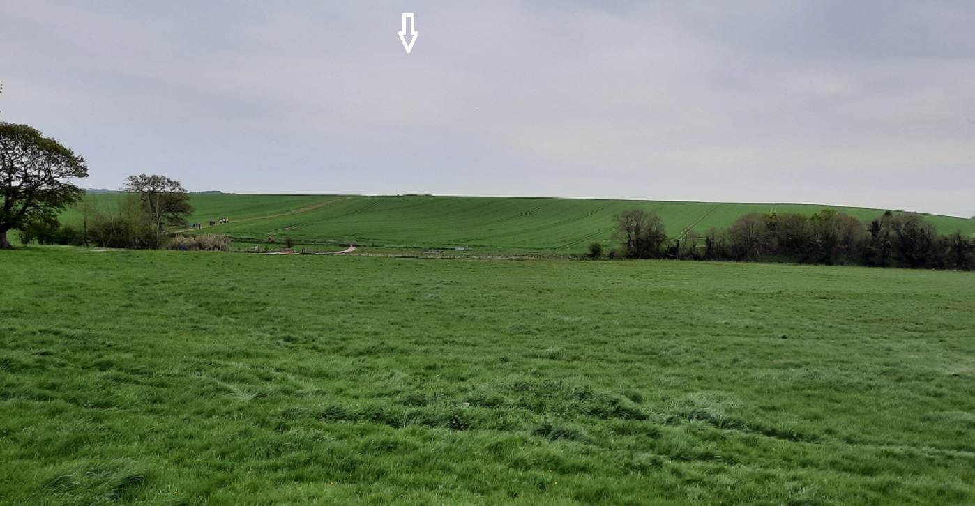
Across the road from the Hill, high up on the skyline, I could see the outline of the Kennet Long Barrow – a Neolithic burial mound. But sadly, much too far away for me to reach. The mound is marked with an arrow.
0-0-0-0-0-0-0-0-0-0-0-0-0-0-0
The sunshine was back again today right from sunrise. And just in case it wasn’t going to last, I decided to prepare a packed lunch and get an early start. I’d spent a bit of time looking at the canal route on Google maps. I wanted a stretch of tow path that I hadn’t already ridden – but with car parking close by. I found what I was looking for at Semington – in the High Street. It sounds like an unlikely spot for easy parking, but the High Street turned out to be a wide, hedge-lined, cul-de-sac. I unloaded the bike and set off along the tow path.
After a mile or so I found a lane which led away from the canal towards the village. I decided to follow the track. Eventually, I made my way back, through the village, over the canal bridge and back to the car – ready for some lunch.
My after-dinner snooze was interrupted by a low-flying helicopter. During the afternoon, I discovered the headquarters of the Wiltshire Air Ambulance was just over in the next field. I set off along the towpath in the opposite direction to the morning ride. Eventually, I arrived at the Bowerhill Residents Grotto which I found earlier in the week.
I cycled along the lane into the village in the hopes of returning to the car by a circular route however, I eventually arrived at a fast main road. I thought it best to retrace my steps back along the canal route.
0-0-0-0-0-0-0-0-0-0-0-0-0-0-0
This morning I awoke to hear that most depressing of caravanning sounds. The patter of rain on the roof. Not that it mattered too much today because it was time to head home. By the time breakfast was over, lunch prepared and chores done, it had almost stopped, so disconnecting of electric, water and legs were seen to in the dry. I was ready to leave by 10.30 and with a stop for lunch along the A303, I was home in the early afternoon.
But only to find that somewhere along the route, my Truma mover cross tube had become loose and fallen off. Being able to control the rollers from only the one side is essential for where I park my van alongside the house.
0-0-0-0-0-0-0-0-0-0-0-0-0-0-0
