Click on each picture to see it in full size.
Click the arrow at the top left to return to the page.
All my caravanning trips begin and end via the M25. For the last two years, they have all been in a clockwise direction. Today, however, was different. I was headed anti-clockwise, towards the Dartford Tunnel. I’d already paid my ‘Dart-charge’ online for both crossings a couple of days earlier. So with 140 miles to do and an arrival time after mid-day, there was no need to leave home before 9.30. But traffic conditions were slow in the four miles before the tunnel, consequently, it was closer to 1pm before I arrived.
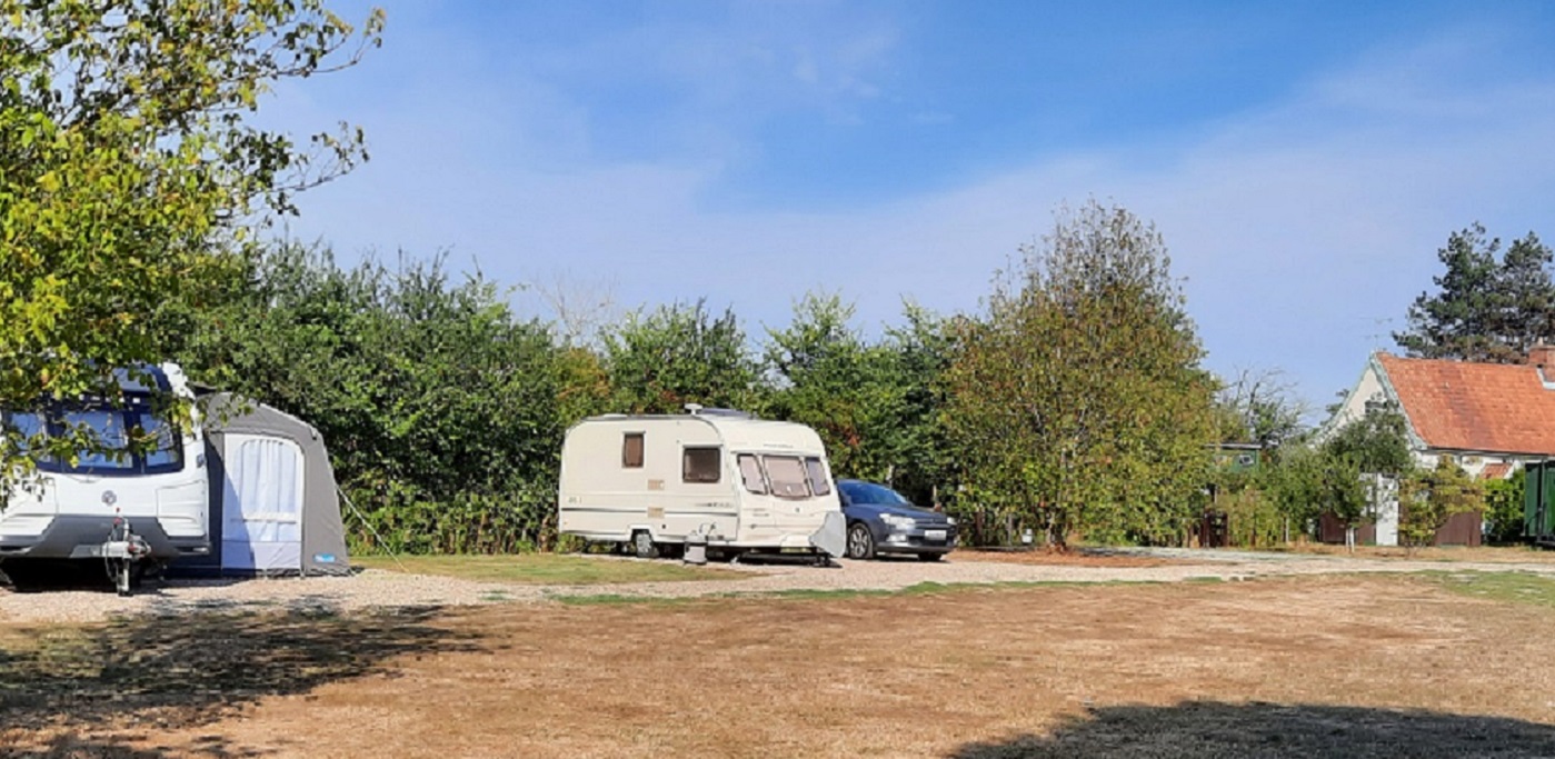
I was heading up into Suffolk on the A12 to a CMC CL at Hill House Farm, situated at Darsham, just a couple of hundred yards from the A12. The site is one of those listed on the CL Booking website, so although you can’t confirm a booking, it shows what’s available. The site has five hard-standing pitches, each pitch with its own power bollard and drinking water tap. The owner allows grey water to be directed into a ditch which runs around the perimeter of the site. In the corner of the site is a portacabin-style building which houses toilets and showers. In an adjoining field, the owner has an additional site for Pitchup bookings. Fees for Caravan Club members are £21 per night for a couple, which includes electricity and a good internet connection. A deposit, and later, the balance of the fees are paid via bank transfer, and a welcome letter and information sheet are left in a small box attached to the water tap. Thus throughout my ten-day stay, I didn’t meet the site owner.
0-0-0-0-0-0-0-0-0-0-0-0-0-0-0
Today’s drive was a circular route of fewer than 30 miles. I was heading first to Framlington Castle which is in the care of English Heritage. A wooden castle was built here shortly after William the Conqueror came from Normandy, but by the 12th century Hugh Bigod, a powerful Norman baron started building the castle in stone. In 1213 a later member of the Bigod family was entertaining King John at the castle. But within two years, the Bigod family had fallen out with the King and Roger Bigod had become the leader of a group of barons who planned to force King John to agree to their demands, The charter they forced him to sign became known as Magna Carta.
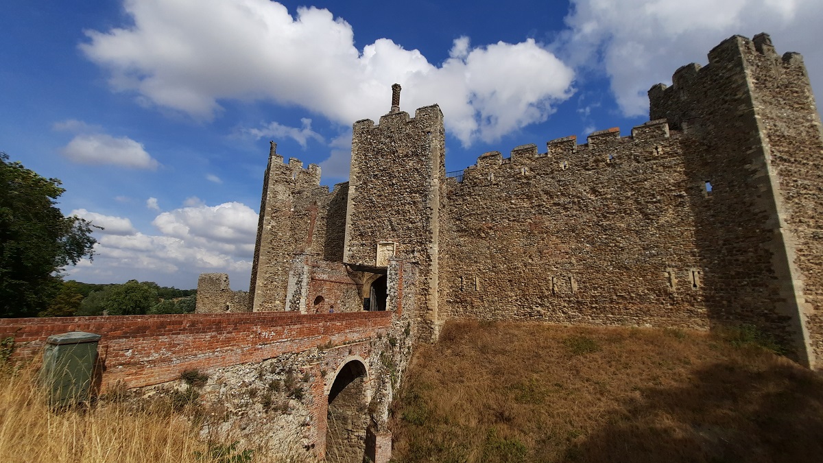
By the 15th Century, the Castle had become the property of the Howard Family but eventually, the Howards fell out of favour and they had the castle taken from them. Not surprising perhaps! Henry VIII had married their daughter, Catherine but a short while later, he signed her death warrant. She was executed at the Tower of London. Henry’s eldest daughter, Mary Tudor, already owned many estates in East Anglia, and with the fall of the Howard family, Henry gave her Framlington. It was whilst she was here planning her struggle to obtain the crown and to restore the Country to Catholicism, that she got the news that she had been proclaimed Queen. She restored the estates and the Castle back to the Howard family.
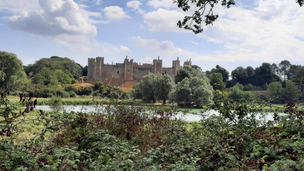
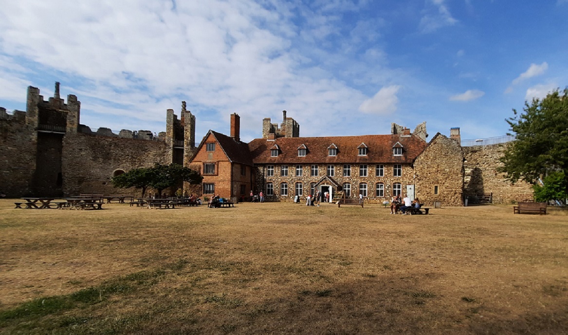
By the mid-1600s the castle had changed hands again. It was bought by a local lawyer. He directed in his will that the buildings within the confines of the castle should be pulled down and a poor house built in their place. What became the workhouse is the present brick building in the courtyard, which now houses the cafe with a museum upstairs.
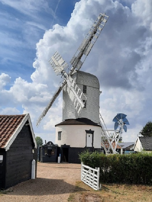
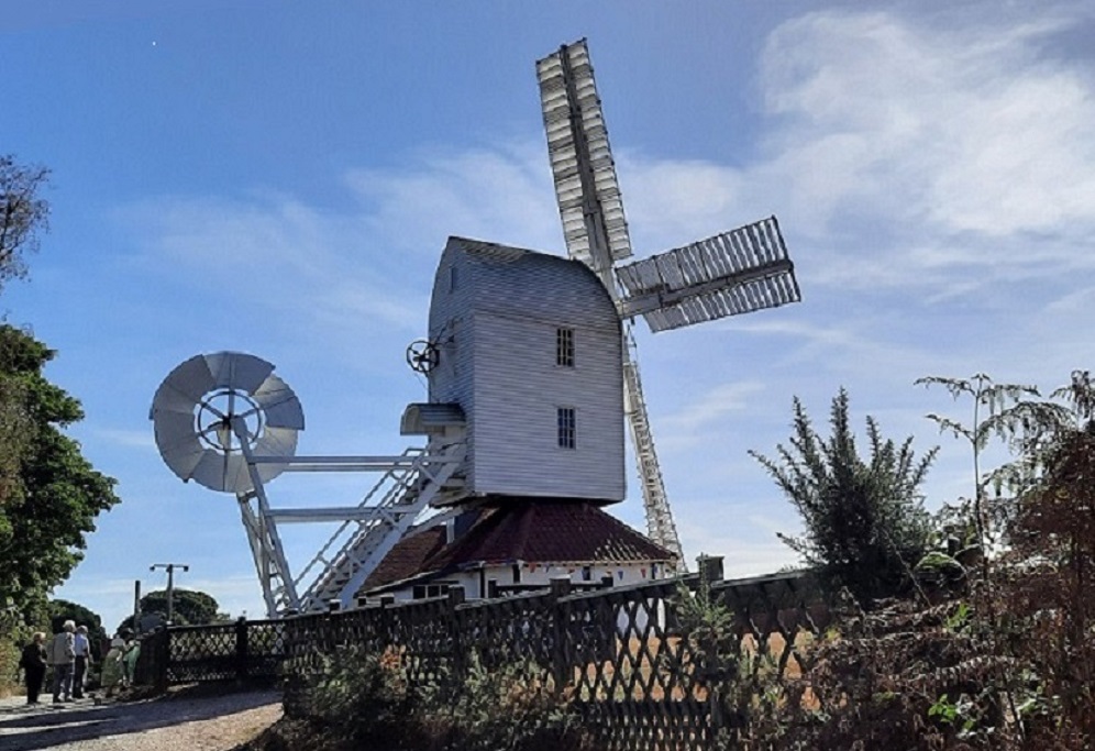
It was only a couple of miles drive to my next stop at Saxstead Green. I wanted to visit the post Windmill. Historical records show that a windmill has stood on the Green since the 1200s, but in medieval times, almost every village had some means of grinding cereal. The current mill dates back to 1796, although it has been altered several times during its lifetime. The ownership of the mill passed through several generations of the Aldred family, but the mill ceased working in 1947 after the death of the last Aldred. Ownership passed to one of his daughters and son-in-law who placed the mill under the guardianship of the Ministry of Works in 1951. In later years, the care of the windmill became the responsibility of English Heritage. The present owner, a descendant of the Aldred family still lives in the Mill house and takes every opportunity to chat with, and show visitors the workings of the mill. The mill is only open on Fridays and Saturdays during the summer.
0-0-0-0-0-0-0-0-0-0-0-0-0-0-0
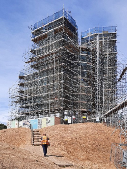
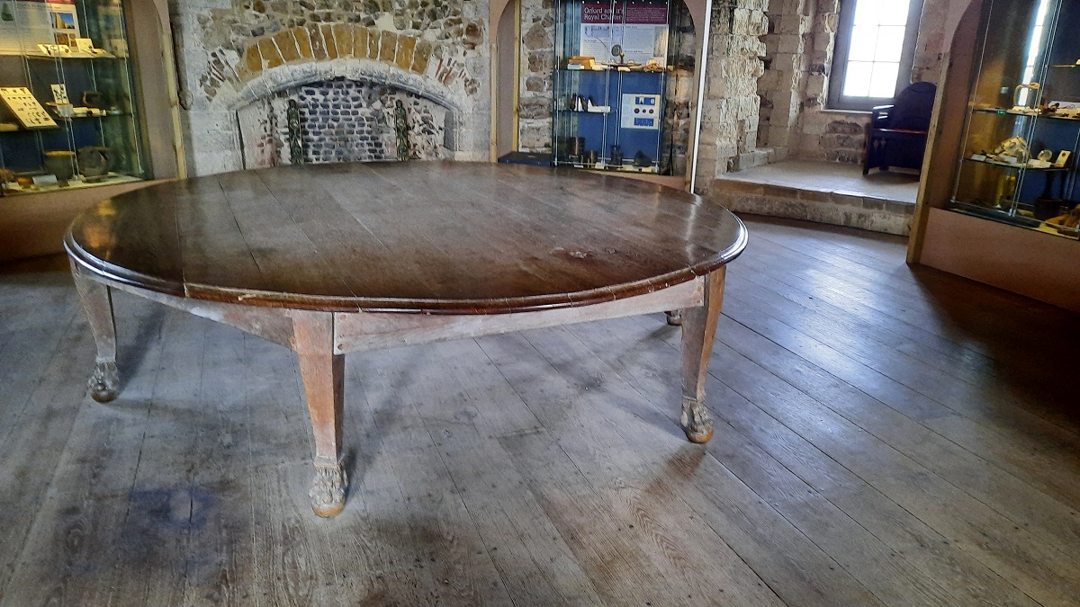
Today I drove down to Orford to visit the castle. Although it was open, they had the builders in. The entire keep was surrounded by scaffolding with builders applying a coat of lime render in an attempt to stop any further deterioration of the delicate stonework.
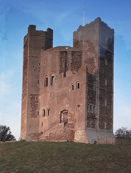
The castle originally consisted of a keep, surrounded by a long curtain wall with seven defensive towers. It was built in 1165 on the orders of King Henry II whose reign followed a state of civil war between supporters of Stephen and Matilda who both had claims to the throne. Henry realized that some of the East Anglian barons were getting too powerful. Baron Hugh Bigod had built himself no less than five castles.
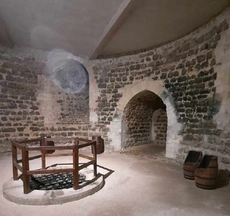
At Orford today, all that is left is the keep, but that, at least internally, is in a remarkably good condition. From the entrance, a winding stair leads down to the basement where kitchens were once installed with a well at the centre. Above there are three other floors, reached by a circular stone stair until finally, you have a fine view from the battlements. One floor is laid out as a museum. Having climbed down to the basement, then up to the first floor, I just couldn’t manage any more climbing. Old age called the shots!!
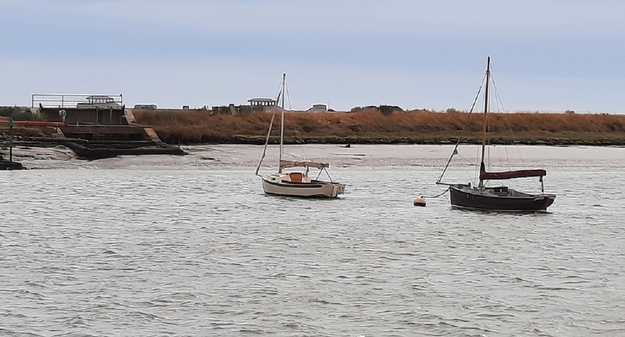
From the Castle, I drove the short distance down to the quay.

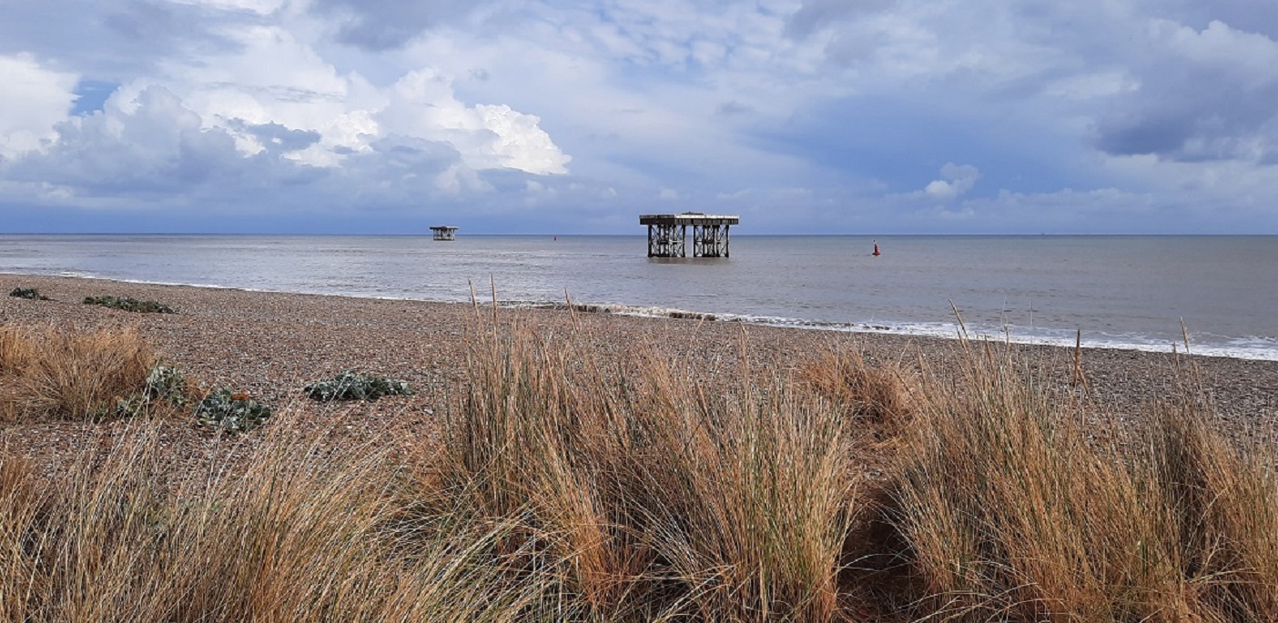
In Tudor times, Orford was a seaport. Now when you stand on the quay, it’s the River Alde which flows past for a further five miles before reaching the sea. On the far side of the river is Orford Ness which besides being a nature reserve, in times past has been used as an Atomic Weapons Research Facility and a ballistics experiment laboratory. The deserted buildings still remain.
-0-0-0-0-0-0-0-0-0-0-0-0-0-0
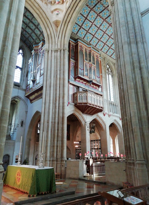
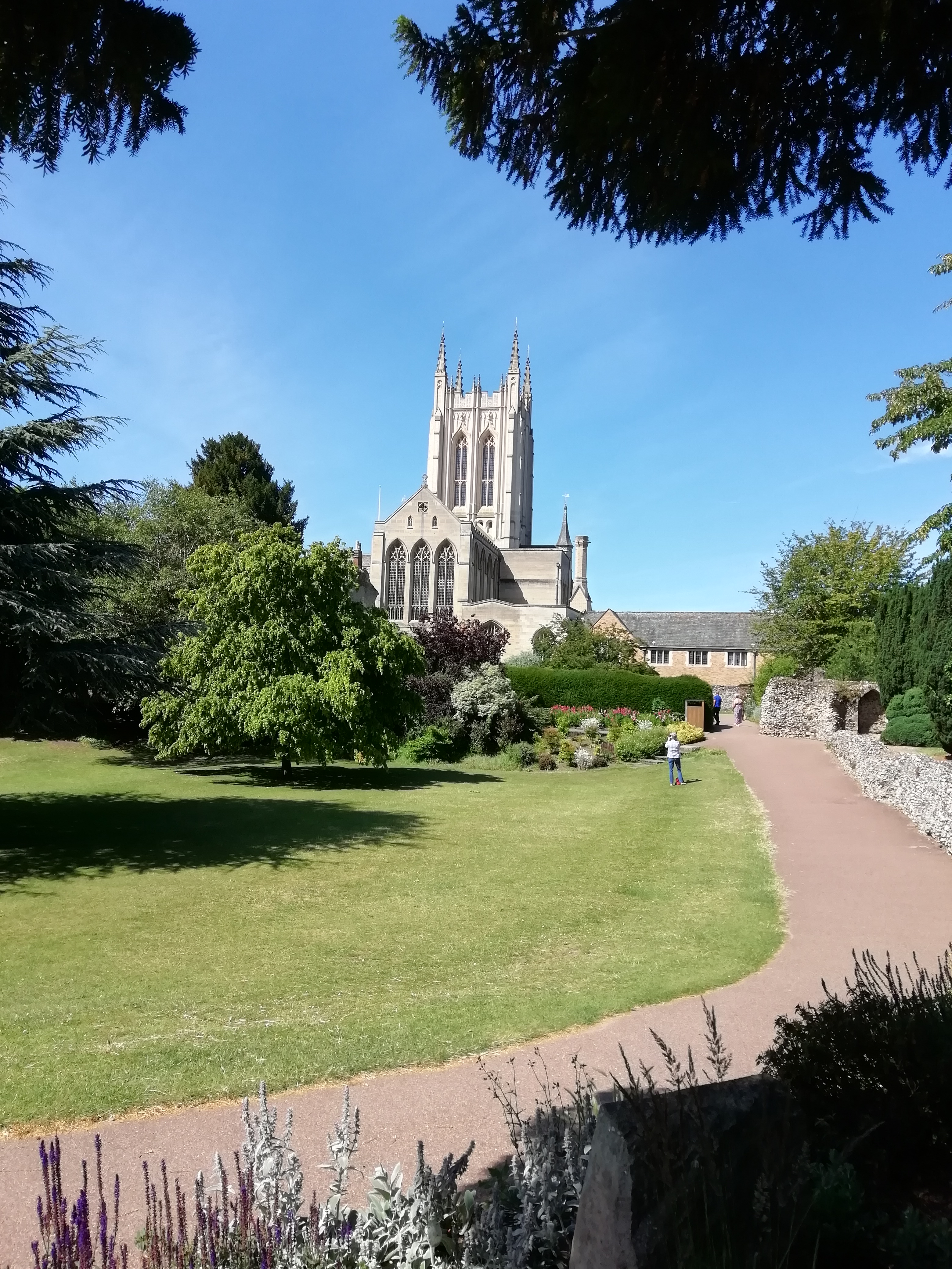
Today’s destination was Bury St. Edmunds. I found a parking spot close to the Cathedral. A church has been here since the 11th Century when an abbey was built, but in the 16th Century, the church was pulled down and replaced by the present one. Not until 1914 when Bury was declared a city, did the parish church become a cathedral. As a cathedral, it needed something on a grander scale so in the 1960/70s the chancel was pulled down and replaced with a new tower built in the gothic style with transepts and a new choir and side chapels and cloisters. Built in the 1990s was an extension to house the new choir school. New blends with the old exceedingly well.
From the cloisters, I found myself in the gardens, with a gate leading into the former abbey grounds. The extent of the ruins shows the vast size that the abbey must have once been. Having the tomb of the martyred King Edmund in its church ensured that it attracted thousands of pilgrims and the Abbey became one of the wealthiest in the whole country.
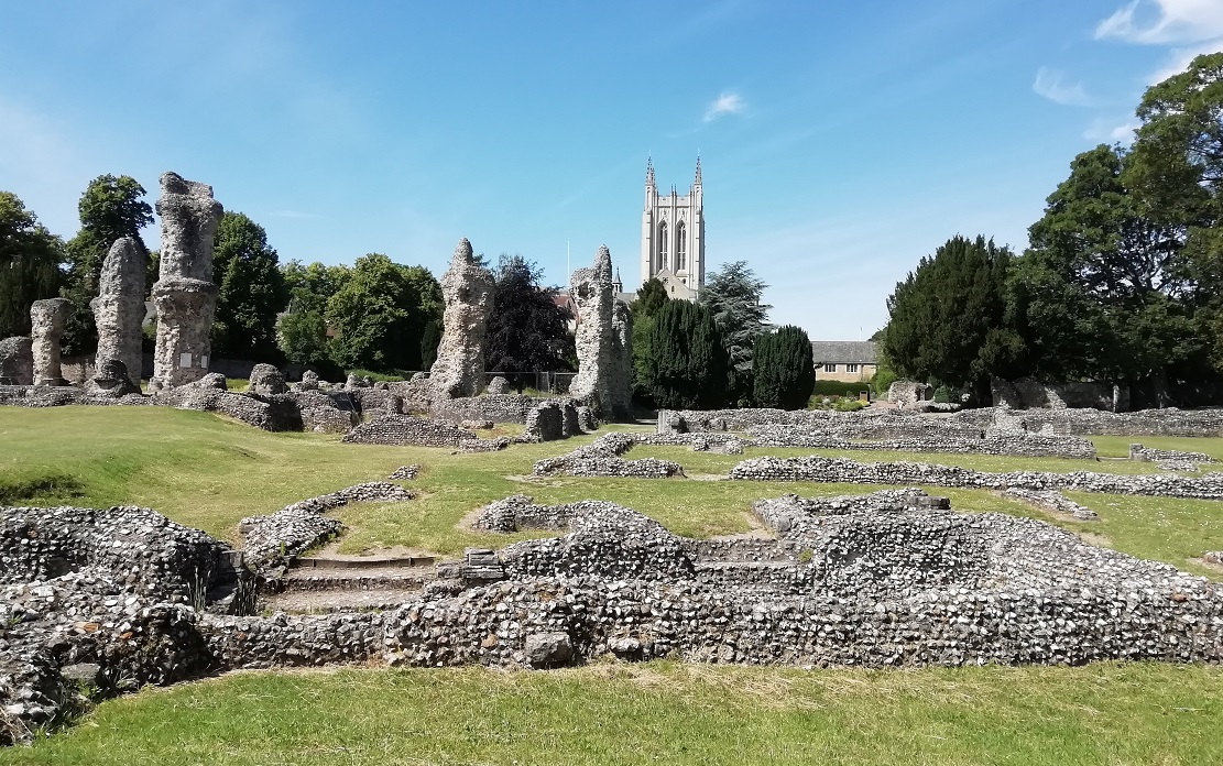
Also, it was here that in 1214, twenty-five of the most powerful barons in the land met and made an oath to force King John to agree to the terms of Magna Carta.
Close to the gatehouse is another memorial – this one is the Holocaust Memorial – in memory of thousands all over the world who have met an untimely death, but in particular, the sixty-seven Jews who were massacred in the town in 1190.
During Medieval times whilst Jews were despised, they were also tolerated because their religion allowed them to lend money in return for interest. They were the only people from whom one could borrow. Lending for profit in Medieval England was forbidden to Christians. Many influential people were indebted to the Jewish community. . It is said that the Prior of St Edmunds Abbey was heavily in debt to them. Historical records appear to show that public unrest was encouraged against the town’s Jews and in the riot which followed, 67 of them lost their lives. The remainder were banished from the Country. Thus all debts were wiped out!.
Now, the only part of the abbey which remains is the gatehouse which stands in the High Street.
0-0-0-0-0-0-0-0-0-0-0-0-0-0-0
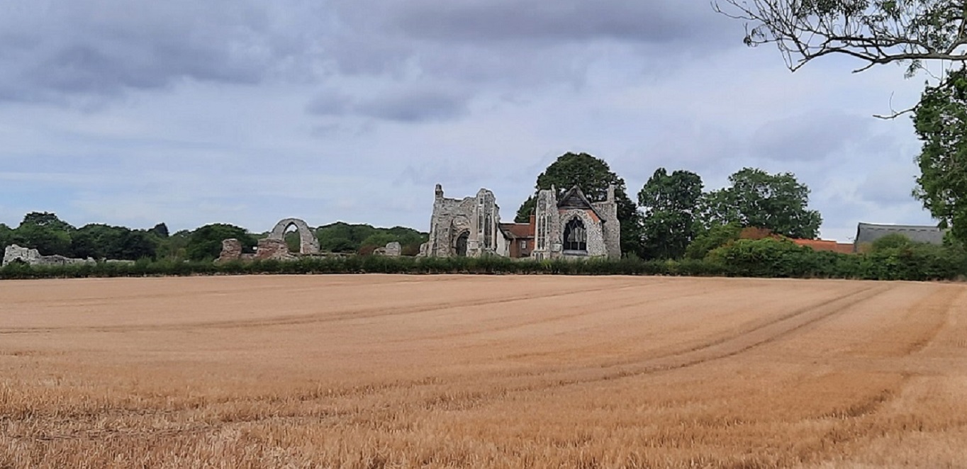
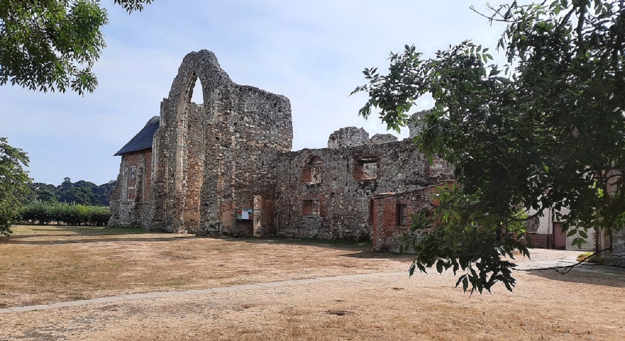
Today’s circular trip began close to the village of Leiston where I wanted to see the remains of the Abbey. Although the Abbey was first built during the 1100s, it was later decided to dismantle the building and move it, so in about 1363 the abbey was moved away from what was a rather unhealthy location on swampy ground and rebuilt on its present site. The old abbey was dismantled for building materials and as a result, the 14th-century building incorporates some Norman features. After the dissolution of the monasteries, the Abbey was given to the Earl of Suffolk who put the buildings to other uses. The church became a farmhouse and barn, whilst other parts were converted in the Tudor style. Some of the buildings are now owned by the music school – Pro Corda.
My next stop was at Greyfriars Priory at Dunwich, which from the area within the boundary wall, indicates it must have been a large thriving community. The Greyfriars order was begun by Francis of Assisi in the 13th Century and became popular with local people because one of their commitments was to provide care and treatment for the sick. But like all the other religious communities, the priory was disbanded by Henry VIII during the dissolution.
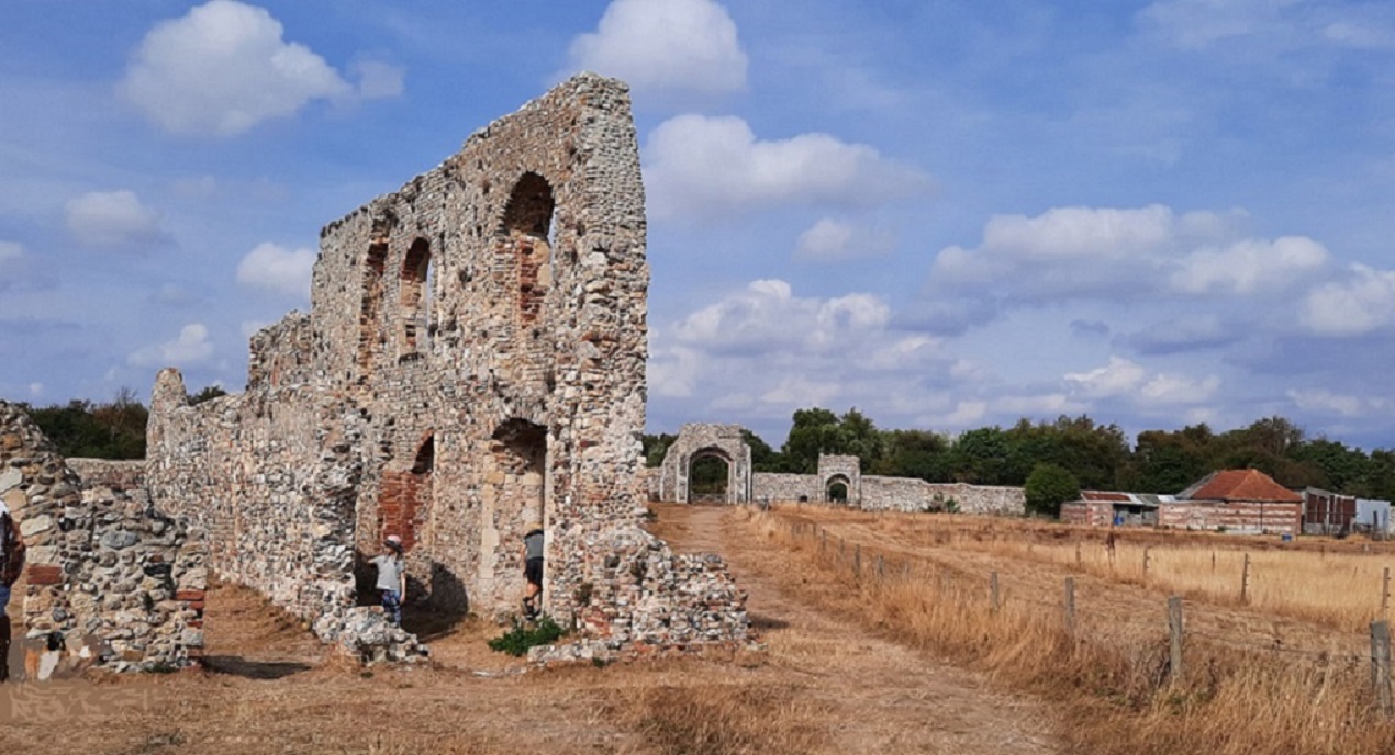
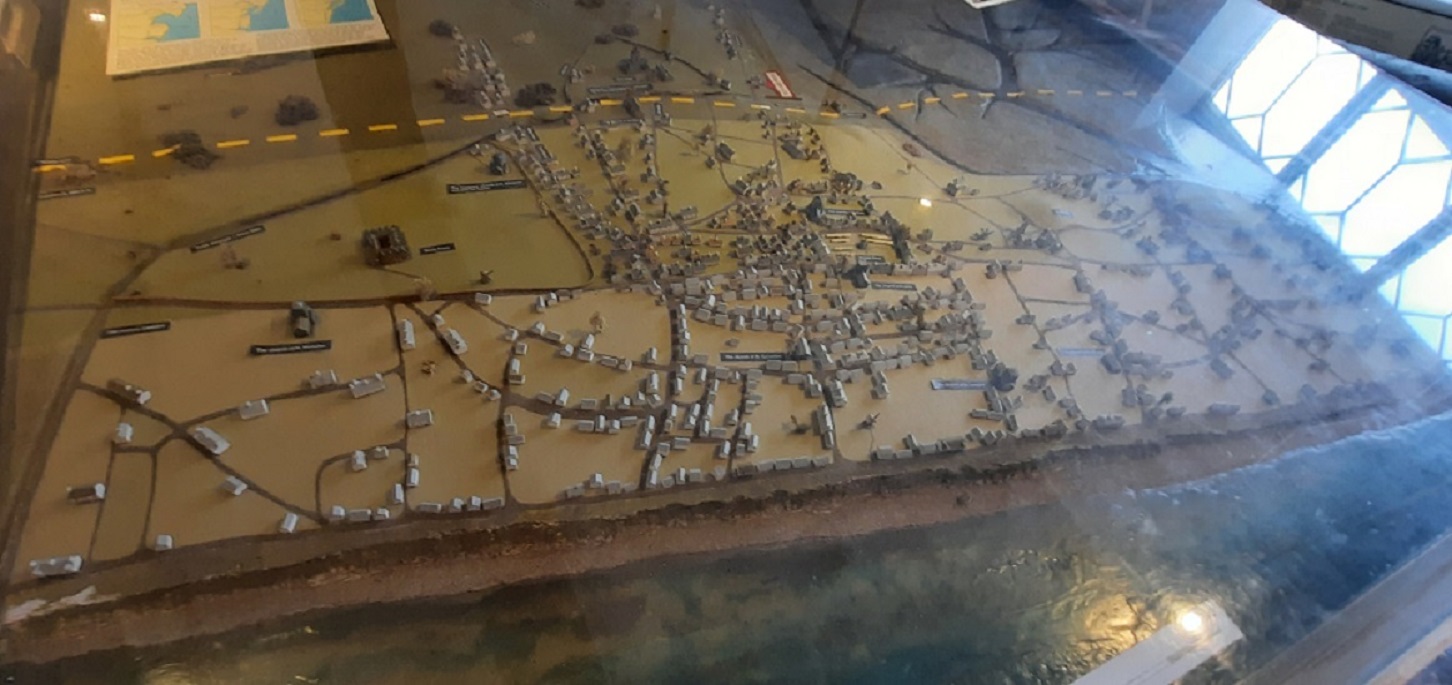
From there, it was just a short distance along the road and down the hill into Dunwich. Today Dunwich is a tiny village of around 60 people and only a few cottages, but in Medieval times it was one of the most important seaports on the East coast with many grand public buildings, several churches and also, its own mint. It was the capital of the Saxon kingdom making it the tenth largest town in the Country with a population of around 4000 people. But in the two hundred years from the start of the 14th Century, rising sea levels began to change the course of the river and wash away the port and town. In the tiny village museum, there are models on display showing the layout of the town with several churches now below the waves. Also, there is an even earlier lost Roman fort there as well.
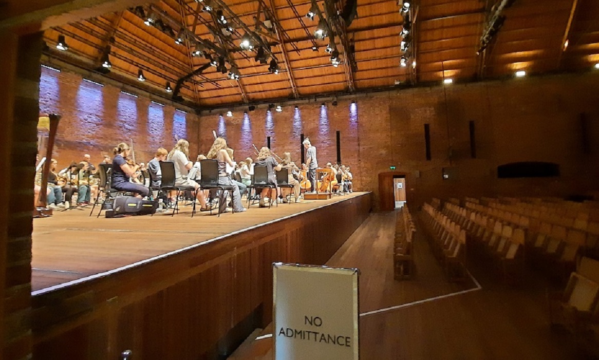
On the way home I stopped off at the Snape Maltings. All the old warehouses and storage sheds where once barley was roasted for beer making have now been converted into shops, studios and a music centre.

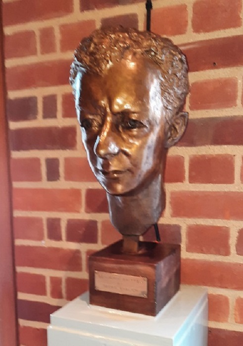
The large concert hall was the creation of Benjamin Britten and Peter Pears in the early 1950s as a venue to hold their annual Aldeburgh Festival.

0-0-0-0-0-0-0-0-0-0-0-0-0-0-0
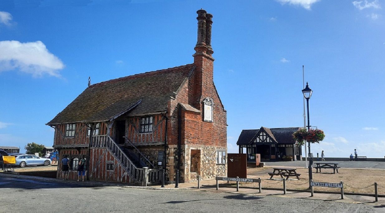
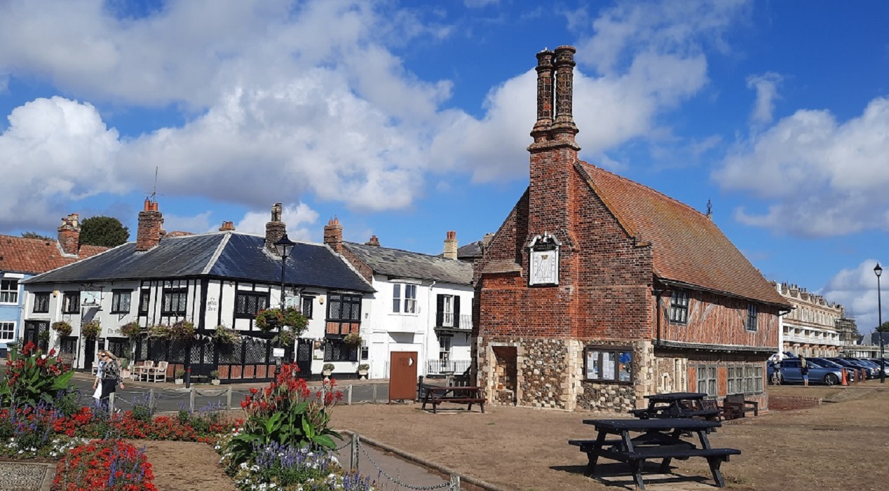
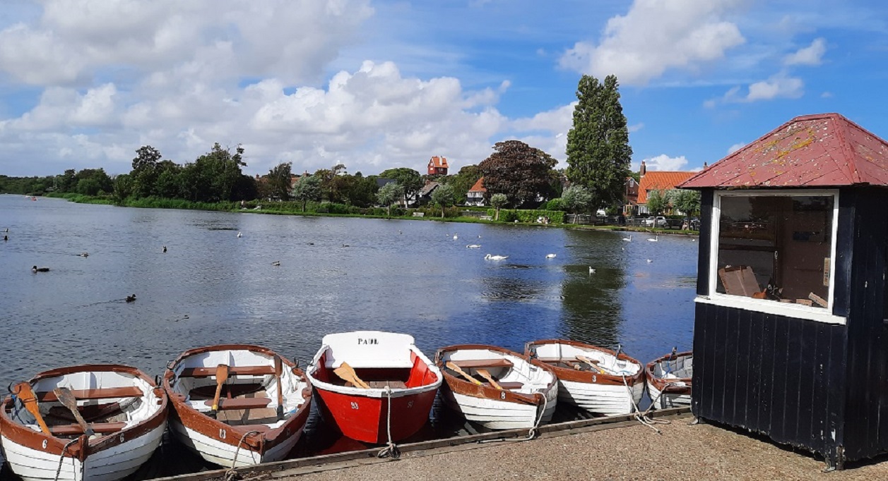
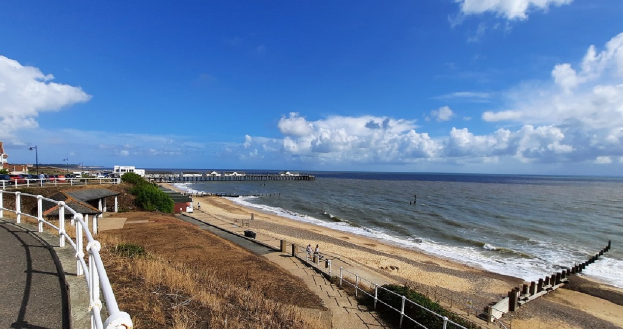
Today, I did the short drive to Aldeburgh. In Tudor times, the town was a thriving sea port with many shipbuilders working in the dockyards at the mouth of the River Alde. It was here where Francis Drake’s ‘Golden Hind was built. But over time the river changed its course to the sea, leaving the port unusable. Then coastal erosion washed away part of the town. In 1520 when the Moot Hall was built in the market place, it was at the centre of the Tudor town. Today, the building stands just a hundred yards or so from the beach.
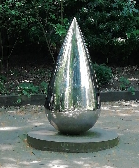
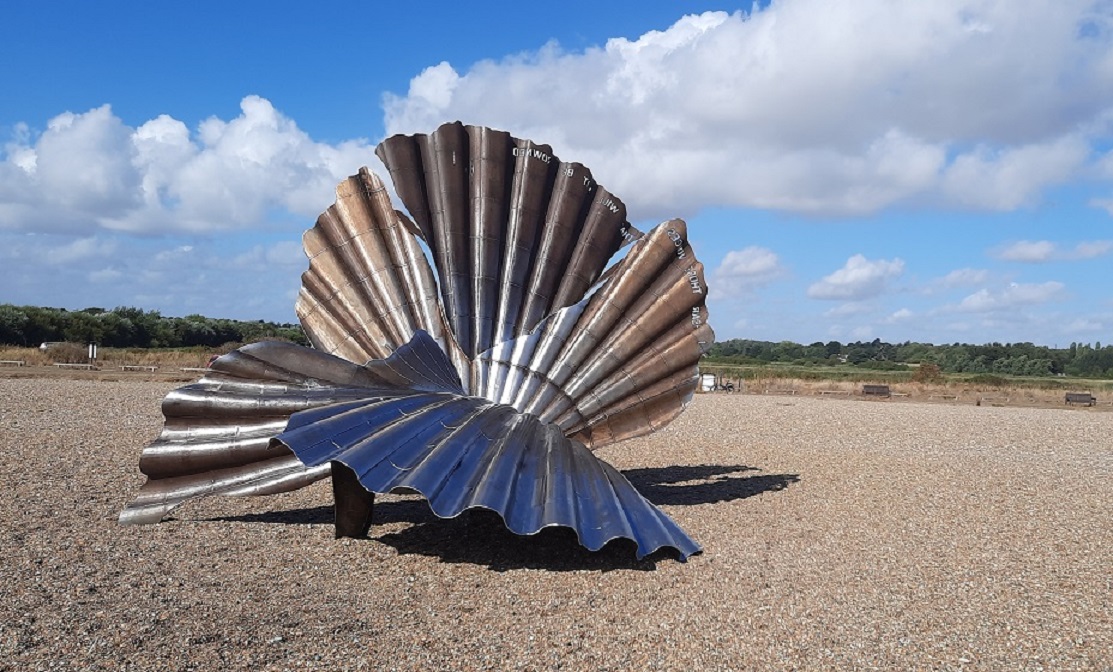
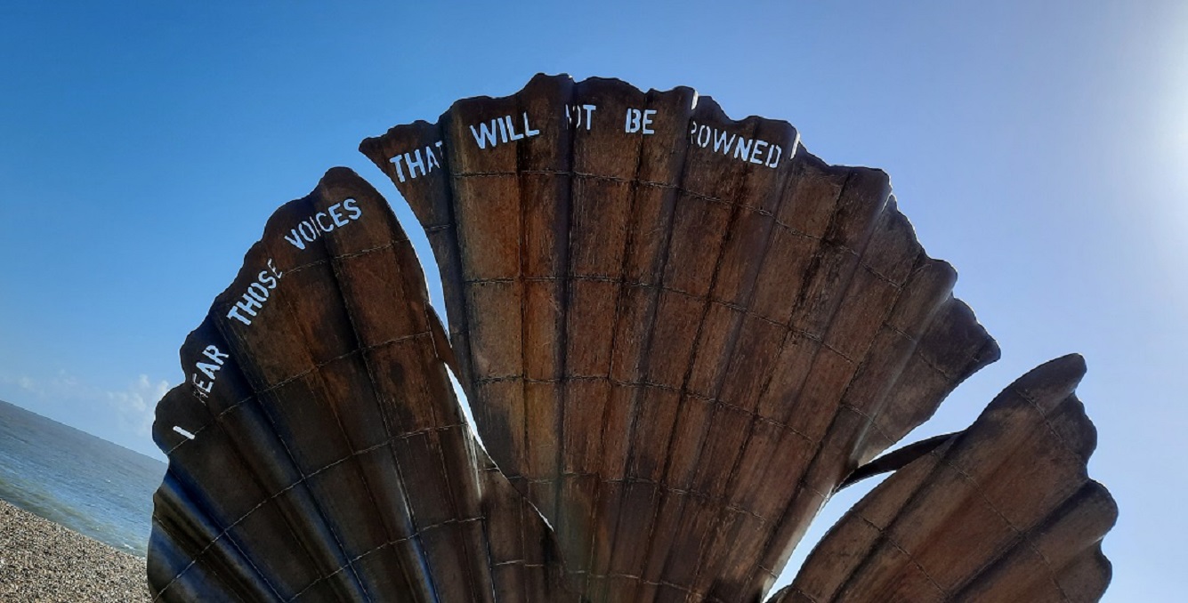
I drove out of town and along the coast road for several hundred yards before stopping to see “The Scallop”. This 13-foot high stainless steel structure of two intertwined scallop shells was erected in 2003 to commemorate the life of Benjamin Britten who spent much of his life in Aldeburgh. At the time, the sculpture caused friction amongst the townspeople, with some residents demanding that it be removed. Frequently, it was vandalised. However, it appears now to be accepted as part of the landscape, since a large parking area has been built to accommodate visitors.
Another mile and I’d reached Thorpeness. Or Thorp, as it was known when it was just a fishing village. In the middle 1800s, a successful Scottish engineer bought Sizewell House as a holiday home on the coast of Suffolk. Over the years, he bought more and more parcels of land. In 1910, when his son inherited the estate, he planned to build a new village of up-market mock-Tudor houses, together with a windmill, a golf course and a Country Club. These properties, he planned to lease to the new super-rich so that they could spend time in idyllic surroundings. He also had a large piece of low-lying land dug out to a depth of three feet so that it flooded, forming a large lake. He had a garage built so that the holidaymaker’s cars could be fuelled and attended to. Also, an extension to the railway network was laid. The houses were supplied with water which was contained in a huge tank 70feet from the ground

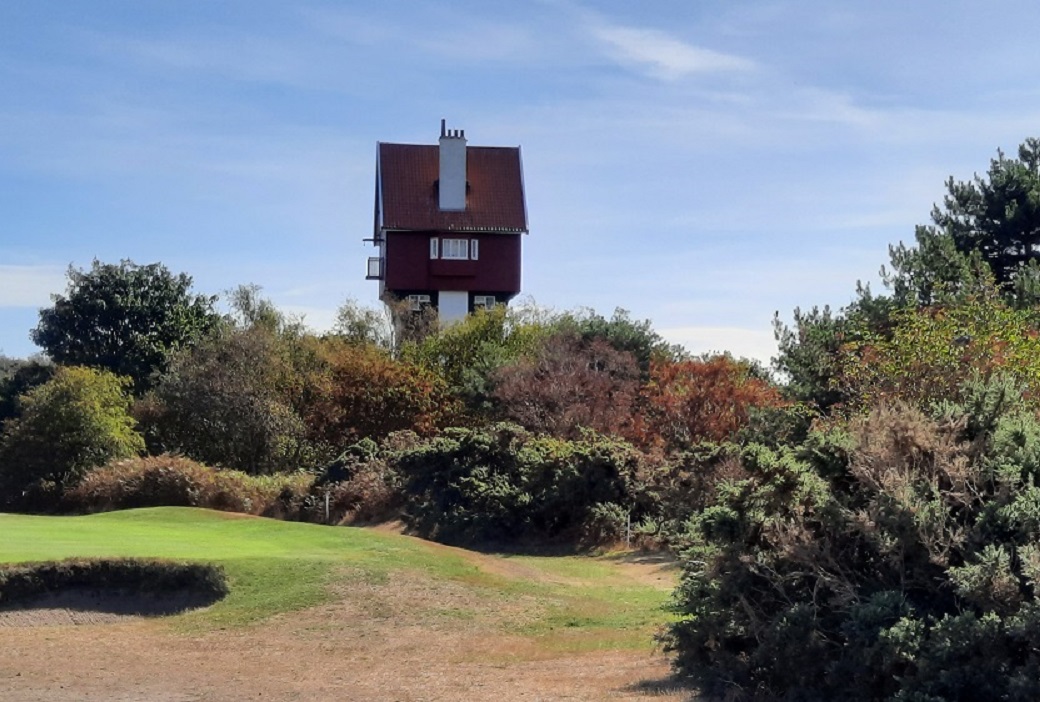
. To disguise the monstrous tank, it was covered to appear to be a house. In later years, when piped water had been installed, the tank was removed but “the house in the clouds” remains. Close by is the windmill which was used to pump the water from a well up into the tank.
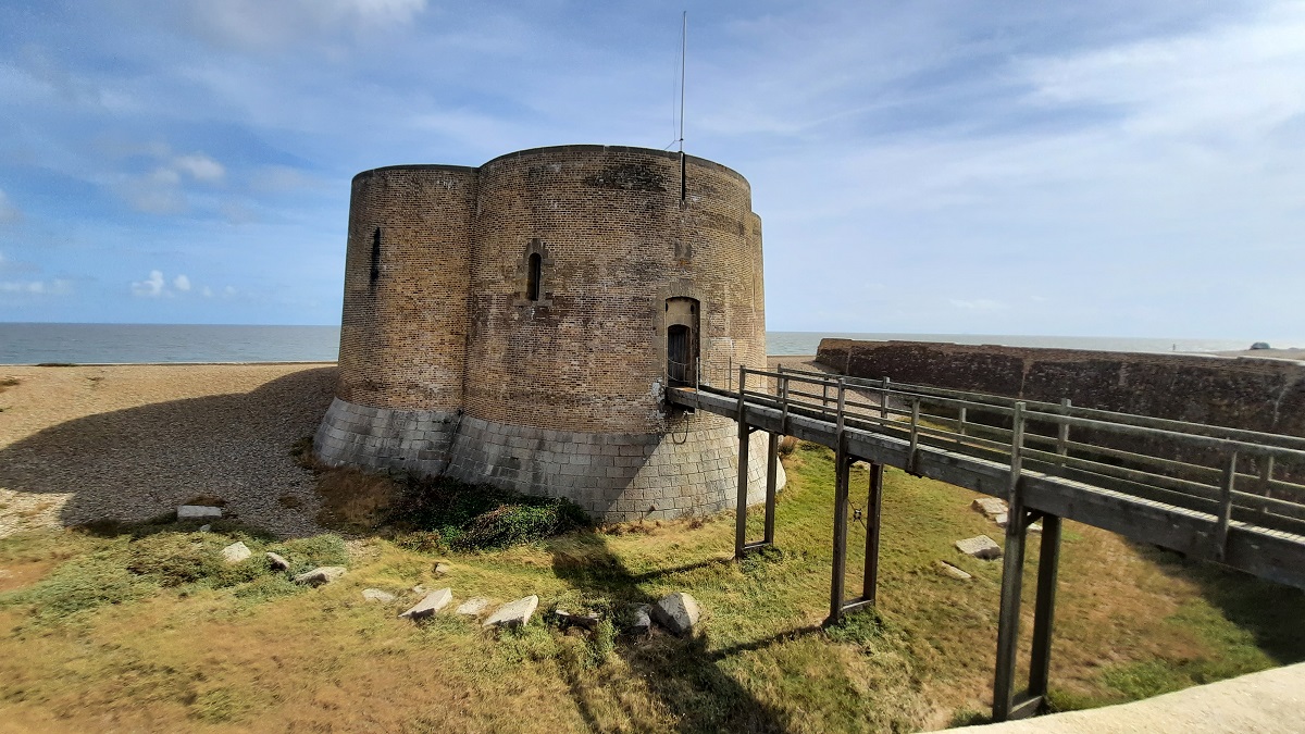
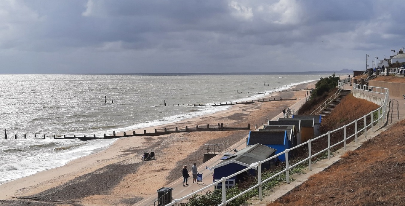
The last visit of the day was a drive through Aldeburgh then out along the narrow embankment which divides the sea from the river Alde. Just before the shingle opens out into Orford Ness, is a Martello Tower. This one is the last and most northerly of a string of 74 towers built along the North Sea and the English Channel coastline. They were built during the early 1800s when there was a threat of invasion by Napoleon Bonaparte. They ranged from 30 to 40 feet high, with walls 9 feet thick on the seaward side, and were surrounded by a deep ditch. Entry was by a small, rear door at the head of a ladder. A gun platform held two big canons and a smaller swivel gun. A powder magazine and living quarters for a few men were below. This particular tower may now be booked as a holiday home.
0-0-0-0-0-0-0-0-0-0-0-0-0-0-0
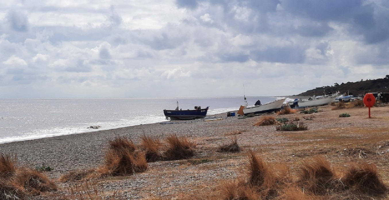
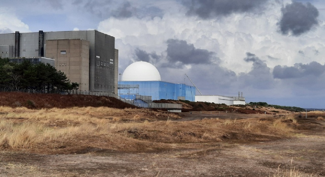
Today I took a drive, first to Southwold, then on to Sizewell Beach. First, I took a bike ride; then a stroll on the beach. Looking south – a deserted shingle beach with a few fishing boats. Looking north – a huge nuclear power station; with a third facility soon to be built alongside it, judging by the roadside protest posters erected by local residents.
0-0-0-0-0-0-0-0-0-0-0-0-0-0-0
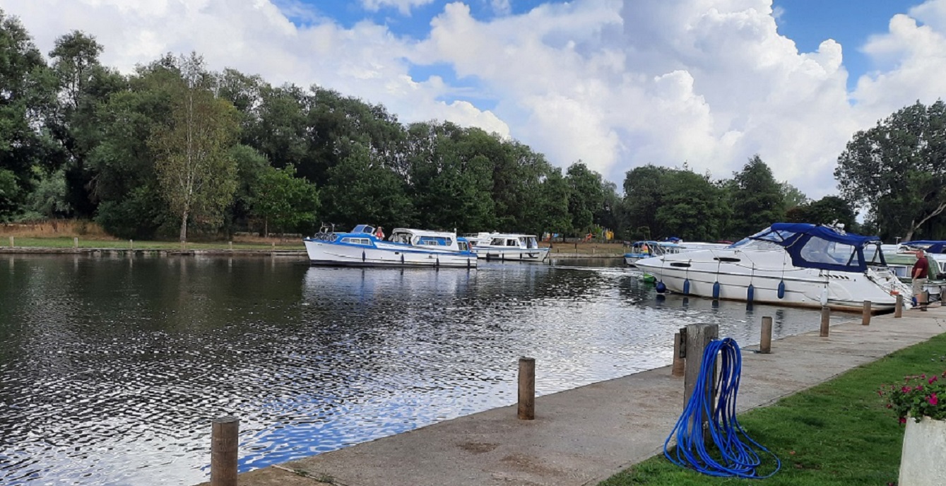
Another bike ride today. This time along the banks of the River Waveney at Beccles. I parked at the yacht basin which was obviously a popular spot for the boating fraternity to spend a night. £12 a night with water and electric connection nearby, with toilets and showers on the quay, seemed to be a good deal. Seven miles along what turned into a rather narrow, bumpy footpath making a circular ride was more than enough.
0-0-0-0-0-0-0-0-0-0-0-0-0-0-0
It was leaving day today. Despite some rather poor daily weather forecasts, every day turned out to be very acceptable. I left the site just after 10am and with a stop for some lunch, reached home around 2pm.
My onboard electric meter confirmed that I’d used 66KWh during the 10 days.

If you are coming to East Anglia any time in the future please let me know as you know I would love to meet you. You single handedly gave me my trip to Spain. It may have only been the once because covid struck but John would never have agreed to go if it hadn’t been for your blogs. You again have just covered the same areas as me but you have written about it and photographed it so much better than me. Lovely to read. Jenny
LikeLike
John, thank you once again for a very informative and enjoyable blog, long may they continue
LikeLike
Thank you for your comment Peter. I derive much pleasure from the research before I go and the writing after I return. Hopefully, my adventures will continue for a while longer.
LikeLike