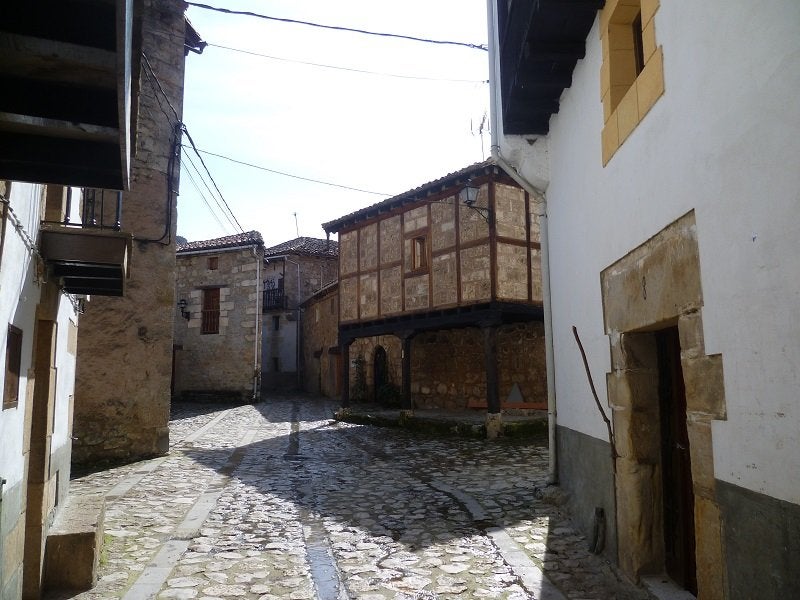
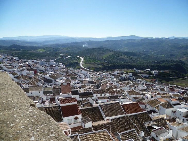
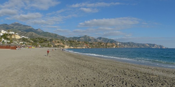
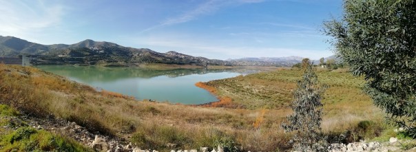
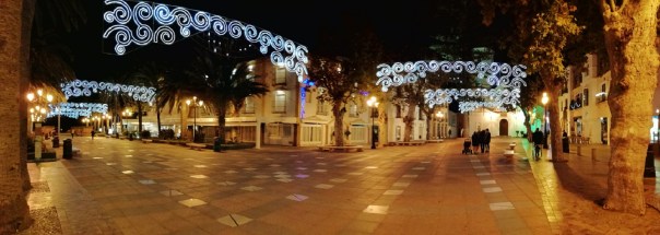
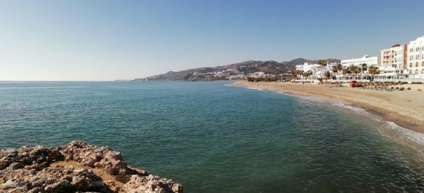
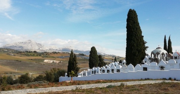
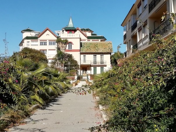
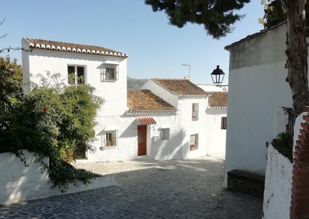
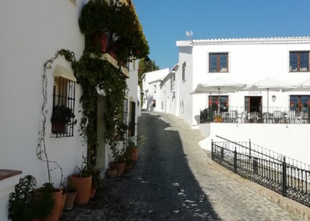
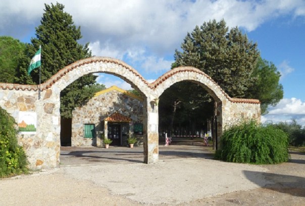
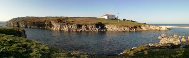
It’s the end of October and time to head south again for the winter. This will be the twenty-fifth winter when I’ve spent some of the months caravanning in Spain. Our early visits were comparatively short: the first one being only four weeks. But gradually, they have lengthened, so that now, I stay for the maximum time my insurance will allow – 122 days. Over the years, we’ve stayed at several popular areas from Alicante on the Costa Blanca round to Albufeira on the Algarve, but our favourite has always been the Costa del Sol. So it will be to El Pino at Torrox where I’ll be going after a slow meander through Central Spain. In the early 1990’s we flew to Malaga and stayed in an apart-hotel so that we could explore the possibilities for caravanning. It was during that stay that we discovered the site at Torrox. However, we didn’t stay there during our first years because the lack of a decent road made it very inaccessible. By the end of the ‘90s, as the area began to be developed, the approach road was somewhat improved. Now that I caravan on my own, I look forward to arriving at El Pino where I know I will meet lots of friends from previous years.
The ferry I’m booked on this year is the Baie de Seine; it’s what Brittany Ferries use for their “Economie” Service. The ship is smaller than the two cruise ferries, so the facilities on board is not as great However, cabins are comparable on both services. Bunks and en-suite bathrooms are the same. The only difference is that one has carpet on the cabin floor whilst the other has wood laminate. The Economie ferry has a self-service dining room with a limited range of meals, whilst at least one of the cruise ferries has a waiter-service dining room.
For me, one of the plus points of the smaller ferry is that unloading is done in much less time. Being parked in the ‘wrong’ position on the big ships can mean a wait of up to an hour between doors opening and driving off. The second plus point of the “Economie” sailing is that for my sailing dates there is an approximate saving of around £60 each way.
All the crossings from Portsmouth to Northern Spain take between 30 and 36 hours. For the first time traveller, both departure time and arrival time should be carefully considered. A convenient departure time will not necessarily be followed by a convenient arrival time. For instance leaving Portsmouth at 17. 30 means arriving in Spain in the evening by which time, in winter, it will be already dark. On the other hand, a departure from Portsmouth at 22. 30hrs gives a very early arrival at 07. 00hrs, with a good day of travelling time ahead of you.
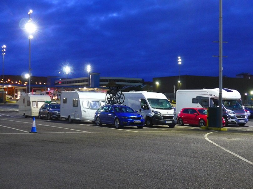
On Tuesday morning the departure time from Portsmouth was 08. 45hrs and whilst I could have managed by leaving home at around 5am, there’s always the chance of early morning fog, and I do like to have time in hand for contingencies, so I left the evening before and spent the night on the dockside. When I arrived at the port, there were six other towed caravans and motor vans already there, so I parked where the marshal indicated. Having ascertained that I wouldn’t be required to move before morning, I wound down the legs, settled down for dinner followed by an evening of DVD’s in the caravan.
0-0-0-0-0-0-0-0-0-0
Tuesday morning started early with check-in opening at 05. 45. Having been there over-night, I was one of the first through. I was immediately met by Border Control. Maybe because it was the start of their shift, the lady assigned to my outfit was conscientiousness personified. After many questions regarding my car and its contents, she then asked for access to the interior of the van. This was followed by an examination of the underside of both car and caravan with mirror and torch. Finally I was allowed to proceed to the loading lines. From being almost first to check-in, I became almost last to board, and found myself with some other tourers down below the water line on deck 4 among the solo trailers and HGVs. My cabin was on Deck 8 and in an ideal position for both restaurant and reception. In fact, it was so close to reception that I was able to get on the internet in the cabin.
0-0-0-0-0-0-0-0-0-0
The crossing was made in good weather with only a mild swell as we crossed Biscay.

The ferry docked on time and within twenty minutes I was heading towards passport control and the exit. Border Control took a quick look at my passport and I was soon out on the road leading up to the A8.
For several years, when arriving at Bilbao I’ve wanted to stop to see the Hanging Bridge which is built close to where P&O used to berth their “Pride of Bilbao”. I’d already researched on Google Earth a likely stopping place for the car and caravan, so with coordinates entered, I headed for the spot and unloaded the bike. I cycled around the harbour for a couple of miles and arrived at the mouth of the river where the Vizcaya Bridge was built to connect the two sides. The builder, who was a student of Gustave Eiffel was given the brief to build a bridge that wouldn’t disrupt the river traffic, but would also not need long ramps to gain height. He came up with a design for a hanging bridge.
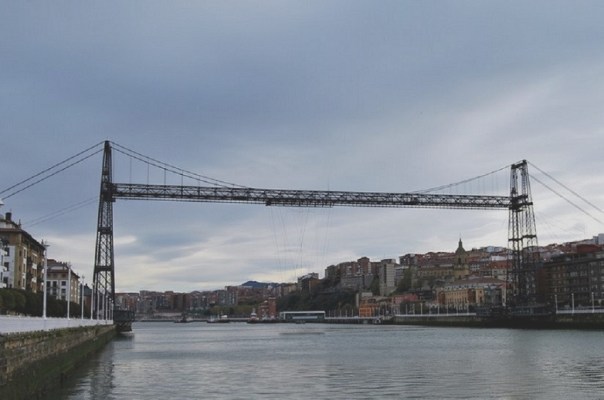
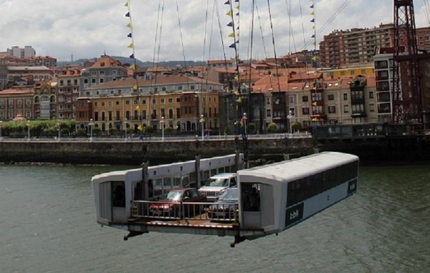
The bridge was built in 1893 and is made of iron. It uses twisted steel cables with a gondola hanging below which can carry six to eight cars and maybe a hundred foot passengers, The crossing takes less than two minutes. I would loved to have made a crossing on it as a foot passenger, but already the first few drops of rain were starting so I headed back to the car.
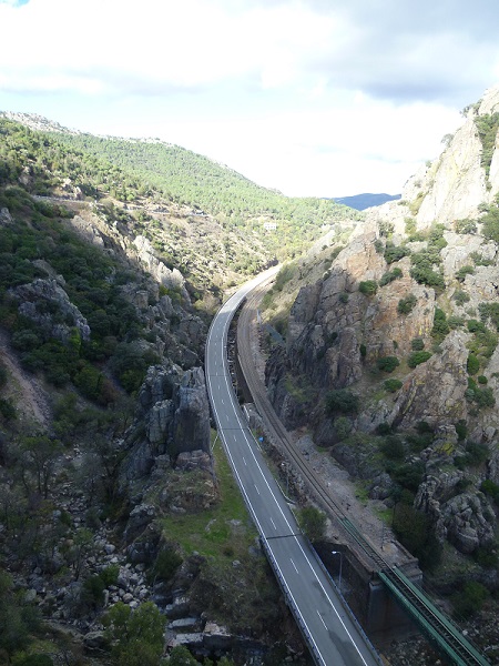
By the time I’d reached the A8, the rain was really hammering down. It was time for a review of my plans. Instead of heading west towards the Pico de Europa, I turned for the A68 and set off for Burgos – just over 100 miles away. It rained all the way.
A topic often mentioned on forums is about how to keep the caravan fridge cold on the ferry. My method is to turn on the caravan fridge the day before the travel date. At the same time put items in your home freezer. I put three 1ltr cartons of orange drink and I already had two fruit loaf cakes prepared a week ago. In addition I prepared a large chicken casserole and doled it out into meal -sized cartons. On the afternoon of departure, all the frozen stuff was taken from the freezer and packed into the caravan fridge, together with packets of ham and cheese, plus other necessary items. For my night on the dockside, the fridge was operated on gas. By not opening the fridge door too often, by the time I arrived in Burgos, my chicken casserole was still frozen and only required several minutes in the microwave.
0-0-0-0-0-0-0-0-0-0
The rain petered out during the night and the morning was giving a promise of a lovely day.
I was already beginning to regret my change of itinerary. But what’s done is done! For the present, the most important thing was to get to the local Mercadona and stock up on some essential items – most urgently some rolls for lunch. The store was only 6 or 7 minutes away by car, so it was to there I headed. Even from some distance away I could see the car park was empty. My suspicions were confirmed when I saw the shuttered entrance. It was closed. It was a Bank Holiday!
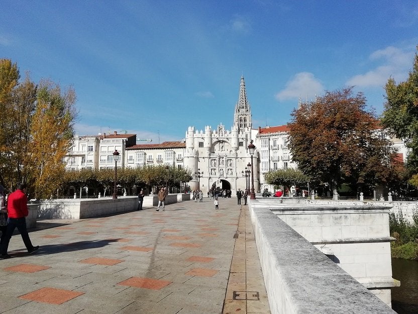
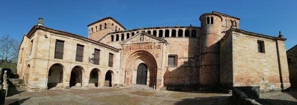
I continued on into town and Tomtom directed me to an underground car park close to the Cathedral. Having parked, I crossed the road and onto the bridge which leads up to the Arco de Santa Maria – the most impressive of the dozen gates which in the 12C were built into the wall surrounding the city.
Through the gate, is a plaza in which the Cathedral is built.
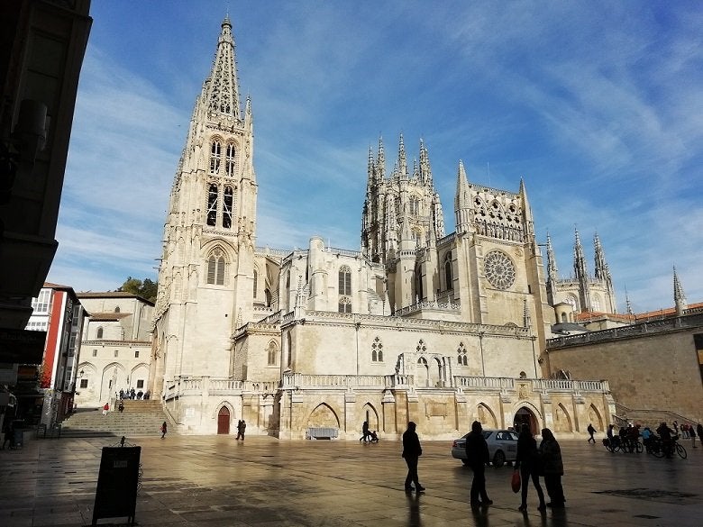
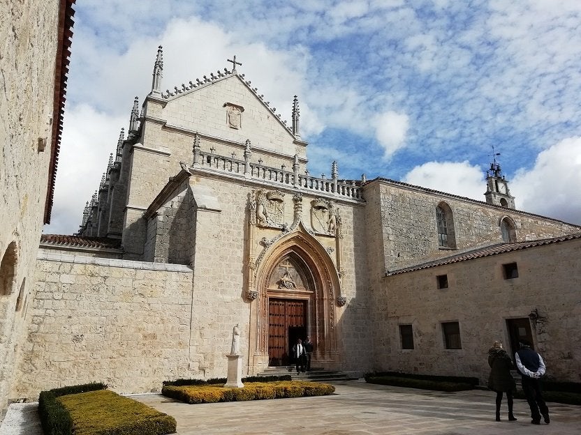
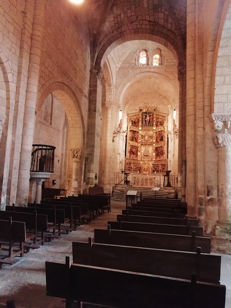
Work started in 1221 on the orders of King Fernando of Castilla. It’s built in the form of three naves surrounded by 19 chapels. To one side is what is reputed to be the finest Gothic cloister in Spain, decorated with sculptures from the 14th Century.


At the centre of the Cathedral is the tomb of Rodrigo Díaz – better known as El Cid. He has become a Spanish folk hero; especially in this part of Spain because he was born only a few miles down the road at the village of Vivar. Rodrigo Diaz de Vivar was born around the year 1040 into a family of the Spanish nobility.

He became an important general-administrator fighting against the Moors but when his King died, he was caught up in a Royal family squabble and was exiled. He worked as a mercenary-general fighting for other leaders, both Moor and Christian. It was the Moors who gave him his tittle – ‘El Cid’. Later in life he captured the City of Valencia, ruling it himself until his death in 1099. After leaving the cathedral I went to see his statue in one of the town’s squares.

Later I walked through shopping streets hoping to find a bakery open, but there was nothing. I returned to Fuentes Blancas for a very late lunch. Thank heaven for some baking potatoes in the car together and a tin of beans. Mercadona will have to wait till tomorrow.
0-0-0-0-0-0-0-0-0-0
To reach Burgos from the port at Bilbao, one needs to take the A8, then the AP68, then finally turning to the AP1. The road is a dual-carriageway toll motorway with several service stations along its route. Drivers take a ticket shortly after the start of the motorway and payment is made by cash or card at the exit. The final peage is situated just before the exit for the Burgos campsite. For the 100 mile tow, the toll charge was €21. 50
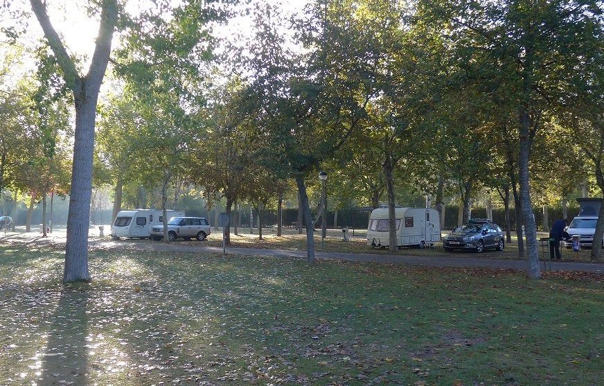
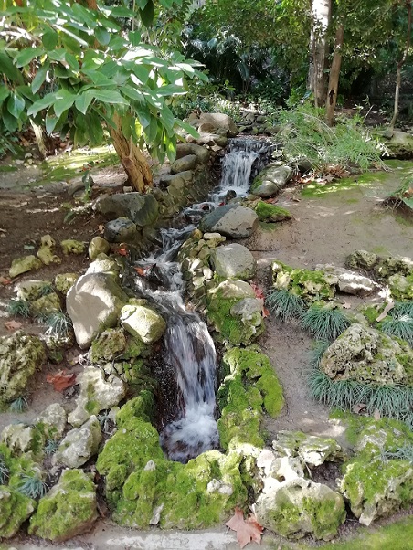
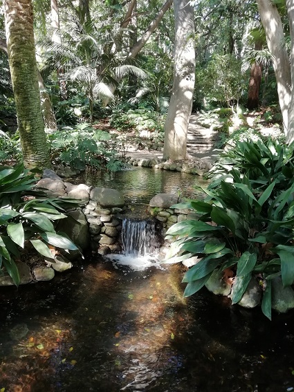
Fuentes Blancas at Burgos is a popular site used mainly as an overnight stop-over on longer journeys. But there are sufficient places of interest around to warrant a stay for two or three days. At the site, the pitches are laid out on either side of three parallel roads through the camp. Close to reception are the caravans and bungalows which are semi-permanent. Further through the site are pitches for tourers and motorvans. Open air sink units are situated every 100 yards or so but in the winter, the water is turned off because of freezing. Similarly with the electric bollards. They are placed every 50 yards. The electrical connections are of the two-pin continental type, which are showing their age. During the winter months, two of the four toilet blocks are open – one is heated, one is not. Both are clean and functioning with hot water in sinks and showers. From past experience, I know the pitches tend to become water-logged during periods of heavy rain. As it was raining when I arrived, I reversed the caravan on to the pitch ensuring that my front drive wheels stayed on the roadway before unhitching.
The site has a good internet connection which is free to log on to. Login details are available at reception. The ASCI discount card is also accepted.
0-0-0-0-0-0-0-0-0-0
By Thursday evening the rain was back again and continued through the night and into the next morning. But by lunchtime, it had stopped and the sky was clearing so I got into the car and headed off to Burgos. On the road leading to Fuentes Blancas, there’s a turning which is signposted “Monastery of our Lady of Miraflores”. I decided to explore, so I turned off and drove to the top of the hill. The gatehouse was open with a few visitors coming and going. I joined them. The building is home to monks of the Carthusian Order, and this monastery was founded in 1442 by King Juan II of Castille & Leon. Carthusian monks wear an oatmeal coloured habit and hood. But none of them was to be seen, because they live a life of silence and solitude, with each monk living in his own cell. The first service of the day begins at midnight, followed by eight others throughout the day. Carthusian monks are only allowed two visits per year by members of their immediate family. The French members of the Order are the producers of the cocktail ingredient, Green Chartreuse.
Once through the gatehouse, there is a small area with cloisters on two sides. On the third side is the church with the coats of arms of King Juan and Castille over the arched doorway.
Like all religious houses in Spain, this one is highly ornate with gold leaf decoration everywhere.
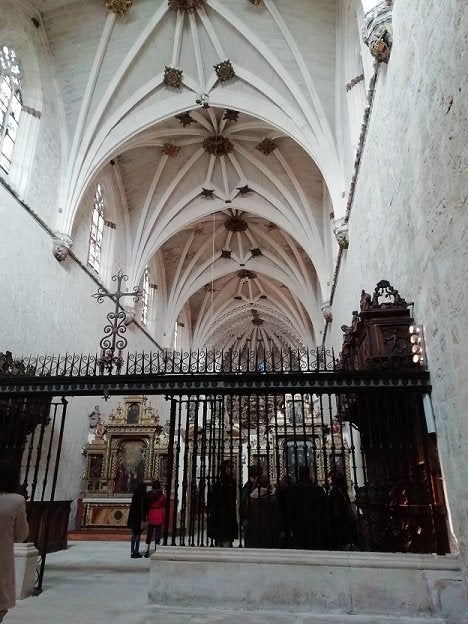
However, it is to the wood that my eye is always drawn. Here there is wood carving in abundance.
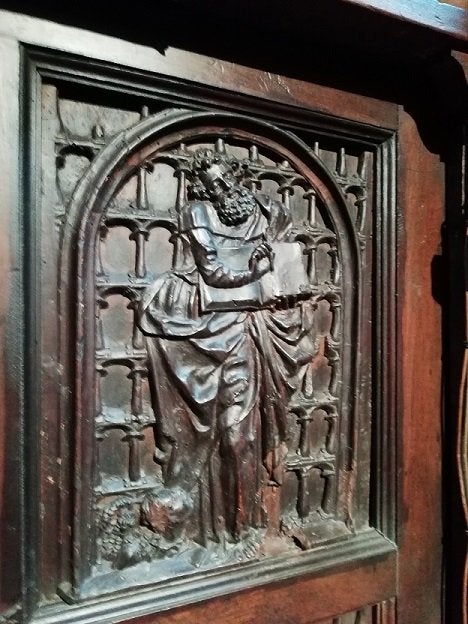
Two banks of choir stalls are arranged down either side of the chancel. They are all intricately carved from walnut and were completed in the 1550’s. In a side chapel, three sides of the room are taken up with massive chests of drawers containing vestments and altar frontals.
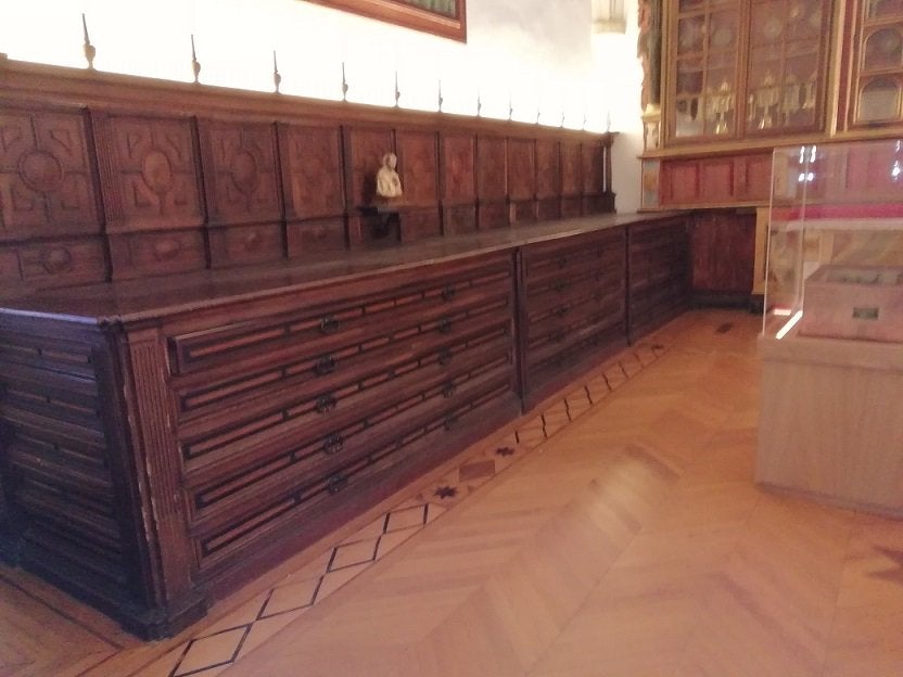
These too were constructed in the 16thC using walnut.
0-0-0-0-0-0-0-0-0-0
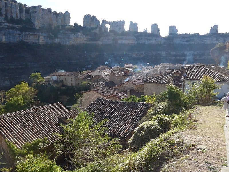
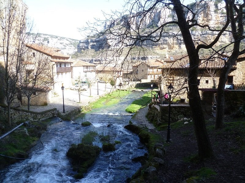
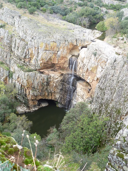
Saturday looked to be a promising day so I packed some lunch and set off back towards Santander, but by the old N-623 road. On a forum recently – maybe the C&CC – someone asked about towing on this road. Well yes! it’s possible, but there are several hilly, multiple S-bends on the route, so why would anyone want to when the toll-free A67 is just 15 or so miles to the west. However, I was on it because I wanted to visit the medieval village of Orbaneja del Castillo. The village was built during the Moorish occupation of Spain and the thing that makes it unique is that it’s built into the side of the Ebro Gorge. In the cliff, towering above the village is a cave from which spring water flows. The water runs into a culvert through the village, then cascades down the cliff face before reaching the river in the bottom of the gorge. .

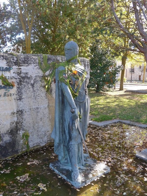
On the way back to Burgos I detoured slightly to stop in the village of Vivar. It was in this village where the Spanish hero, El Cid was born. At the centre of the village is a rather neglected memorial to him.
Time to move on tomorrow.
I was ready to leave Fuentes Blancas by 9 am and being Sunday, the roads were quiet. Very soon I’d reached the start of the A1 which is a toll-free, two-lane motorway which goes all the way to Madrid. You won’t find service areas on the road but there are many filling stations, some with large parking areas alongside them. However, most are entered from a service road, and some of them are long. One of my favourite stops is at KM150. And another, just before the Madrid ring roads at KM27. At both, service roads are short; pumps are caravan-friendly and there’s a large carpark for meal breaks behind the shop.
A few weeks ago, when I was researching my present route with the aid of Google Maps, it gave me three choices for the journey from Burgos to El Escorial. One was via Segovia using the toll motorway, the second, a longer route via Madrid and a third – the shortest, using a 30-mile section of local road from KM50 on the A1, across to the A6. Looking at Street View, the road seemed fine for towing.
So when I reached the foot of Puerto de Somosierra, I disregarded Tomtom’s instruction to head for Segovia, and instead, continued on to the top of the pass. After several attempts to have me turn round, the device reset its self for a new route. But from the new ETA details, I realized it had chosen the long route via Madrid. It didn’t seem to want to consider the local road. Was I about to make a mistake? The exit came up…………… and I decided to take it. The road was as I had seen on Street View. An undulating road through the mountains, with some beautiful scenery. Yes – there were a couple of small towns to go through with a few speed bumps, and one of them where the whole population seemed to have turned out to attend a Sunday street market. Eventually, I met up with the AP6, but the short distance I had to travel meant that I left it before reaching the toll-booth. Ten minutes later, I was checking in at Camping El Escorial.
It was just around lunch-time when I arrived on a lovely Sunday afternoon. The place was heaving with Spanish weekenders. I drove around the lanes of pitches with not a vacant pitch visible anywhere. Eventually, I realized I had got into the area for semi-permanent caravans. A few minutes later, I found the ‘parcelas’ where there were lots of spaces. I pitched close to a water tap and within a reasonable distance of the toilet block. With water and electric connected, I took a walk around. The activity and noise, mainly from young teenagers were horrendous. It was back to the caravan to put the kettle on.
As if by magic, two hours later the place was as quiet as a tomb. Some caravans had towed off, but many had just been locked up and left. Now, as I look around, this part of the site looks busy, but nearly all of the vans are deserted. And as the crowds departed, so the rain began. It continued throughout the night.
0-0-0-0-0-0-0-0-0-0
Monday morning – and the rain was still hammering on the van roof. According to Meteo, it would continue all day. And they were right! But with the Royal Palace and the Valley of the Fallen being closed on Mondays, it was no great hardship. So the high point of the day was a visit to the local Mercadona.
0-0-0-0-0-0-0-0-0-0
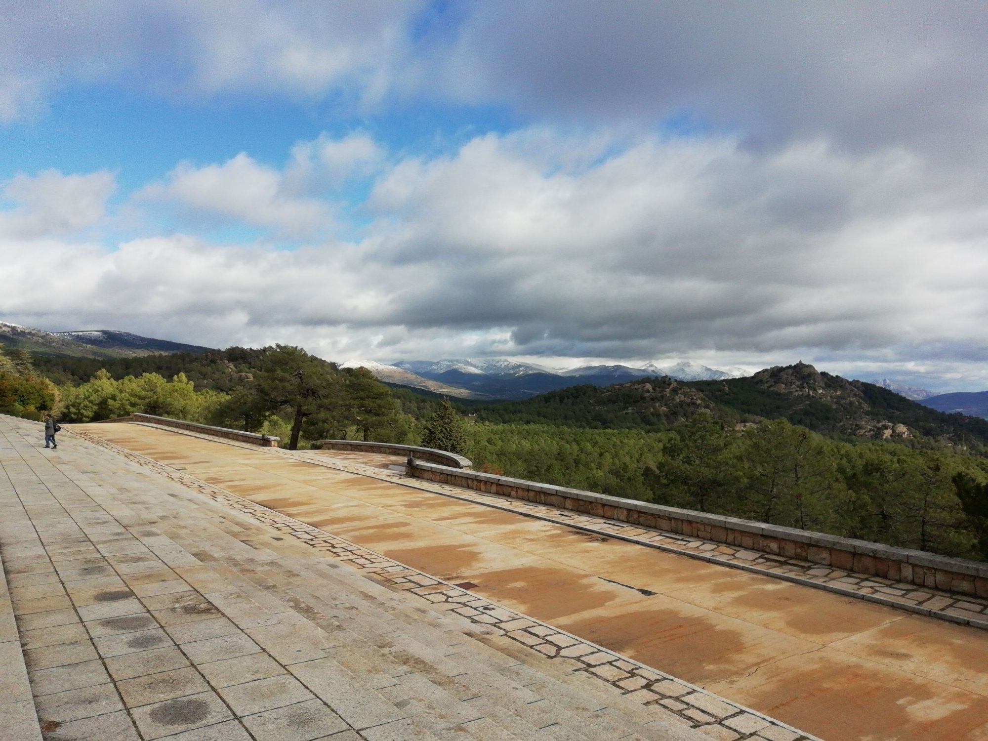
Tuesday started as a dull, dismal day and so it continued throughout except for just a few periods of broken cloud. If I were to visit the Valley of the Fallen, it would have to be today because more rain is forecast for tomorrow. The complex is situated within a huge pine forest only five or six miles away from the site, but high up in the Guadarrama mountains.
It was built between 1940 and 1958 and is a monument intended to commemorate all those who died of both sides during the Spanish Civil War. About 40,000 soldiers are buried here. However, because Franco was the one who ordered its construction, and because he has his tomb close to the high altar in the Basilica, the complex is inevitably associated with the Dictator’s regime. Then there is controversy regarding the labour used in its building. Some say it was built by the forced labour of prisoners of war. Others say the work was carried by criminals on parole who were working to reduce their sentence. Suffice to say that it became such a political hot-potato that in the late 2000’s, the place was closed to the public. Even now, security is tight with outer-clothing and pocket contents having to go through an X-ray scanner.
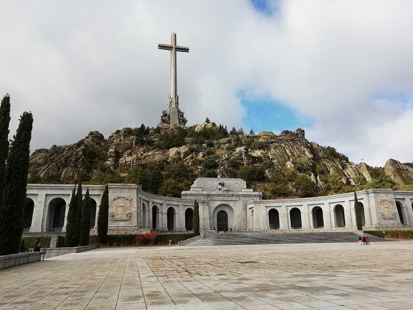
From several miles away the huge cross is visible. It stands on top of a cliff, approximately 4500 feet above sea level. The cross itself is nearly 500 feet high and the arms have a span of 154 feet. Around its base are four colossal sculptures of the four evangelists.

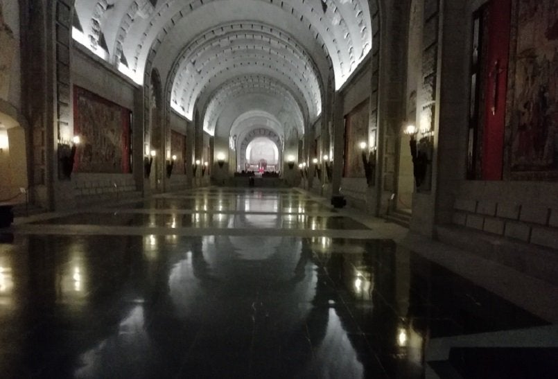
Down below on the Esplanade is the entrance to the Basilica which has been cut deep into the mountain – and it’s huge.

Unfortunately, the authorities have chosen to ban photography – although I did manage to sneak one shot.
There is a funicular which carries visitors up to the cliff top alongside the cross but today, it was closed. The view from the top must be superb.

0-0-0-0-0-0-0-0-0-0
My next stop was at the Royal Palace of San Lorenzo. It was King Philip II who ordered the palace to be built in 1557 to commemorate the Spanish victory over the French at the Battle of St. Quentin.

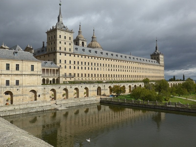
His idea was that the complex would serve as a burial place for his parents and himself. In fact, many of the Spanish monarchs are buried here.
I was here some years ago so for today I settled for a view from the outside and a walk through the gardens.
By late evening, the rain was back again, and the weather forecasts make a depressing view. Talavera and Merida, my next planned stops look awful for the next three or four days. Maybe it’s time for some replanning.
0-0-0-0-0-0-0-0-0-0
The weather was determined to make my departure from El Escorial as unpleasant as possible. My plan was to drive 90 miles to Talavera, but to detour slightly and visit the archaeological park at Carranque where there’s the site of a Roman Villa and mill. Then later I wanted to visit the site of the Battle of Talavera which was the Duke of Wellington’s first major victory of the Peninsular War. Followers of Bernard Cornwell’s fictional character, Richard Sharpe, will remember it was at Talavera where Sharpe captured the French Eagle. But with more rain forecast, and the fact that the windscreen wiper blades were thrashing to and fro, my plans were out of the window. Therefore, instead of heading off along the A5, I continued around the M50 and took the familiar A4. I thought perhaps by heading more easterly, I might get away from the rain. But I was wrong. I arrived at Camping Santa Elena, and I took the rain with me.
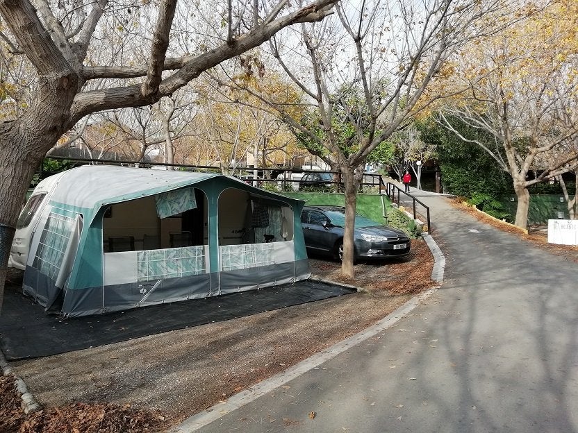
Camping Santa Elena is a useful stop-over site because it’s very close to the motorway. I’ve stopped there several times and a review of the site can be found in some previous years blogs. This time, I hadn’t unhitched, so getting ready to leave was quicker than usual. I followed the A4 all the way to Cordoba and beyond then took a cross-country route for 50 miles to arrive at Olvera – having taken the rain with me. Camping Pueblo Blanco at Olvera is a large site situated on a hill, about a couple of miles from the town, which stands on another hill across a valley. Roads within the site are well surfaced and lit during darkness, as is the approach from the main road. Every pitch has been levelled and each pitch has a capped grey water drain. Water taps and electric bollards are within easy reach of each pitch. Shower and toilet blocks are clean and well maintained. ACSI cards are accepted out of season with a night’s fee being €17. Wifi connection is available but at an extra cost.
Once I’d got settled, I texted forum-friend, Jim who was already at El Pino. As I’m likely to arrive there earlier than planned, I wanted to know if my usual pitch was empty! Apparently, they too were having a rainy day.
0-0-0-0-0-0-0-0-0-0
This is more like it! ……………A clear sky, at last, bringing the promise of a good day.
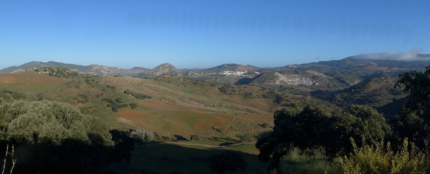
This is the 08. 30 view from my pitch across the valley towards Olvera.
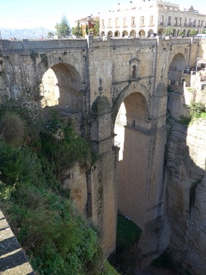
With breakfast done, I packed some lunch and a beer and set off towards Ronda. Several times in the past, I’ve stood on the New Bridge at Ronda looking out over the landscape far down below me and thought how it must look from down there looking back at the cliff top. Using Google Earth and GPS Coordinates I planned to try it. After much searching I found the back lane in Ronda that I needed to get down there. Very quickly I was off the smooth tarmac and on to uneven cobbles. The road twisted and turned down the cliff side. I would have given up and turned around but that was out of the question as there was nowhere to turn. Finally, I reached the bottom; then parked to get my picture.

When I saw a couple of tour company’s people wagons getting ready for the journey back to the top, I took the opportunity to keep in convoy with him. Back in the town, I was lucky to find a parking place close to the town gate.
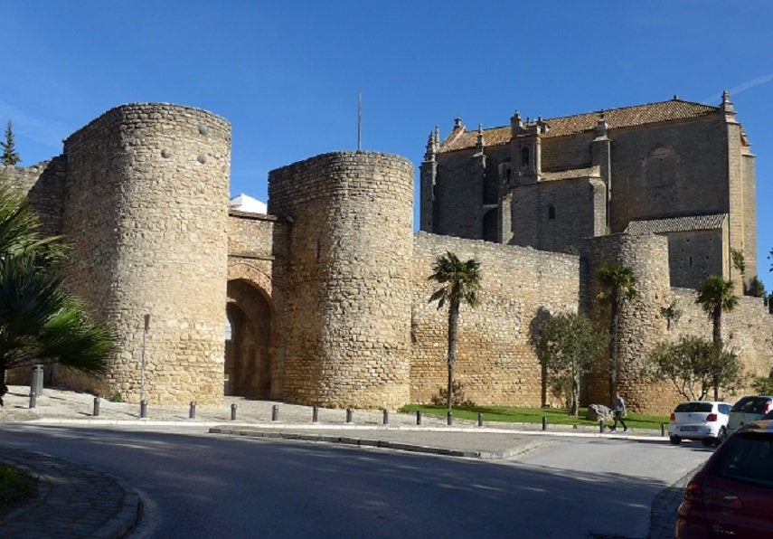
When the Romans came to Iberia they built two towns in this area. One they called Arunda and its near neighbour was Acinipo. Acinipo was much the more important. Its trading influence grew so much that it was authorized to mint its own currency. It also had a theatre which would seat around 2000 people. But with the gradual retreat of the Romans, the two towns declined. Acinipo virtually disappeared whereas Arunda continued to flourish. Then along came the Moors and rebuilt Ronda surrounding it with a protective wall, making the place their own, complete with public bathhouses.
Later I walked to the New Bridge – which isn’t new because it was built in the 18th Century but there’s also an old bridge which was built in Roman times.
From Ronda, I drove down across the valley then up onto the next escarpment where the once flourishing Roman town stood. This is Acinipo. The area is full of heaps of building stone with the remains of the theatre standing high up on the skyline.
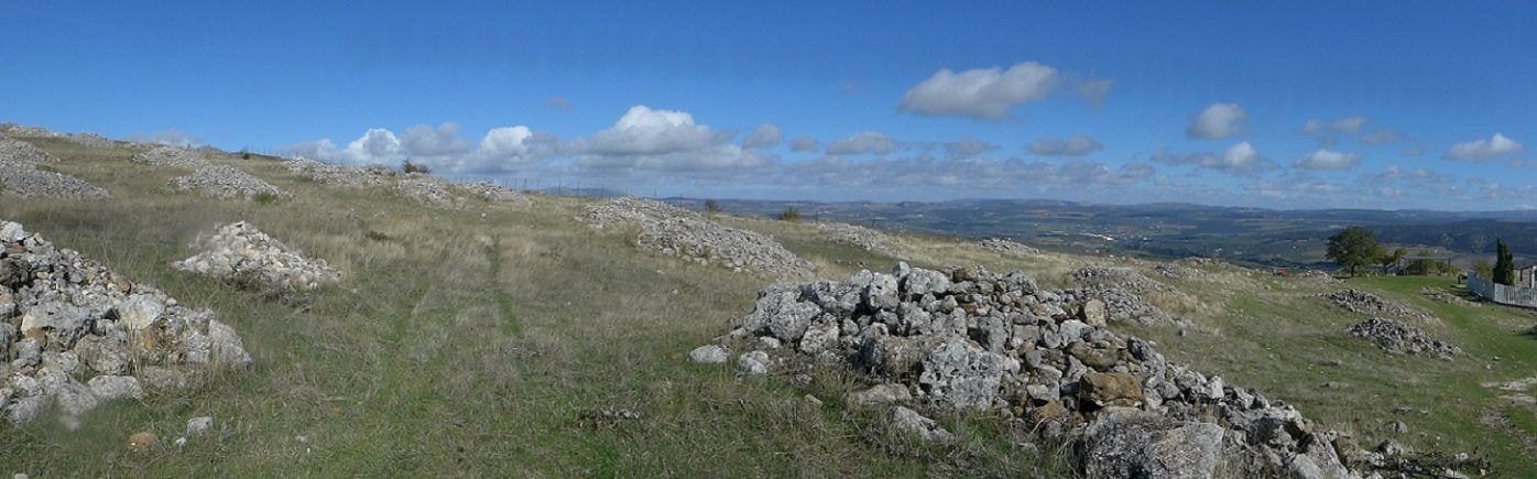


The seating has been cut into the limestone rock. Three archaeologists were busy in different areas around the theatre. I returned to Pueblo Blanca via the cross country roads.
0-0-0-0-0-0-0-0-0-0
Sunday had all the promise of a good day, so I packed up lunch and set off along the A384 towards Antequera. After 30 miles, Tomtom directed me to turn left and go across country. The traffic-free road took in some beautiful scenery. After several miles, I could see the lagoon which was the purpose of my visit. It’s known as Fuente de Piedra and is home to a range of water-fowl including vast numbers of flamingoes. As I drove along the flat landscape I couldn’t help but notice the large expanses of flood water standing on the fields. Before long I went round a bend and ahead of me was a flooded road with three abandoned vehicles standing with water reaching the door sills. A tractor was in the process of removing them. I had no alternative but to reverse a considerable distance and try to find another way – with Tomtom throwing a wobbly – until I switched it off. After several miles of following signs for Antequera, I reached the Seville/Granada motorway and before long I saw an exit for Fuente de Piedra. The carpark and visitors centre is just beyond the town. At the visitor centre, there are several rooms telling the history of the lagoon, then another describing the water-fowl which may be seen. Unfortunately, there is no English language version. Binoculars may be hired at the centre.

Two circular walks are laid out with observation ‘hides’. Sadly, I am unable to walk very far these days so I regret to say that the only flamingo I saw was the model in the visitors’ centre. And probably the birds prefer to congregate as far away from humans as they can.
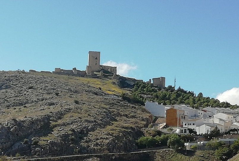
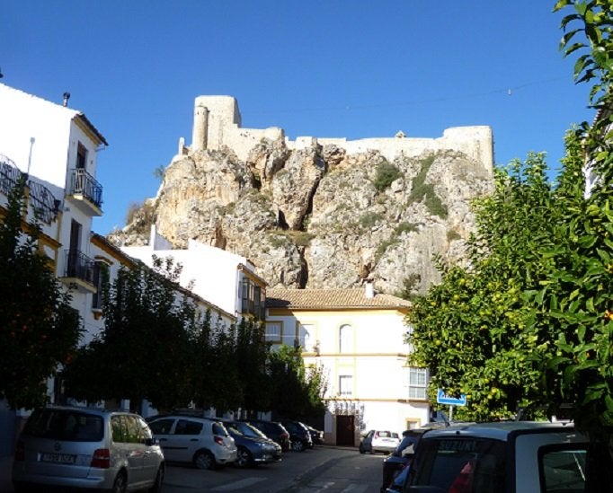
After lunch, I set off back to the site, but before I got too far along the road, I detoured and followed the signs for the Moorish village of Teba.
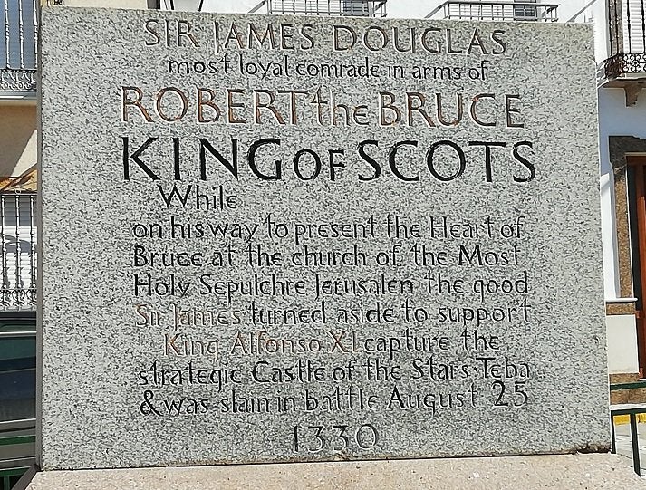
During August in1330, King Alfonso of Castilla was busy trying to dislodge the Moors from the castle in Teba. At the same time Sir James Douglas, commonly known as Black Douglas was crossing Spain on a crusade. His task was to carry a jewelled casket containing the heart of his recently dead King, Robert the Bruce and deposit it in the church in Jerusalem. Not being a man to miss out on a fight, Douglas offered his assistance to Alfonso. Together, the two armies defeated the Moors, but in the thick of battle, Douglas was killed. A commemorative stone in one of the plazas has been raised in his memory.
0-0-0-0-0-0-0-0-0-0
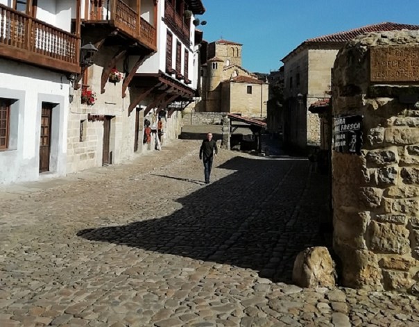
Another decent day at Olvera so I drove into the town. Olvera is built on the side of a hill with the church and castle crowning the peak. Being of Arab origin, the streets are narrow and steep. Certainly no place to try and park a car, so I parked on the perimeter and walked up towards the church. What a steep hill! The final 50 yards was not only steep, but was stepped as well. Finally I reached the small plaza where the church is on one side with another steep track leading to the castle on the other. For a small town, the church is remarkably ornate with many richly gilded memorial chapels erected along the aisles.
I looked across at the castle standing on even higher ground and decided I’d had enough climbing for one day, so after resting in the shade, I made my way back to the car and drove out of town to find the Vía Verde de la Sierra.
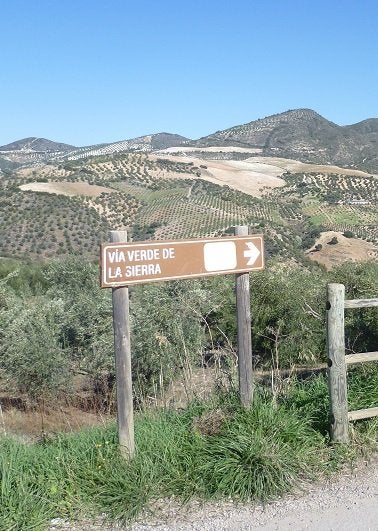
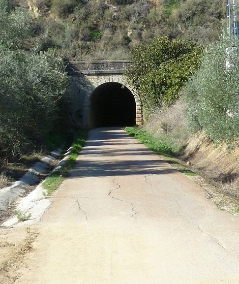
Back in the 1960’s work started on a new seventy-five mile railway line which was planned to connect Jerez with Almargen. Embankments and cuttings were created, tunnels were bored and lined, stations were built – but for some reason, the tracks were never laid. The project was abandoned and the track-way became overgrown. Only in recent years has a twenty-four mile section of the route been rescued and turned into a track for walking, cycling and horse riding. I unloaded my bike and cycled through the tunnel and along the track for a few miles. It passes through some beautiful scenery.

0-0-0-0-0-0-0-0-0-0
Tomorrow is moving day
0-0-0-0-0-0-0-0-0-0
Changes to my itinerary brought about by so many rainy days has meant that I will be arriving at El Pino six days earlier than what I’d planned but friend, Jim (CT’s Wigandiver) assures me that my pitch will be available. So having missed out on Merida and Carmona, there’s only 105 miles to do to reach Torrox.
With a ten o’clock departure from Olvera, I reached El Pino around mid-day and was welcomed by Silvia, a long-time receptionist at the site.
Having got the caravan on to the pitch, I set about positioning it as I like it. Not an easy task and maybe even impossible without a mover because of the trees. With water and electricity connected, I broke off for some lunch and a snooze. The afternoon just whizzed by, chatting to friends old and new, but then, I’d already decided to do nothing more until tomorrow.
When I was packing the car before leaving home, I made the mistake of laying the awning bag, the groundsheet and mats with the poles on the floor of the car before piling the travel crates on top. Consequently I had the car to unload before I could reach the awning. I got cracking by 9am. Shortly after, Jim and two of his mates arrived and we had the awning erected in no time. After lunch, I took it easy, installing my kitchen range at one end of the awning. Over the course of the next few days, I’ll get gear sorted and put where I want it.
0-0-0-0-0-0-0-0-0-0
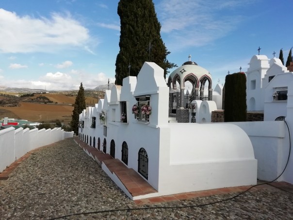
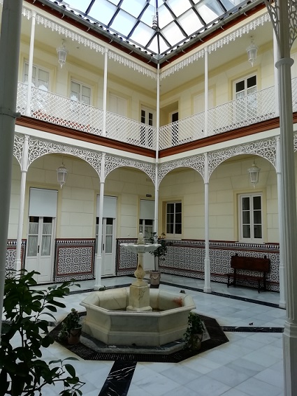
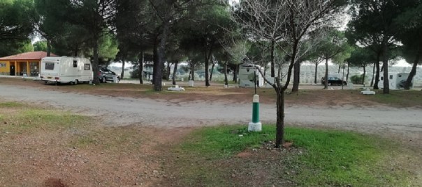
El Pino is a large, sloping site on seven levels where slopes have been bulldozed into level areas, although not every area is available to tourists. Four levels have been equipped with toilet and shower blocks. Every pitch is within fairly easy reach of a mains power box where a 10amp supply is connected via a continental adapter. Drinking water is available at the toilet blocks, plus at a few extra stand-pipes. Roads within the site are well surfaced although some of them are steep. Main gates are locked from mid-night until 8am with a security watchman posted in reception. A small shop is available close to reception which is open 9-7 throughout the year. Above the shop is an open-air patio for the site’s bar-restaurant, which is normally open throughout the year. (Having said that, at the moment it’s closed – undergoing a change of management)
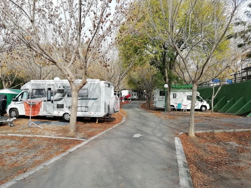
Part of the site is devoted to permanent chalets which are privately owned. Many of them are British owners who were once caravanners here. In another section are some more basic chalets which are site-owned available for short letting periods, although in the winter months they are rentable by the month. Again, some of the people using them, I first met when they were caravanners here.
There is a free wifi connection which has a strong signal at my pitch. I understand it’s not so reliable further away from reception
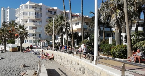
Within two hundred yards of the site are three bars, two of which are restaurants as well. There’s also another small shop selling bread and essentials. Larger supermarkets are about a mile away close to the sea-front. The area is well-catered for with an Aldi; a Lidl; a Mercadona; a 10%Dia and a Supersol.
0-0-0-0-0-0-0-0-0-0
It’s two weeks since I arrived at El Pino and the weather has been pretty awful. In fact, it’s probably the worst autumn weather I’ve experienced in all the years I’ve stayed here. Yes! In previous years we’ve had rain that’s gone on for 36hours at a stretch. But then, it has stopped and the sun has returned again. Not so during the past fortnight. Just an odd dry day interspersed with day after day of thunderstorms and torrential rain, turning site roads into rivers and flooding some of the pitches. This was just one day.
https://www. youtube. com/watch?v=WezpqWkC1KE&feature=youtu. be
All of which was probably responsible for the rock fall which occurred last Tuesday along the coast road. A lump of rock – the engineers estimate the weight to be in the region of five tons, detached itself from the cliff face and rolled down into the road completely blocking it in both directions.
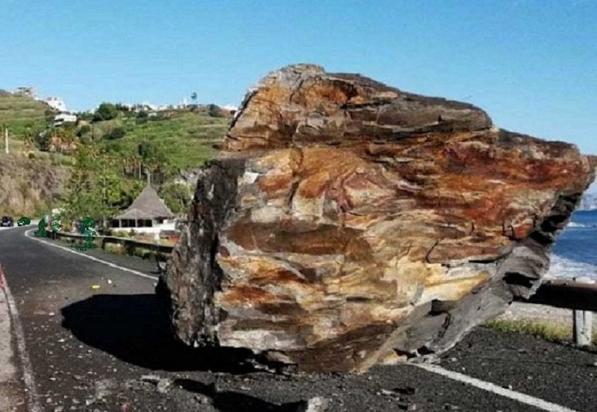
Before it could be moved, breakers had to be brought in to cut it into manageable pieces. The road will remain closed until the cliff face can be secured and the road surface repaired.
A section of about ½ mile is closed
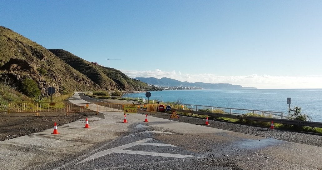
And here is where the fall occurred

The road surface is damaged, the Armco barrier bent where the rock hit, then rolled back to the centre of the road.

The A7 motorway runs through the hills, about 2 miles inland, but the coast road carries a lot of local cars and buses. The gods were certainly smiling when they arranged the fall to coincide with a lull in the traffic.
Happily, the weather has changed for the better and we are able to get out again. I rode the bike along the coast road to see how repairs were progressing…………………. They weren’t!
0-0-0-0-0-0-0-0-0-0
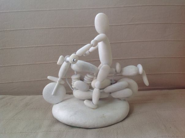
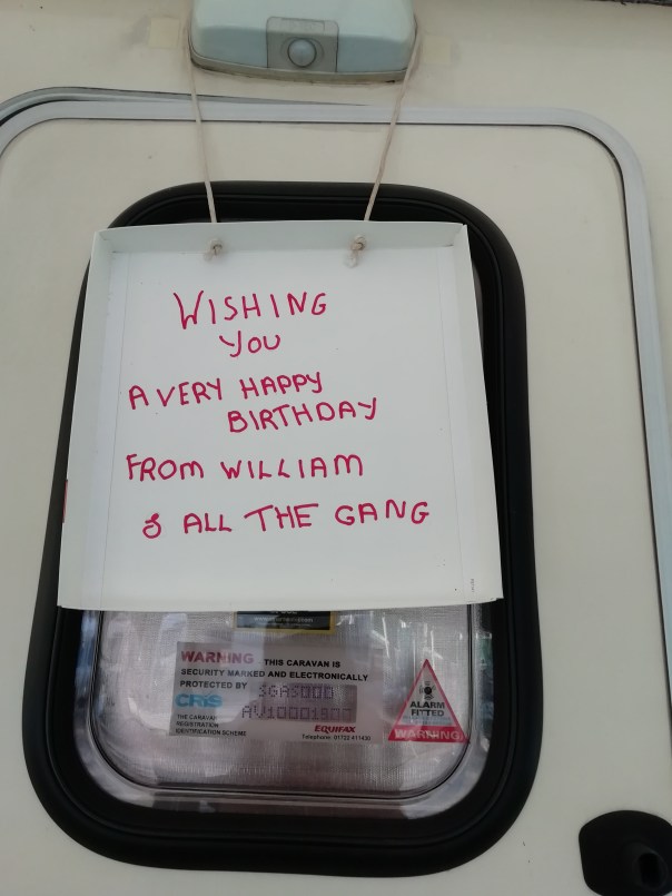
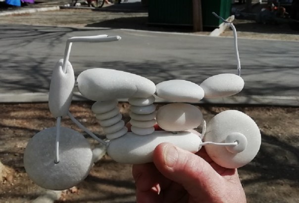
Usually, I write about somewhere I’ve been, but here I’m going to write about someone I’ve met……… Or rather – I’m going to write about his hobby. It features friend, William – a guy I first met here several years ago, who with Yvonne, has been a regular visitor to El Pino for a lot of years.
Every morning William and Bentley – his dog, take a walk, down the road, along the beach and back up along the river. As they wander along the shoreline,

William picks up likely pebbles,
pockets them and takes them back to his van.
Using a masonry bit in a cordless drill, the stones are drilled, threaded on a wire and formed into figures.
Each figure William builds is created with a particular recipient in mind.
So last year, at their farewell party, Martin and Joanne, our longtime friends from Scotland, and a keen boules player were presented with a figure carrying his boules, and of course, dressed in tartan plaid and kilt.
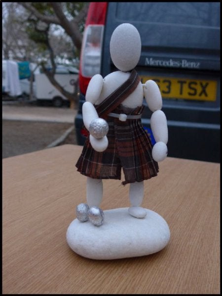
During the party the inevitable question was asked………….. was he wearing anything under his kilt?
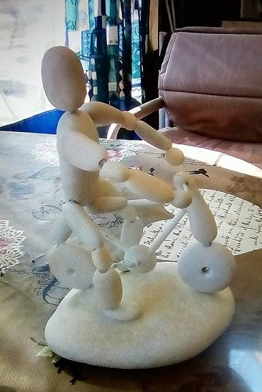
Another Martin who we nick-name Dutch-Martin hardly goes anywhere without his bike so this was his figure.
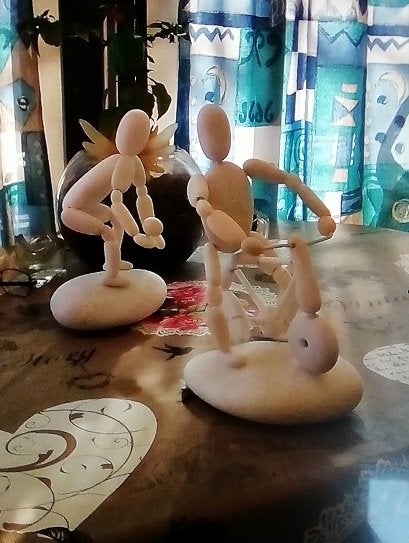
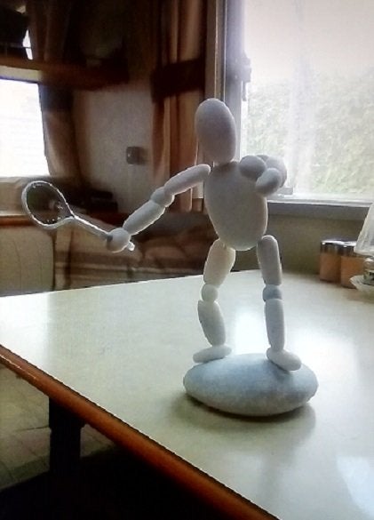
Another friend who is always going off to play tennis got this one
Ormond, our Norwegian friend is occupying his usual pitch across the road from me. Being from Norway he knows all about skiing. William made him his figure two years ago.

Since last year, a guitar-player has appeared in the shrubbery outside the site’s reception,
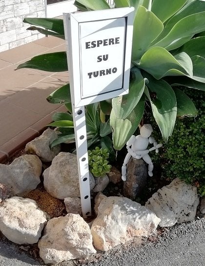
Take a closer look!
.jpg.d53c56423760d97b4eddc5af2c04cc0c.jpg)
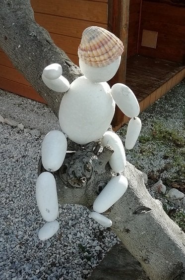
as has another figure sitting on the tree at the front of Les and Val’s bungalow.
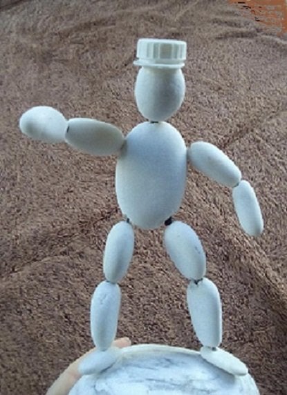
My pebble-man, wearing the inevitable cap has been sitting in my dining room at home for the past three years.
I wonder where next one of William’s trademark figures might appear?
Oh – and the question as to whether or not Martin’s Scotsman was dressed under his kilt?

Comments
Les Medes What a brilliant idea, keep the piccies coming JD,
ivan leslie Only one word – brilliant.
Longtimecaravanner Love it.
Bergamo Brilliant! How talented he is. Love the photos.
Standrewac Wow!
0-0-0-0-0-0-0-0-0-0
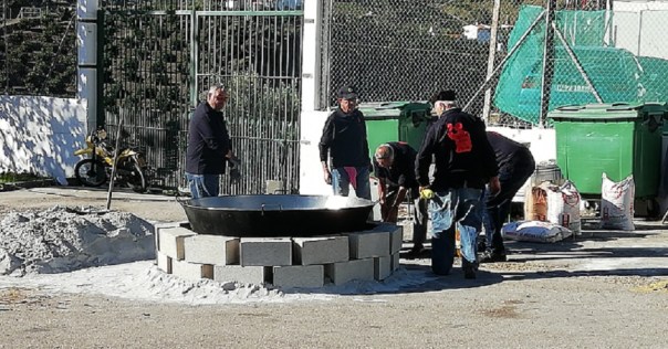
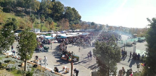
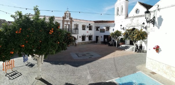
The Internet is a mine of misinformation. A few weeks ago I Googled the date of the Migas Festival in Torrox. The answer came up – “The Migas Festival is always held on the last Sunday before Christmas.” So this year that’s the 23rd of December. Brilliant – my daughters arrive in Malaga on the 19th, so for once, they can experience the Festival rather than listen to me telling them about it. They were delighted!. But then last Thursday I saw the warning notices for road closures on the 16th. Enquires revealed that the Festival was indeed to be held on the 16th. Well done Google!
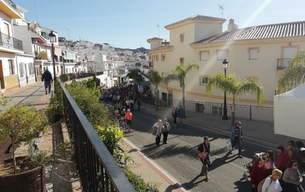
So today is the day. It’s impossible to get anywhere near Torrox by car, so my previous visits have usually been by bike. But health-wise I didn’t quite feel up to tackling the long climb up to the pueblo on the bike. So instead, I drove up to the motorway junction, parked on a piece of waste ground and for a Euro hopped on the bus for a mile and a half. It worked really well.
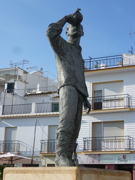
If you are not familiar with Migas, it’s an Andalusian dish which at one time was made in bulk to feed the labourers working in the vineyards, orange and olive groves on the estates. Tradition has it that at mid-day one of the kitchen boys blew into a conch shell which summoned all the workers to the estate buildings for a meal and siesta. A statue in the Plaza at Torrox commemorates such a young man.
The Migas was made in a huge pan over an open fire. The first ingredient was a large pouring of olive oil. When it was hot, stale bread was crumbed and added to the oil. Now they use flour. Almost anything can be added to it – milk, salt, peppers, onions, garlic, tomatoes, chopped chicken, sea-foods – all cooked then served with fresh salad.
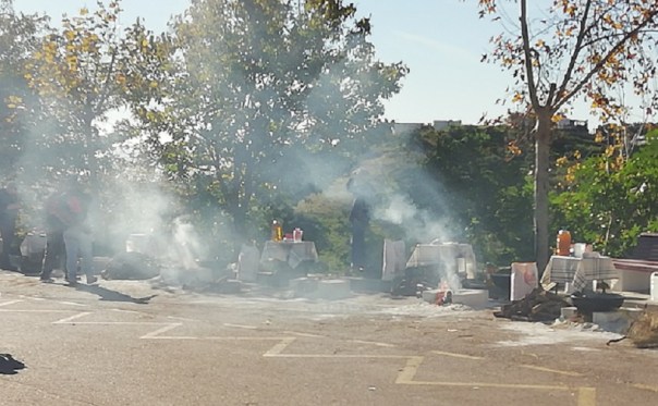
The day starts early with groups of volunteers arranging their fires and hearths around the perimeter of the car park, on which to set their huge pans.
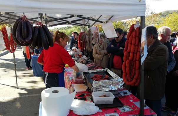
Across on the other side of the park various stalls are set up where charcuteros and patissiers display their produce.


As the morning wears on, the crowds get larger, all collecting their cups of wine which are dispensed from several large barrels situated around the park.
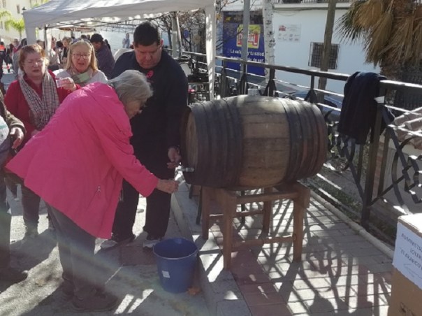
A few weeks earlier the local wine growers hold a competition for the year’s wine production. From the winners, the suppliers for the Festival is chosen. By midday all is ready and the crowds join one of many queues to collect their dish of Migas.

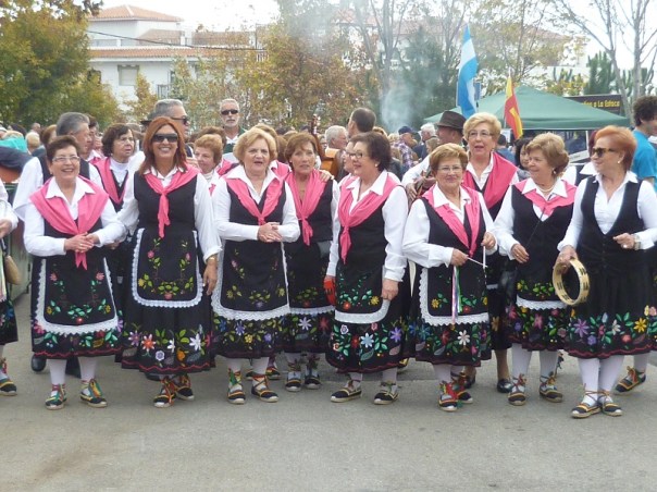
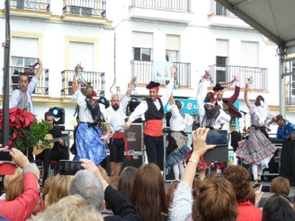
Meanwhile over at the Pueblo in the main square, a stage had been set up where groups of singers and dancers perform for the watching crowd.
But I couldn’t afford to stay long because there was another pressing engagement. So it was back to the bus, back to the site, a quick shower, then up the hill to the next level.
0-0-0-0-0-0-0-0-0-0
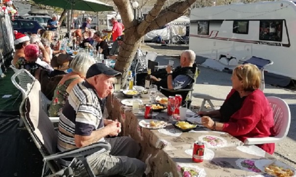
There I found the UK contingent of caravanners already in party mode. Several tables had been set up with almost every Brit on site in attendance plus a few Swedish and Dutch friends. A big thank you to those responsible for the catering.

William – the pebble-man

Watch the video below-
As I sat there in the sun, I wondered how they were faring at home. I opened my phone to BBC weather for my local town. Heavy rain and 3 degrees. What’s not to like by being here?
0-0-0-0-0-0-0-0-0-0
Phew!………………….What a busy eight days that’s been. On the 19th Dec I drove over to Malaga Airport to collect my two girls and grandson off an Easyjet flight from Gatwick. No sooner had they got themselves installed in their rented villa two or three miles along the road from my site,
than they were congratulating themselves on their choice of travel date, for that same evening, Gatwick Airport closed down for 36 hours because of the drone trouble. Once they had settled in and sorted their bedrooms, we drove into Nerja to have dinner at Mirasol, one of our favourite restaurants.
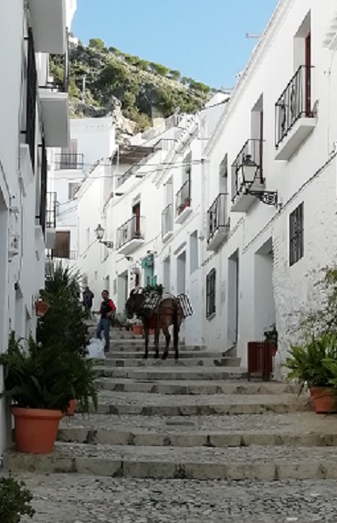
On their second day we drove only a short distance inland, and up the hills to Frigiliana which is the local ‘postcard’ village.
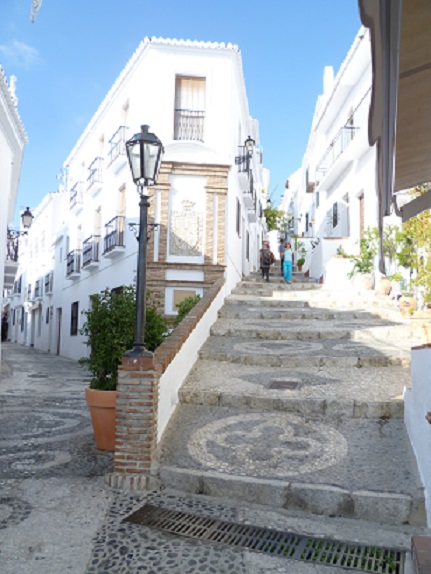
Parts of the village were built during the Moorish period so as it’s built on a hill-side, many of the streets are not only steep, but they are stepped as well which makes work difficult for builders and other maintenance workers. As I walked through the streets, one builder was having his bags of sand and cement delivered by donkey.
The tiny main plaza is dominated by the 16th Century church.

Even the main street through the village is narrow with sharp bends so vehicle traffic is restricted to residents. The top of the hill was once dominated by a Moorish castle, now virtually just a pile of rubble. From Frigiliana we drove down to Burianna, where we enjoyed a packed lunch and a beer on the beach.
Next day after meeting up we took a quick sprint along the A7 to Velez-Malaga, then turned inland where the road follows the valley bottom through plantations of avocado, olive and palm tree nurseries. After six or seven miles the road suddenly rises and we arrived at Viñuela which although it’s referred to as a lake, is a reservoir with a dam built at one end. I drove first to the eastern side because in the mornings that is where the view is seen at its best.
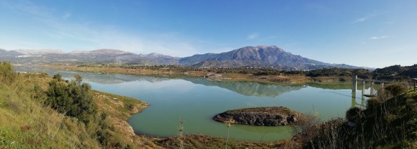
Comparing the water levels with those of ten or so years ago, the level is very low. Having said that, the present level is slightly higher than last year, thanks no doubt to that week of torrential rain we had just after my arrival at El Pino. After a short stroll along the bank we returned to the car and drove down into the valley and up the next range to Alcaucin – another hill village dating from Moorish times. One of the features of Alcausin is its restored Moorish water supply. Five fountains run continuously even during the driest dry spell. The water has been declared “potable” so local people arrive with trolleys and cars to fill numerous 5-litre containers with the water. There is a local legend which promises that any ‘unattached’ person who drinks from the centre fountain, will marry someone from the village within the year. Grandson, Sam was taking no chances since he chose spout number four to drink from!

This village also has a tiny plaza where one side is taken up with the 17th Century church.
We returned to the lake in time for a packed lunch. Part of the surrounding woodland has been laid out with twenty or so picnic tables and seating. Adjacent to every table has been built a concrete barbecue hearth. Being Saturday, many of the barbecues were in use. During the afternoon we took a walk along the dirt road through the woodland surrounding the lake.
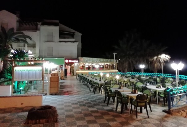
We later met up for dinner at the Bamboo, another of our favourite restaurants where we’d booked a table.
On Sunday we turned east and drove along the old coast road for twelve miles to Marina del Este. Where the road has been improved along some of the headlands, the old road has been left as lay-bys. From the cliff tops there are some fantastic views.

At Marina del Este a large rock close to the shoreline has been ingeniously changed by adding a breakwater at one end, thus forming a marina where some very expensive looking craft are tied up.

 Around the hillsides are tiers of apartments and villas. Some apartments were bought ‘off plan’ – ie: purchase agreed and paid for before they were finished. Unfortunately, before even the new owners were able to take possession, building faults became apparent which made them uninhabitable. With the builders bankrupt and long since vanished, the owners were left with a problem – which still continues. We later drove over the headland and into the next bay at Herradura. Here a horseshoe shaped bay is backed with a gently sloping beach.

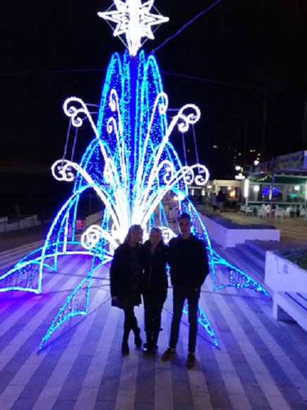
It was an ideal spot for our packed lunch. In the evening we had wanted to visit La Paloma Blanca on Torrox prom for dinner. After admiring and photographing the ‘Christmas Tree’ erected at end of the prom,
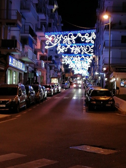
we were disappointed to find La Paloma closed. We returned to the car and drove to Nerja where we visited Mirasol again. Later in the evening, we walked through Nerja to see the Christmas lights at the Balcon.

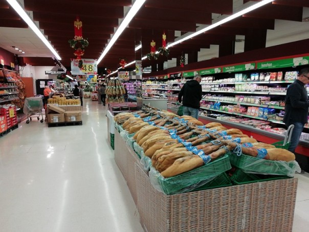
On Sunday we decided to do our Christmas Day shopping so we went to the local Lidl. In none of the supermarkets do you see any Christmas turkeys. Instead hundreds of hams are on display. This is the view down one aisle in Mercadona.
Christmas Day’s weather was similar to the previous few weeks; clear blue skies, lots of sunshine and temperatures around 20C by mid-day. After coffee and an exchange of Christmas presents, we sat out on the balcony until after lunch.
During the afternoon the family took a walk along Playazo Beach; then it was time to return to the villa for the girls to start preparing dinner.
Boxing Day is not celebrated in Spain. The 26th Dec is a normal working day so shops are open and most people are back at work. We drove westward along the coast road as far as Torre del Mar. There we found a quiet section of the beach for sitting out and having lunch. During the afternoon my girls and grandson walked the four miles along beach and promenade to our rendezvous point further along the coast. In the evening we returned to the Bamboo for dinner.

Sadly, today was all bustle and hurry. By ten thirty villa door keys were handed back and we were on our way to Malaga. It’s a 40 mile drive to the airport but even so we had time to stop at Torremolinos beach for a coffee and for daughters to have a final look at the sea before completing the five minute drive to the airport. Some reluctant farewells and all that was left for me to do was drive back to the site for a late lunch.
0-0-0-0-0-0-0-0-0-0
Had it not been for a Senior Moment, you would be reading a piece, and looking at photographs of Nerja’s Three Kings Fiesta. But I got the date wrong! How could I do that? For the past umpteen years, I’ve attended the Fiesta on the evening of the 5th of January. For some reason, I got it into my head that it was on the 6th. Fortunately by lunch time on the 6th, I’d realised my error. So as my bike was already loaded in the car, I decided to drive and then cycle. I drove a few miles along the coast road towards Nerja and parked the car on Playazo Beach.
From there, I cycled along the dirt road, crossed the almost dried up river, then along a short piece of promenade to the headland, known as La Torrecilla. In the 16th Century a small castle was built on the promontory to ward off marauding Berber pirates. However, in 1812 the Mediterranean Fleet of the British Navy bombarded the castle and rendered it useless to prevent its use by Napoleon’s invading forces.
From the point, there are beautiful sea views in both directions.
 The small beach to the east, takes its name from the Castle. Being a bank holiday, both the beach and the cafes were popular.
Even a swimmer was temped into the water.

At the far end of the beach the rocks begin again and a promenade runs uphill. At the foot of the steps where they go up into the town, a commemorative column has been set up to mark Spain joining the EEC in 1985.

The column contains a worked piece of stone transported from each of the then 15 member countries, plus a stone quarried from Nerja. The piece from “England” is close to the bottom. I couldn’t help but wonder if they will want to remove it in three months time?
At the top of the steps is a row of restaurants and bars. The first is one of my favourites, The Bamboo.
Continuing up through the town, one enters a maze of narrow street.

Eventually we arrive at the Balcon. Here, some 150 years ago, this was just another high headland, also with a 16th Century castle built on it’s point. This castle, like the one at Torrecilla, was also attacked and destroyed by the British Navy.

During the second half of the 1800’s, the area suffered a drastic downturn in its fortunes.
An insect plague devastated the vineyards. Outbreaks of cholera and typhus lead to hundreds of deaths. Then finally in 1884, the area was rocked by a severe earthquake which ruined much of the town. No wonder many of the population set out to seek new lands in South America.
After the earthquake the town was visited by King Alfonso 12th. Tradition has it, that he was so impressed with the view from the headland, that he suggested it should become “The balcony of Europe”. Whether or not that’s true, on the strength of the story a full sized statue of Alfonso has been erected standing alongside the railings.
Certainly the views in both directions are superb.

After spending some time enjoying the views, I cycled back through the town to the car, eventually reaching the site to find I’d had visitors!
And I thought I’d kept it a secret!!!
0-0-0-0-0-0-0-0-0-0
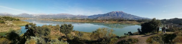
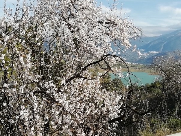
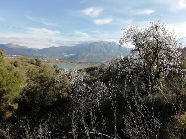
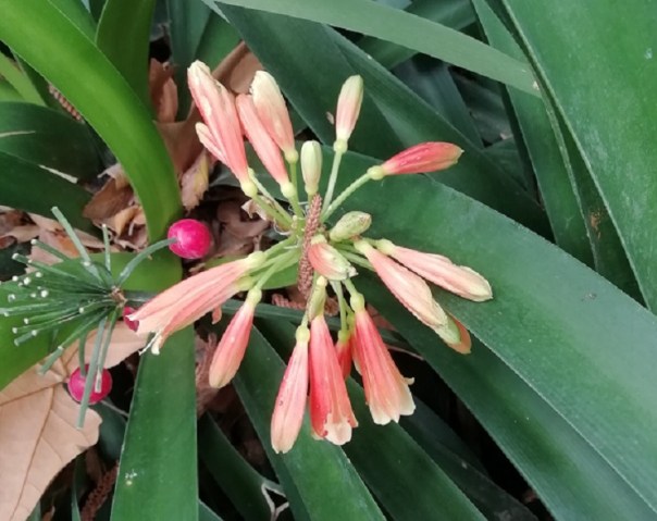
Is anybody still using a Microsoft Autoroute programme on their computers? I have the 2010 version and together with Google Maps & Google Earth, use it for all my route planning. I had decided it was time for another day out, away from the site. Usually I try to plan a circular drive with three or four stopping off points. The route which I’d worked out for yesterday began by doing the nine mile sprint westward along the A7, then taking the familiar road along the valley bottom, then up into the hills to Viñuela. I took the road to the western side of the lake, and there, I saw the first signs of Spring – the almond blossom coming into bloom on the trees.
A few miles further on I called in at Camping Viñuela.

I’ve known about this site for years although I’ve never stayed there. I walked around the site some years ago and the place was deserted. This time, there were probably ten or so outfits on the pitches.
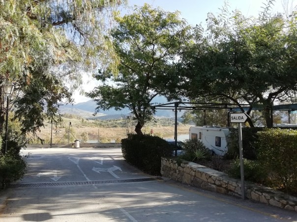
For anyone who is fond of hiking, it could make an ideal base. Reception was closed, but from what I could make out from the Spanish price list, in the winter, a pitch for an outfit+2 people would be €16 per night with a 30% discount for staying for a month. No mention was made of electricity so maybe it’s on a meter. Considerably more than what I currently pay. Also on the down side …………….the nearest large supermarket is 9 miles away. But the views…………..
 The white building on the extreme left is the hotel/camp site.
The road continued for another twenty miles following the undulating ground through the mountain ranges.
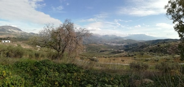
Eventually I arrived at my next stop in Casabermeja, a village close to the Malaga to Antequera motorway.. Casabermeja’s claim to fame is its San Sebastian Cemetery – declared in 1981 to be of historic and artistic value. See: https://www.tripadvisor.com/Attraction_Review-g2440070-d2717787-Reviews-San_Sebastian_Cemetery-Casabermeja_Province_of_Malaga_Andalucia.html All the graves are built above ground, as they often are in Spain, but the tombs are set out in streets – some even with their own pavements.

Continuing on my drive, my route took me under the A45 motorway, along the road heading towards Villanueva de la Concepción. But I needed to go slowly because I was looking out for a dirt road signposted “Arroyo Carnicero” and leading off through the olive groves. My search was on for an olive tree. Not any old olive tree – but this one.
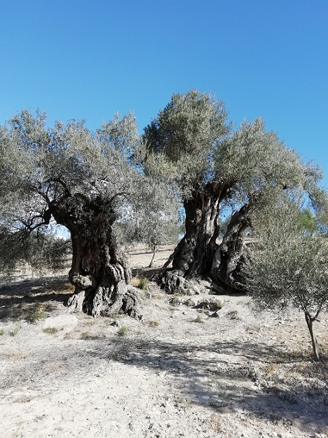
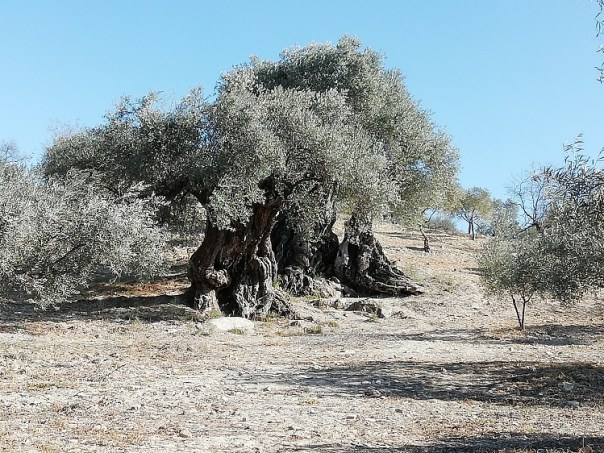
What makes it special is that it has three trunks. Cordoba University has carried out dendrochronology on the tree and their tests tell them that the tree has been growing for more than a thousand years. It’s mind-boggling to think that an Arab farmer was here planting this olive tree even before the Battle of Hastings took place in England. Despite its appearance, genetic studies have confirmed that the three trunks all grow from the same root. Back at the car, the remote area made it an ideal spot to unload my chair, open a beer and have a picnic lunch.
Later, I took the motorway and drove fifteen miles towards Malaga. After leaving the A45 at the last exit, in less than a mile I arrived at the Jardín Botánico-Historico. I parked close to the entrance and paid the €3 entry fee.
In 1855 Jorge Loring whose family owned the Malaga Iron Foundry married Amalia Heredia and they began buying up several fincas, olive groves and citrus fruit plantations situated to the north of Malaga. They planned during their honeymoon to bring back exotic plants from all the countries they visited around the world. They built the mansion which is still standing in the grounds.

Over the next sixty years the gardens continued to grow and mature. Being in the foundry business, the owners had a long pergola created from cast iron and over the years, has become intertwined with branches of Japanese Wisteria which I’m told comes into flower during March.
In the rest of the house there is further evidence of their ‘iron’ connection.
Also during the 19th Century, the French-born archaeologist, George Bonsor was discovering and excavating the Roman artefacts at Carmona. He, together with his partner took every opportunity to sell some of their discoveries to the highest bidder. Hence, one of the newly discovered Roman mosaic floors at Carmona was lifted, badly damaged then installed in the Loring museum built in the grounds.

By 1911 the house and gardens had changed hands and had been bought by a family whose business was in ship building – this time a family from Bilbao. They continued expanding the gardens but they mainly used the mansion as their winter home, staying from September till May.
In 1990 the house and grounds was purchased by Malaga City Council, in whose care it now is.
0-0-0-0-0-0-0-0-0-0
When I went to bed the full moon was streaming in through the roof light. I don’t sleep terribly well at the best of times, so it was no hardship to get up at 5am on Monday morning. I pulled on a tracksuit, grabbed my camera, and went outside. At that stage, the moon was semi-eclipsed. With the camera being hand-held, and on a longish exposure, the pictures don’t have great definition. This is the moon at around 5.10am.

I returned to the caravan, made some coffee and had a read for an hour. When I went out again, the moon was fully eclipsed. There it was – fully round again, but glowing in an eerie orange colour.

No wonder our ancestors became afraid and fearful about the near future. At the time, many Londoners were convinced that the plague which broke out in 1665, followed by the Great Fire in 1666 were the result of the eclipse of the moon which took place only a few months previously.
If you missed the eclipse this time round, your next opportunity to see one in Europe will be in May of 2022.
0-0-0-0-0-0-0-0-0-0
Yesterday’s drive to Maro was only eight miles along the coast road. It’s a tiny place situated on the cliff top and long since bypassed, first by the N340, then more recently, by the A7 motorway. All the parking is outside the village so I unloaded my bike in a space close to El Acueducto del Águila —- the Eagle Aqueduct. The design is copied from the Roman style of building aqueducts so it’s made up of 37 arches arranged in four tiers.
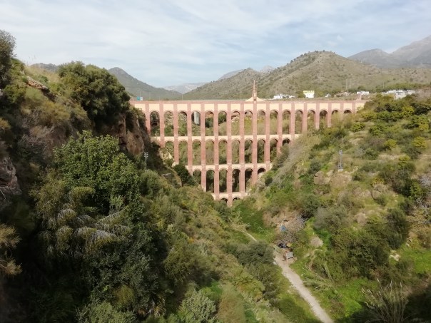
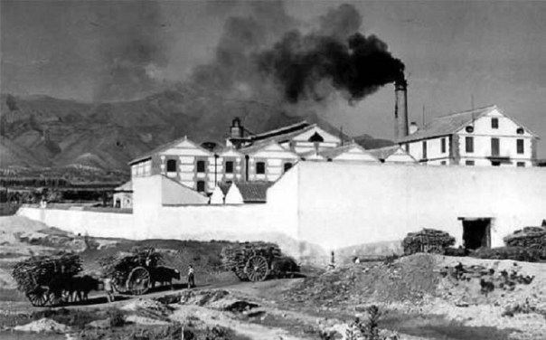
Building was started 140 years ago to carry water to a newly opened sugar factory, one of three which were built in the district to process the local grown sugar cane.
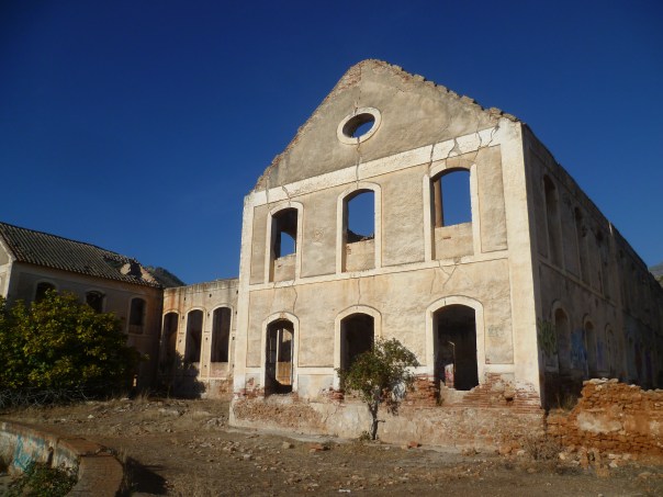
Sugar cane has been around for more than a thousand years and it was very likely introduced into Andalusia during the Arab period. In England, because of high taxation, sugar was very expensive with the price being up there with that of the most expensive spices. But in1874 the tax was removed, making sugar available to almost everyone. Within thirty years of the Nerja & Torrox factories opening, the sugar industry in southern Spain had collapsed and with the factories closing down, the land previously growing sugar cane was turned into smallholdings, growing vegetables, mangoes and avocados. All three factories now stand roofless, ruined and neglected. Water still runs through the Aqueduct but it’s now diverted into various irrigation ditches for the small holdings and greenhouses. I came across an interesting picture of the San Jose factory when it was working.
Just two years ago the Aqueduct underwent extensive repairs due to damage sustained during the Civil War. During the Battle of Malaga in February of 1937, many thousands of Republican supporters left the city to avoid the bombing and bombardment from ships. After the city had fallen, many of those that had remained were executed. Franco’s military commanders, aided by Hitler’s air force and Mussolini’s navy harried the refugees as they made their way along the coast road towards Almeria. A recently laid plaque at Torre del Mar commemorates the thousands who lost their lives on the journey.
During the same week, a cargo ship – The Delfin had been chartered to deliver a cargo of rice to Malaga. As the ship approached the city, she was attacked by planes of Göring’s Luftwaffe. Bombs and aerial torpedoes failed to sink the ship, although because of engine trouble, she drifted along the coast. She went aground near to Torrox lighthouse where her crew abandoned her. They later re-boarded and the vessel was towed into deeper water. She drifted slowly eastward, and was then attacked by an Italian submarine. She was finally torpedoed and the crew abandoned her once again. She sank close to the shore at Calaceite Point, less than 200 yards from the beach. Visiting the wreck is now a favourite dive for those who enjoy scuba-diving. The wreck can also be seen on Google-Earth. See my screen-shot for a close-up,
 and the last photo in this chapter. The white dot marks the wreck site.
My next stop was at the 17th Century church named after its patron saint, the Virgen de las Maravillas.
Across from the church a long pagola has been built to support climbing foliage. Palm trees and garden benches are spaced along one side, all with a lovely view towards the sea. The building without its roof is one of the abandoned sugar factories.

From the village I cycled down a narrow, twisting road through an area of greenhouses and small holdings. Suddenly, I was at the cliff edge, so I locked up my bike and walked some of the way down the steep hill towards a small, deserted beach sheltered between the two headlands.

Over to my left, standing high on the cliff top is one of many watch towers built along this coast. Some were built during the Arab occupation, others during the 15th and 16th Centuries, but all for the purpose of giving early warning against Barbary Pirates intent on pillage and capturing villagers to take back for their slave markets.
On the way back to my site I decided to visit the next watch tower along the coast.

I climbed the steep, zig-zag hill to the cliff top – only to be faced with disappointment. The tower was surrounded by a padlocked gate and a six-foot high chain-link. But the view made the climb worthwhile. The white dot marks the resting place of The Delfin.
0-0-0-0-0-0-0-0-0-0-0-0-0-0-0-0-0
-0-0-0-0-0-0-0-0-0-0-0-0-0-0-0-0-
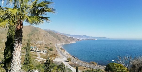
I came across an old aerial photograph when I was visiting a local museum the other day., It showed the coastline near to the site where I’m staying. The photo was taken in 1960 and had the lighthouse not been in the picture, there was nothing from which to identify the view.
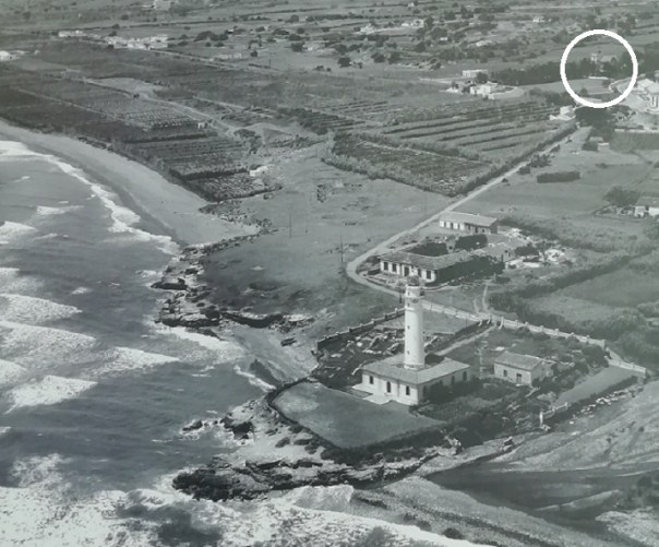
Trawling through dozens of other pictures, I found one taken from a similar view point but about forty years later. Comparing the two images, apart from the lighthouse, the only other building which is common to both pictures is the one within the white circle.
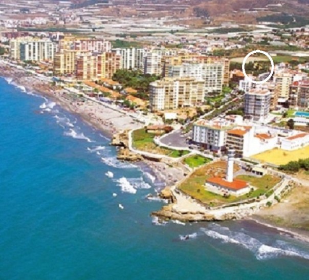
It’s the 19th Century Villa El Recreo.
In its heyday, besides standing in its own extensive grounds, surrounded by walls and wrought iron gates, it would have had a clear view across agricultural small-holdings, right down to the seashore. Along the drive, from the porch down to the front gates, one would have walked through an avenue of palm trees. Just a few farm labourers and local fishermen would have lived locally.
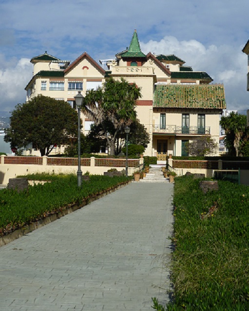
Today the Villa is still there although no one has lived in it for many years. The palm trees are long gone, having succumbed to an infestation of palm borer beetles. An Aldi supermarket has been built slightly to one side of its frontage, and a Lidl supermarket has been built behind it. New apartments fill the other two sides. Across the road, the 200 yard strip of what was once open land, is now filled with concrete high-rise. When I viewed the villa seven or eight years ago some attempt was being made to keep the buildings and grounds tidy. Now it’s overgrown and neglected with a ‘For Sale’ notice attached to the front gates.
There is intriguing information about the ownership of the Villa. Some years ago the local authority was very tight-lipped about ownership, but local gossip has it that at the end of the Civil War, General Franco gave the Villa as a gift to Eva Braun, the mistress of Adolf Hitler, whom he married just before they committed suicide together in 1945. It would be interesting to know the authentic history.
0-0-0-0-0-0-0-0-0-0-0-0-0-0-0-0-0
-0-0-0-0-0-0-0-0-0-0-0-0-0-0-0-0-
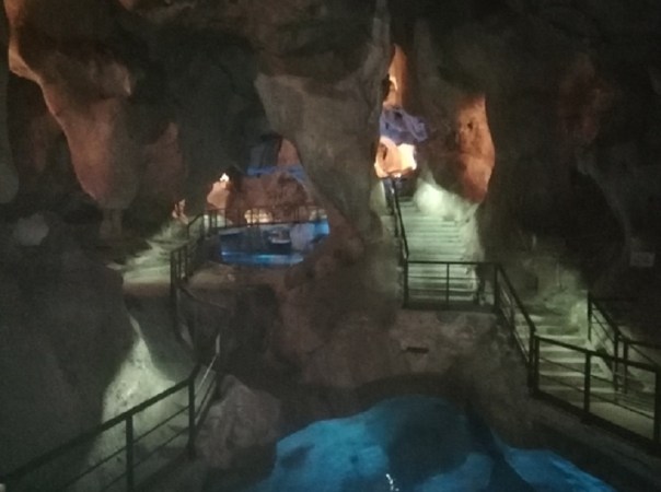
Time is running out for me here and I wanted to give myself at least one more day out before I leave. Somewhere I haven’t been before – which is difficult after so many years. But the internet and Google Earth came to my rescue. After packing some lunch into the cool-box, I was ready to leave El P by 9.15. I headed along the A7 in the direction of Malaga. I took exit 251 and within five minutes I’d arrived at La Cueva de Higuerón at Rincón de la Victoria. It’s one of the few marine caves in the world where a mixture of fresh and salty water from the sea, together with the rise and fall of the tide, has created underground caverns. This one is now some distance from the coastline. Over the entrance, the management uses its popular name, the Cave of the Treasure.

The reason for ‘Cave of the Treasure’ is because of the tales told about them. It was said that a royal hoard of gold was deposited here in the 12th Century by an Arab Emperor just before he was killed. Over the years the treasure was forgotten about, and it was not mentioned again until the 17th century, when a long lost manuscript was supposedly discovered detailing where the treasure was hidden. During the 19th century a local archaeologist spent a lot of time over his 38 year career searching for it. In all that time he found six gold Islamic coins, weighing in all, just 4 grams. However he also discovered a selection of ceramics, some wall paintings, as well as utensils said to date from the Neolithic period.
The caves are extensive, with railed walk-ways leading from one cave to another.

At the furthest distance away from the entrance is an alcove where water constantly cacades down forming deep pools below the paths.
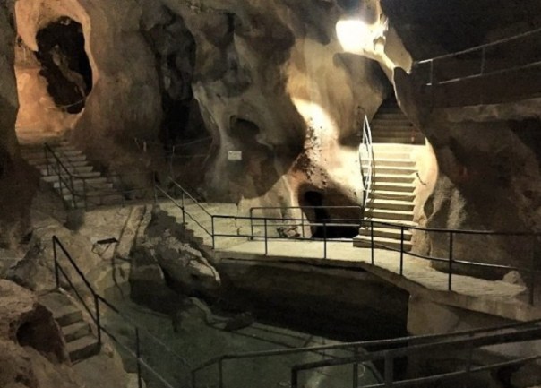 Some caves also contain hand prints although with the low level of lighting, I missed them.
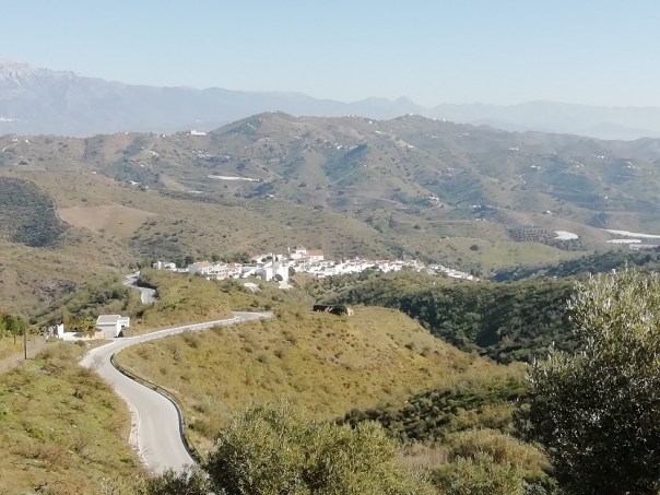
Leaving the car park, I rejoined the motorway for a few miles before taking an exit further along. I drove inland, up into the hills and after a few miles I arrived at the village of Macharaviaya.
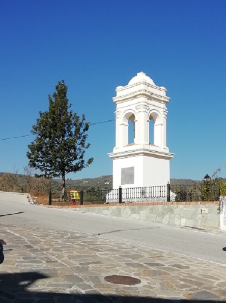
The village was built on the ruins of a Moorish settlement and was home to the Gálvez family, members of the Spanish nobility. Three sons all held positions in the Spanish Court. Bernado, a son of the next generation became the Governor of Louisiana, Captain General of Cuba and Viceroy of Mexico. He aided the Americans in the War of Independence and his forces captured Baton Rouge and Pensacola from the British. The city of Galveston was named in his honour.
In the village the family built the Real Fábrica de Naipes – The Royal Playing Card Factory which for many years produced more than 30,000 packs per year giving the factory a monopoly on the sale of playing card throughout the whole of the Spanish Indies.
The family installed drinking water fountains in the village streets,

had paving laid along the roads, and supervised the reconstruction of the local church which was originally built in 1505. A plaque (in English) fixed to the outside wall of the church tells of his achievements.

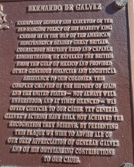
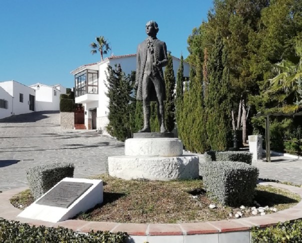
At the entrance to the village there’s a shrine dedicated to the family and a statue in the main square commemorates the life of Bernardo.
The family crypt is below the church. Bernado died from typhus whilst he was in the Spanish Colonies at just forty years old.
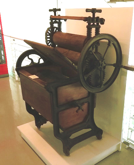
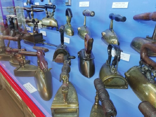
My last port of call was to a two hundred year old disused sugar factory in Torre del Mar. Unlike the factories at Nerja and Maro, this one at Torre del Mar has been restored and is now used as a cultural centre. It stands on an impressive site, still with one of its chimneys in place. Recent palm trees have been planted on the forecourt.

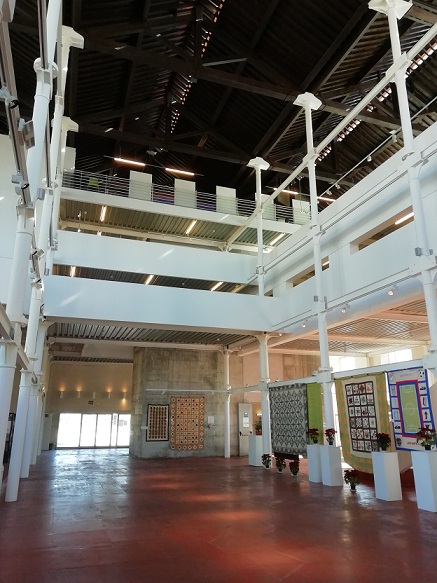
Exhibitions are displayed within which are changed from time to time. In addition to some of the original machinery, there is a display of ancient laundry and ironing ironmongery. Everything from simple flat irons through to gas and oil powered irons. Not just one or two – simply hundred of them.
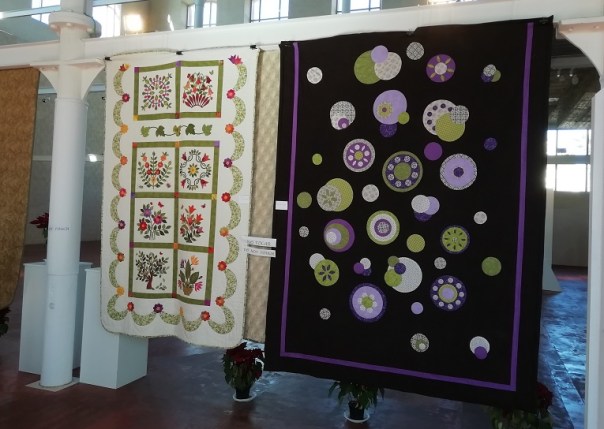
On another floor were some fine examples of modern appliqué needlework in the form of bed quilts. Some of the exhibits were just superb – with such vibrant colours and designs. Along another wall was an exhibit of dressed dolls and appliqué designed cushion covers.


0-0-0-0-0-0-0-0-0-0
By mid-week the weather men were forecasting high winds and heavy rain for the Costa del Sol after the weekend. Certainly by Saturday the view out to sea was looking very stormy.
In view of that, I thought it advisable to take down my awning on Sunday, ready to leave on Tuesday. Saturday morning was spent cleaning the kitchen equipment and emptying the awning ready for packing away the next day. I was most grateful to see Willy and Jim come down to lend me a hand. By 11.15, everything was bagged and put in the car.
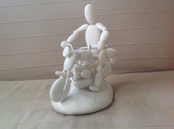
Monday’s rain didn’t arrive. In fact, it was a pretty decent day. In the afternoon, I took a stroll around the site to say farewell to lots of friends I’ve met over the years. I found Willy working on his latest pebble model. You probably recall I wrote about his hobby in an earlier chapter. His current job isn’t finished yet. He still has the rider to make to complete it.
My sailing is on Sunday afternoon from Santander, so leaving on Tuesday gives me a leisurely journey of around 160 to 200 miles each day with time for a bit of sightseeing. So for the first day, with a departure at around 9.15 from El Pino I expected to arrive at Santa Elena in time for a late lunch. Within two miles of leaving the site, I was on a toll-free motorway which continues all the way to Santander. After nearly a 100 miles I pulled into a filling station for a coffee break. I didn’t need fuel but the site has a large lorry park where caravan parking is easy. Once refreshed, I didn’t stop again until I reached Santa Elena.
I booked in at Camping Despenaperros which is situated at the far end of the village in Calle Infanta Elena. The site entrance has a double arched entry which with long outfits needs some care in entering.
Pitches are level and all under trees without any boundary markers. Each pitch has an adjacent electric point, water tap and drain connection although some of the electric sockets need attention. Electricity for the pitch is switched on at reception so if the supply is accidentally tripped, you maybe be in trouble since reconnection requires a visit during office hours.
The toilet block is centrally placed on the site and all the facilities are modern and in a clean condition. However, whilst toilet rolls are provided, none of the pans are fitted with seats. Free Wifi is available over most of the site. With my ACSI card I was charged €18 for the night. That’s a 1Euro increase since November.
After a quick lunch it was still only 2.30 so I thought I would go and have a look at Cimbarra Falls, close to Aldeaquemada. It’s in the next valley and only 10 miles away as the crow flies but via the mountain road, the journey takes 20 miles. As the road twists ever higher, looking back there are some spectacular views of the tunnels and viaducts which now carry the A4 motorway across the Despeñaperros Gorge.
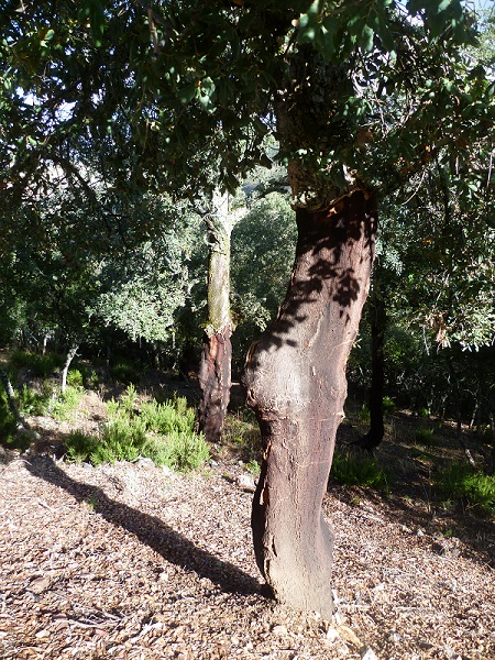
The twisting road passes through woods filled with a type of oak trees which produces cork. A cork oak must be at least 25 years old before its bark can be harvested. Its cork can then be stripped every 9 or 10 years after that for as long as the tree lives.
Eventually the road drops again and one arrives at a small, scruffy looking town. From there an unpaved road goes through olive groves and finally ends at a parking spot. A circular route is scramble over rocks along the edge of the ravine before arriving at a view point over-looking the water fall. Because of a dry few weeks, not much water was falling.

To return to the site I drove along the old A4 which first weaves its way down one side of the gorge, along the bottom, then up the other side. It was a nostalgic drive – I couldn’t help but remember times past, before the viaduct was built, when the road was filled with nose-to-tail, crawling HGVs.
I was ready to leave Santa Elena by 08.30 and took a coffee break at my usual filling station at KM98 having done around 100 miles. I made a fuel stop south of Madrid then took the M50 around the city. Traffic was very light. I arrived at La Cabrera in time for a late lunch having done 206 miles. This site has also increased the ACSI fee to €20. Just one other outfit is keeping me company.

0-0-0-0-0-0-0-0-0-0-0-0-0-0-0-0-0
-0-0-0-0-0-0-0-0-0-0-0-0-0-0-0-0-
In the late evening, four more outfits arrived at Pico de la Miel, bringing our number to six overnight. Since I stayed hitched, I was ready to leave by 8.45. A few minutes with the engine ticking over whilst rear lights and hitch were checked was sufficient to thaw the frozen windscreen.
Within 20 miles I’d reached the foot of Somosierra. The next four and a half miles was a steady 6% climb to reach the top of the pass. But it’s an easy tow on a three lane motorway with gentle bends. The downward slope is a similar gradient and equally as long.
After 100 miles, I stopped for a coffee break. I also debated whether to stay at Fuentes Blancas at Burgos or continue on to another site I’d heard about at Aguila de Campoo on the A67. http://campingmonteroyal.com/ It looked good on the website however Tripadvisor posted several derogatory comments about the site. I should have heeded them – instead I continued to there. Tomtom lead me to the entrance, which involved a tow around the town then three miles down a narrow country road. Reception was closed so I parked outside and went in. Across the forecourt a young guy was working on a car so I went across and asked him if they were open. Without removing his cigarette, he told me “Si — no agua en los banos”. I tried to ask him more about the water supply but he didn’t want to help further so I decided to leave.
Back in the car, I faced a dilemma. Either go 70 miles back to Burgos or do 70 miles onward to Virgen del Mar at Santander. But I still had three nights to put in before my sailing. I decided to drive on to Santander. I’ve stayed at the site several times over the years. It’s not a bad place and I’ve written reviews in previous years. It is however, the most expensive site I’ve ever used in Spain. Summer and winter, it’s €12 for the pitch, €5 for the electric, €5 for each person. So for a couple, it’s €27 per night.
After I’d pitched up and had a very late lunch, I walked down to the nearby beach car park. There’s a drinks kiosk – only open in the summer. The outside of the kiosk is decorated with several old adverts – possibly pre-war and English.
When the tide is in, the island is really an island. A foot bridge connects to the mainland. Situated at its highest point is a small chapel. Built in the 14th century, the shrine honours the Virgin of the Sea, the patron saint of Santander. The chapel is only open on special occasions. I took a walk over to the seaward side of the cliffs.
The weather had been beautiful all the way north and it looked set to continue, so on the Friday, I prepared a packed lunch and set off along the motorway. Within 20 miles I’d arrived at Santillana, a village which in medieval times was one of the stops on the northern pilgrim route, the Camino de Santiago. Tomtom led me to a huge car park on the outskirts of the village. No pay & display. Stay as long as you like. The village is totally pedestrianized, except for residents and deliveries, so armed with a map collected from the tourist office, I set off along the cobbled streets. The most important building in the village, standing in a small plaza is the Colegiata de Santa Juliana, a church built in the 12th Century.

 Close to the chancel is a tomb said to contain the relics of Juliana who was tortured and then beheaded (in Naples by the man she refused to marry!)
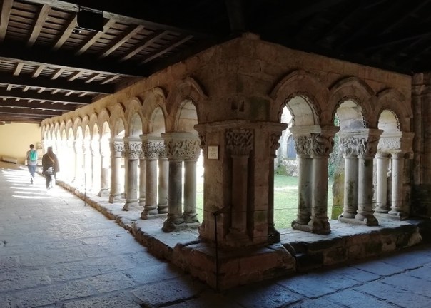
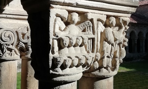
A joining the church are the cloisters which have some remarkable carving around the capitals – sadly looking rather weather-worn now. Across another square stands a 16th Century house known as the Arenas Palace. A Spanish nobleman and local landowner had it built for his family.

Its a pity that views in these old villages are often spoilt by parked cars. In some of the pictures shown here, I’ve used ‘paint’ to get rid of them.
Back at the car, I continued my drive out to the coast and visited Comillas, a one time fishing village and during the 18th Century, a whaling station. Now, just about the only fishing that takes place is with rod and line. But a lovely little harbour and beach.

0-0-0-0-0-0-0-0-0-0
On Saturday, I drove six miles along the coast to the Peninsular de la Magdelena. At the entry point to the park driving was for authorized vehicles only so I found a parking place along the sea-front. Again no pay & display and no restriction on time. I walked to the entrance of the park where I could see the palace high up on the hill. I’d made up my mind that it would be impossible for me to do the walk when I saw a tourist train approaching. I bought a ticket and boarded. It took the longer side of the circular route but finally we reached the forecourt of the palace – which happened to be at the back of the building. I expected that I would be able to get off the train, stroll around and catch the next one. But no! It didn’t stop; it just continued back to its starting point. So maybe not a complete waste of time but certainly a waste of €2.50.
From where I got off the train, I could see spectators being attracted by something so I wandered across. There were several large pens, open to the sea through tunnels. In each pen were four or five porpoise swimming around. Presumably someone feeds them at certain times.  Further up the hill was a display featuring sailing craft from adventures from many years ago. One of the exhibits was a balsa wood raft built in 1970 and sailed from Ecuador to Australia. The trip lasted 161 days and covered 8565 miles.
 Finding myself so close to the top of the hill, I continued upwards and walked around the outside of the palace.
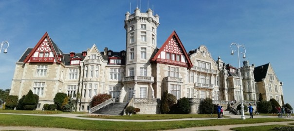
The Palace was built as a summer residence for the Spanish King Alfonso XIII who in 1907 married Princess Victoria Eugenie, one of the grand-daughters of our Queen Victoria. They had the palace built in the style of Osborne House on the Isle of Wight. By1930, and with a large family, the political situation had changed in Spain so both King and Queen were facing exile, however with their marriage already in trouble, mainly due to the fact that Victoria had proved to be a carrier of haemophilia, they separated with Alfonso going to France and Victoria going to Switzerland.
By the time I’d dragged my weary self back to the car, I’d walked a mile and a half. I’d had enough!
0-0-0-0-0-0-0-0-0-0
It’s sailing day today so I’m parked on the quay side at Santander. The Baie de Seine has already docked and unloading is going on. Shortly we’ll be starting to board. If every thing goes to plan, we should be in Portsmouth by 21.00 on Monday night. Within two hours I should be home. Which seems a good time to close this chapter of my blog. As in previous years, I include a breakdown of my essential costs. This year, a total of £2846. Around £500 more than last year, although I did less towed miles this year than last. Undoubtedly a large part of the increase is due to an eye-watering increase for my Red Pennant insurance. Up from £300 in previous years to this years £750.
Expenses
Ferry fare Outward £303
Homeward £324
Total ferry fare which included friends discount £627
Fuel for both directions £280
Toll Bilbao to Burgos Outward €21.50 £19
Site fees for 14 nights outward journey €176
Site fees for 3 months + 1 week €1050
Site fees for 5 night homeward journey €104
Total site fees €1330 Approx conversion £1170
Red Pennant for 120 days £750
Total £2846
It’s three months since I arrived home. Last night I had an email from my good friends, William & Yvonne who are still at El Pino and preparing to leave on Wednesday. That will be a full six months they’ve had away – lucky blighters! William is the guy I wrote about previously who we call the ‘Pebble-man’. His hobby is making models from beach pebbles. This is his latest creation.