On Wednesday I set off to the West Country for a two week stay. For the first week, I’d booked a site close to where my two girls and grandson were going to stay. The girls in a rented house and grandson at university. My destination was Falmouth, a journey of some 270 miles distance.
Within ten miles of leaving home, I’d reached junction 10 of the M25 and although it was still only 6.30 in the morning, the motorway was busy, but moving well. After 9 miles on the M25, my route would be the M3 and later, the A303. After eighty miles I took a coffee break at Solstice Services. Cars towing caravans share the bays with HGVs. Shortly after the next roundabout, the dual carriage way funnels into a single lane road for its passage past Stonehenge. The road continues with a mixture of duel and single carriageways all the way to Exeter. The M5 is joined for a few miles before it splits into the choice between the A30 or the A38 – both roads heading west. I chose the A30 which brought me to my site in the early afternoon.
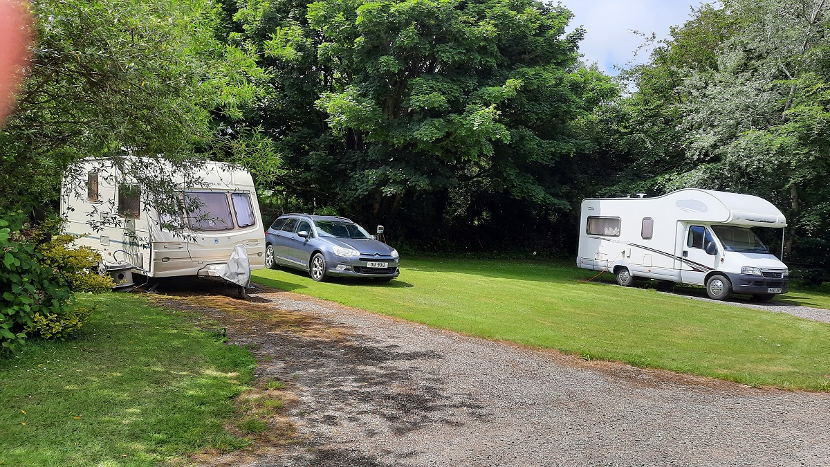
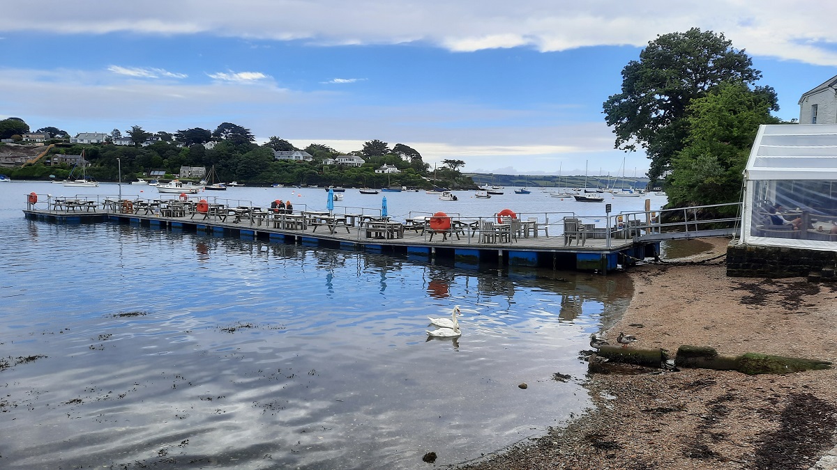
The site I’d chosen was the Camping & Caravanning Club’s CS at Goonreeve Farm. It was just a short distance away from Falmouth, and within ¾ of a mile from the main road. The site is situated on a sloping field with marked pitches down both sides. Each pair of pitches have a shared electric bollard and my pitch – pitch No.9 was hard standing, as was No 8. Even so, I needed around three inches of packing under one wheel to give a level floor. Water taps are situated at the top of the site, outside a small toilet block with a loo and a shower room. Chemical disposal is beneath a manhole cover hidden away within a copse of trees. With electric included, the nightly fee was £14 per outfit.
0-0-0-0-0-0-0-0-0-0-0-0-0-0-0
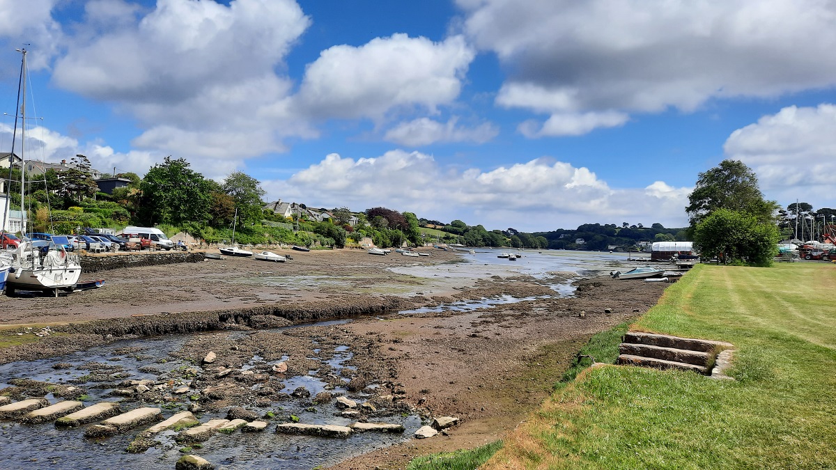
Thursday – The girls had not yet arrived at their house so I unloaded my bike, took a packed lunch with me, and set off down the country road from the site. It was fairly easy riding and mostly down hill to Mylor bridge, but then the road went up and over the next headland before dropping steeply to the yacht harbour. However the scenery made up for the hard pedalling. On my return, I checked the phone app and found I’d cycled 11 miles and covered a range of heights from 6 to 395 feet. But that’s Cornwall! By evening, I heard that the girls had arrived.
0-0-0-0-0-0-0-0-0-0-0-0-0-0-0
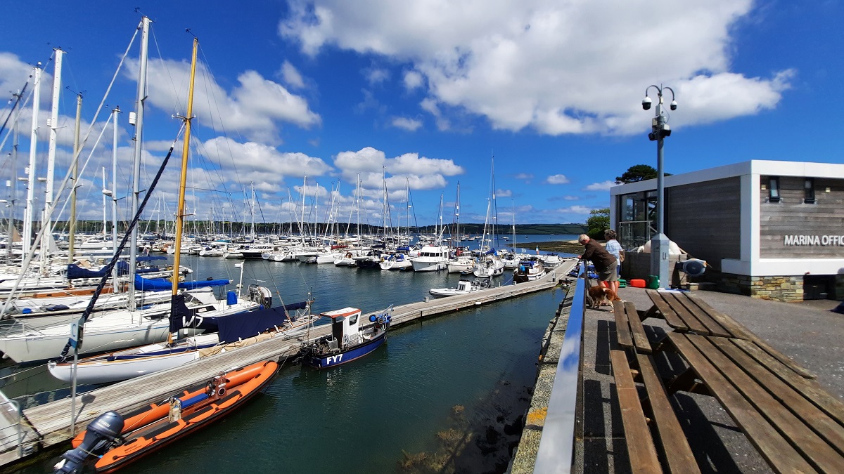
The girls and Sam came to visit me the next day so after lunch, we drove back to the lovely harbour I’d found yesterday. Whilst the girls and Sam took a walk around the coastal footpath, I contented myself sitting in a sun-lounger on the harbour jetty. We met up for dinner in the evening.

0-0-0-0-0-0-0-0-0-0-0-0-0-0-0
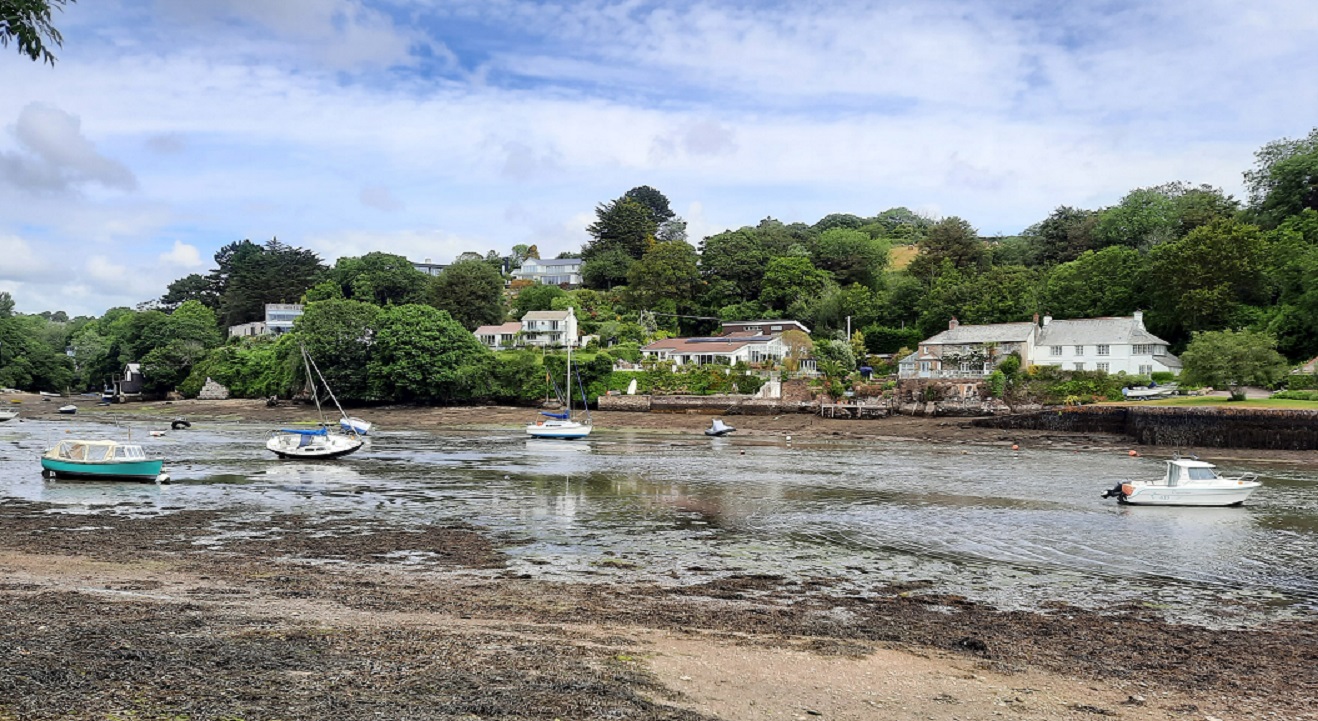
We each decided to do our own thing today. Sam and the girls went off walking and I prepared a packed lunch and got out the bike again. This time to cycled to Restronguet – another short, exceedingly hilly ride, but with some glorious scenery.


With the sun shining down, I sat for a time in the churchyard. A headstone across the path from where I sat caught my eye, and I couldn’t help but feel a touch of sadness for the guy who was buried there. He died in 1923, having lived for 94 years, but tragically, his wife past away when he was only 58. They lost one of their daughters at 21 whilst their second daughter died aged just 23. He lost his son at 41 years, with his daughter-in-law following only 17 years later. I couldn’t help but feel a touch of sadness at what must have been a grief-filled life.
0-0-0-0-0-0-0-0-0-0-0-0-0-0-0
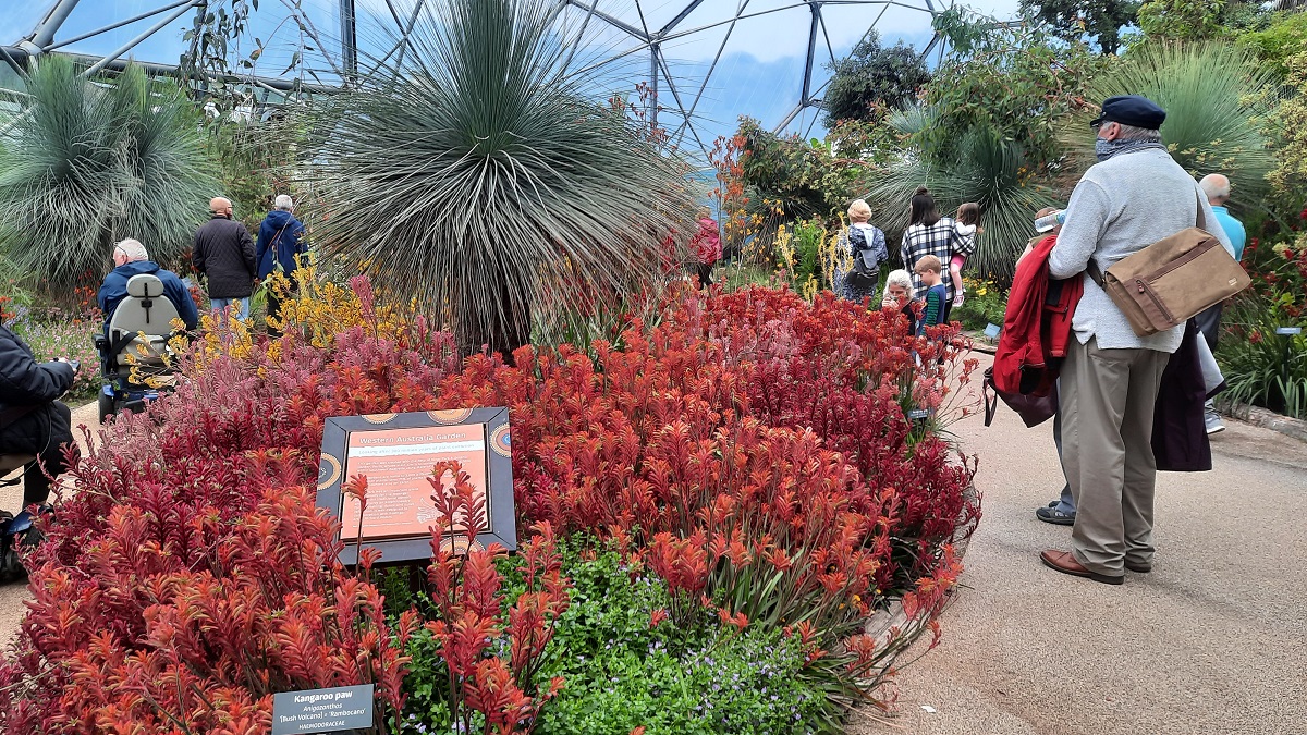
For today (Sunday) we had previously booked online to visit the Eden Project, 28 miles up the coast, near St. Austell. For the four of us, the admission cost would have been an eye-watering £124 but because they have an arrangement with Tesco, £42 worth of Tesco vouchers got us in. The forecast for the day was not particularly good but fortune smiled and the worst of the weather came during the periods when we were under cover. The complex is situated within a disused china clay quarry with the five great biodomes being erected at the floor of the quarry.

The sides are laid out with gardens and paths which wend backwards and forwards before reaching the floor.

The biodomes are devoted to different regions of the world with native trees and plants from those areas having been planted within the domes. Fortunately, any rain we had took place as we were either in the domes or in the under-cover picnic area.

0-0-0-0-0-0-0-0-0-0-0-0-0-0-0
Today, we planned to visit Portscatho on the peninsular across the River Fal. By road, the journey would be around 40 miles, but by using the King Harry Ferry, the distance was around 15 miles. I arrived just as the ferry was arriving at the road ramp. I was amazed to see the ferry was coming in with all the cars rear end first, meaning the cars would need to reverse off. But then – I noticed the ambulance.

The ferry had completed its crossing, but without unloading, had taken the ambulance on board and brought it across the river. With ambulance on its way, the ferry proceed to cross again. Once we found our car park, Sam and the girls went off walking, whilst I unloaded my bike and tackled a few more hills. We met up later to have a packed lunch.
0-0-0-0-0-0-0-0-0-0-0-0-0-0-0
Tuesday – The rain had started during the night and persisted all morning. By lunchtime, I had decided it would be an ‘in’ day. But then around 2.30 the weather suddenly changed, so I went online and was able to book a slot for 4pm to visit Pendennis Castle in Falmouth . My English Heritage membership took care of the admission fee. I drove through the town and out onto the headland on the western side of the mile wide river mouth.
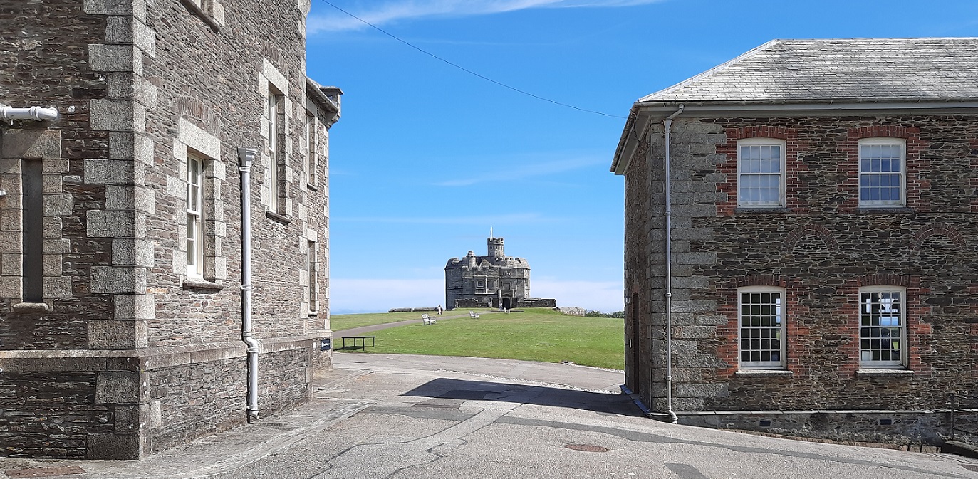

Pendennis is one of a chain of round artillery forts built in the 1540s at strategic points along the east and south coasts on the orders of Henry VIII. Because of his break-away from the Catholic Church, brought about by the King’s divorce from his Spanish Queen, and his second marriage to Anne Boleyn, the Pope encouraged all the European countries to be at war with England, leaving England’s southern shore vulnerable to attack. France and Spain had formed an alliance and were intent on invasion. A chain of forts was quickly built stretching from Kent right down to Cornwall. The area on which Pendennis is built is extensive because it has been adapted for use in later campaigns. An artillery barracks was built at the end of the Victorian era. Across the river mouth, on the opposite headland is a similar fort at St. Mawes.
0-0-0-0-0-0-0-0-0-0-0-0-0-0-0
Today (Wednesday) was moving day. The girls were preparing for home, whilst I was moving 150 miles up to Burnham-on-sea. t was an uneventful journey, with me leaving Goonreeve around 9.30 and arriving at the Hurn Lane CC Club site in the early afternoon. There was a good choice of available pitches and I chose one close to the water and toilet emptying facility. With electric and water plugged in, I spent the rest of the day on the sun-lounger.

0-0-0-0-0-0-0-0-0-0-0-0-0-0-0
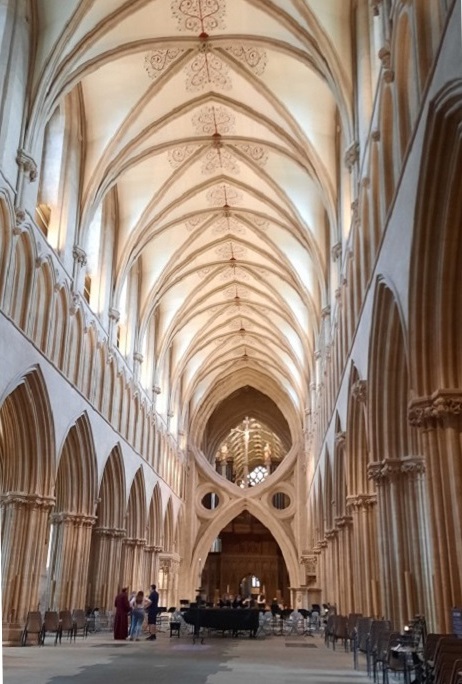
Jobs were done and lunch was packed and I was ready to leave the site by 8.30. I headed off for the City of Wells and found an on-street parking bay at the Cathedral Green. I was disappointed to find the view of the Cathedral’s West front obscured by scaffolding and partitioning. The West front was completed by the 13thC and it has a most impressive collection of medieval sculptures. There are still around 300 of the original 400 statues in position. I found a side door which was open to allow visitors in for ‘private prayer and contemplation’. As I entered, a rehearsal for a concert to be held that evening was just finishing.
Looking down the nave, my eye was immediately drawn to the scissor-shaped arches, which look more modern than what they are. In the mid 1300s the weight of the heavy lead-covered wooden spire was beginning to crack the tower structure. The scissor arches were quickly added to provide additional stability. Because of Covid, the nave and choir and high alter were closed to the public.
I followed the one-way system and as I reached the transepts I came across the famous clock. This clock is the second oldest clock mechanism in Britain. The original workings were made about 1390. When the clock strikes the quarter hours, jousting knights above the clock face rush round and round until one falls from his horse. Standing in the opposite transept is a wooden triangular cope chest. Dendrochronology indicates that the chest was made around the year 1126.


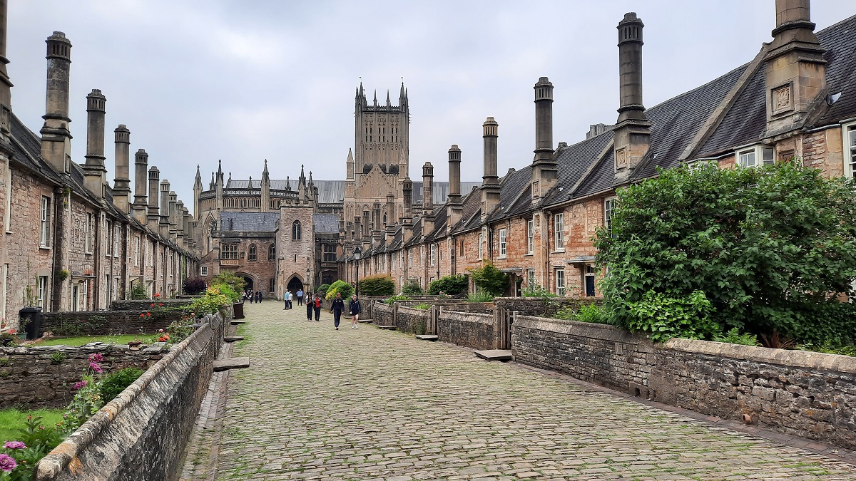
Within the grounds of the Cathedral is the Cathedral Music School which occupies many of the ancient buildings which once belonged to the Priory. During the 1300s the then Bishop of Wells over-saw the building of a complete street of houses. Vicar’s Row still exists, with many of the houses occupied by the Cathedral School.
Next, it was on to the site of the Bishop’s Palace. In medieval times bishops were also fighting men and often went to war with the King and his army. When at home, they lived in a fortified dwelling. Here, the bishops palace is surrounded by an outer wall and a moat with a gatehouse which originally had a drawbridge. Within the grounds are the original Wells, from which the City takes its name.

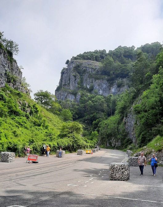
On the way back to the site I took the opportunity to drive through Cheddar Gorge.
0-0-0-0-0-0-0-0-0-0-0-0-0-0-0
Today called for an early start because I had lots of plans for the day. Sadly, the weather forecast wasn’t looking promising for the weekend so today (Friday) I had three visits planned. So my first online booking was at Wookey Hole for 9.15 and was around 20 miles away. GPS coordinates enabled me to find the car park quickly, although it was well hidden away down a frighteningly narrow track – aptly named The High Street. showed my phone on which I had my booking (a freebie thanks to Tesco vouchers) and I was issued with tickets and information. Then I followed the signs to the entrance. My word! What a long path-way! And steep with it! Had I known the distance, I would probably not have made the booking. But don’t let that put you off! Younger persons would do the walk and think nothing of it. But finally I made it to the entrance, and was relieved to see that I could progress at my own speed without having to keep up with a group. The long flight of steps went down and down until finally I entered a huge chamber which just went on and on. Steel handrails were dripping with condensation, and glasses becoming constantly steamed up, I headed for the bridge which went over a river.
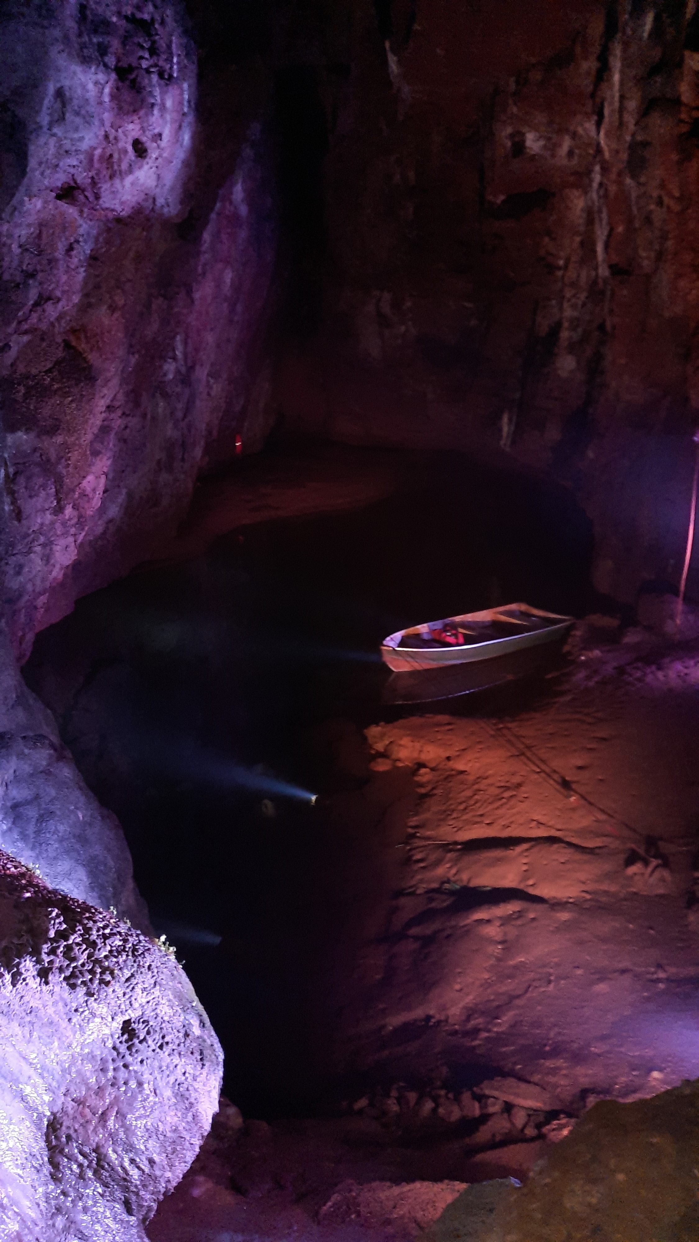
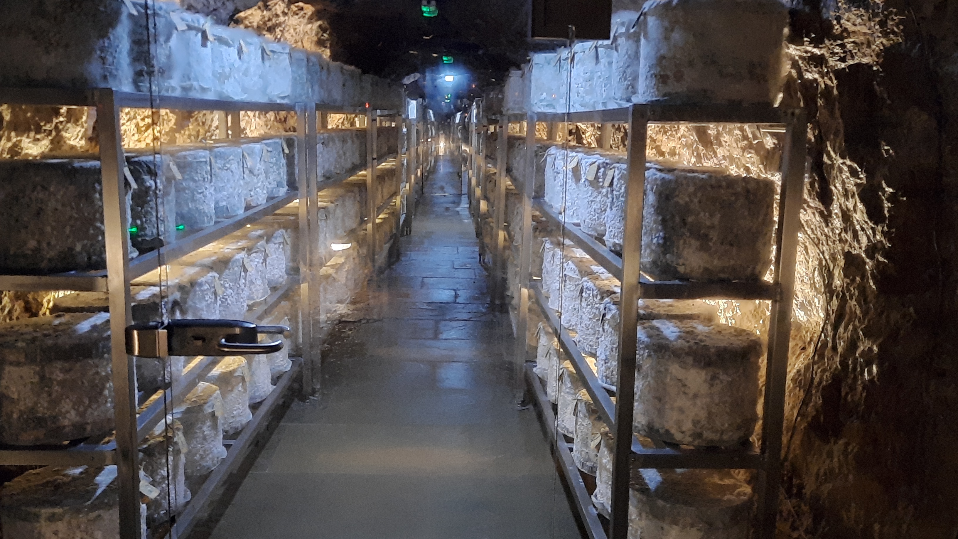
My information sheet told me was the source of the River Axe, which eventually flows into the Bristol Channel. The one way pathway continued through several more caverns, one of which was used as a cheese store where dozens of cheeses were maturing.
The tunnel continued until it finally exited at a lower level. Which was something of a relief – I’d been getting worried about having to climb back up all the steps!
After a quick cup of coffee, I set off for my next destination at Glastonbury, some eight miles away. I wanted to visit the Abbey. In it’s heyday, Glastonbury Abbey was one of the richest monastic houses in the country. The Abbot wielded tremendous power in the region and when this Abbey was founded, the Abbot would have been chosen from one of the leading Norman families. Kings and princes would be frequent visitors, and because the monks claimed to have found the tomb of King Arthur, rich pilgrims poured in. Much of the Abbey is now in ruins but there is sufficient left standing to show the immense size it must have been.

The Abbot’s kitchen can still be seen with its four great cooking fires where meat was prepared for the Abbot’s table.
Monks of the lower orders didn’t normally eat meat, but relied on a diet of fish and grain. It was during the period when the Abbey was functioning that the Somerset marshes were drained.
But in 1538 came the Dissolution – a plan hatched up between King Henry and his right-hand man, Thomas Cromwell to seize all the treasure from the 800 monasteries and destroy the buildings. The then Abbot was presented with the Deed of Surrender, but he refused to hand over the Abbey. Nothing would persuade him, so trumped up charges of heresy were brought against him. Naturally he was found guilty and was taken to nearby Glastonbury Tor where he was hanged, drawn and quartered. With the treasure seized, the Abbey buildings and lands were sold to John Thynne – the same family which now owns the Longleat Estate.
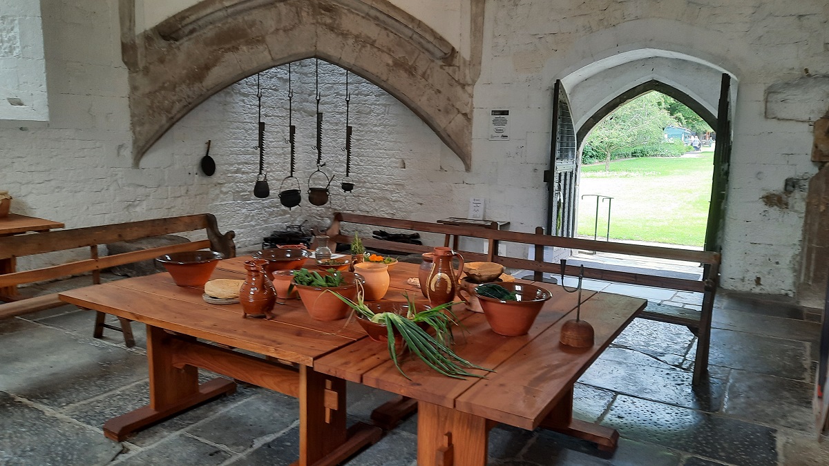
I found a nice spot under the trees and in the shade to enjoy my packed lunch. After enjoying the tranquillity for awhile longer, I returned to the car and set off again on another 12 mile journey, eventually reaching Mulchelney. where I wanted to visit the ruins of the Abbey. This one was founded by monks of the Benedictine Order but because of the Dissolution, in 1538 the buildings and lands were surrendered by the Abbott to the Crown.

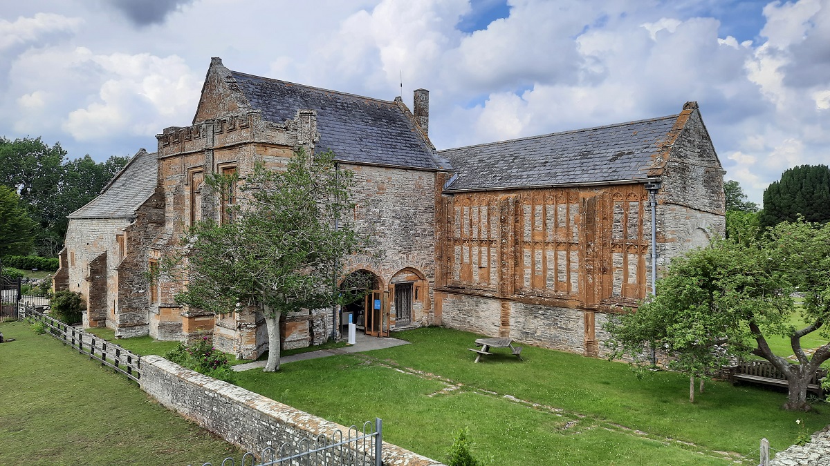
The whole parcel of buildings and land were given to Edward, of the powerful Seymour family – a friend of Thomas Cromwell and the elder brother of Henry VIII’s third wife, Jane Seymour. He had the Abbott’s house left as it was, but the church and all the other abbey buildings were torn down with some of the materials being used in the nearby parish church. But Edward’s ownership only lasted for 14 years. He fell out of favour and ended up at the executioner’s block on Tower Hill. All his possessions were taken by the crown.
0-0-0-0-0-0-0-0-0-0-0-0-0-0-0
The rain started during the night and persisted all the next morning. By two-thirty it has stopped and was beginning to look brighter, so I loaded the bike and drove ten or so miles to the medieval village of Axbridge. There are some lovely original houses in the market square and adjoining streets.

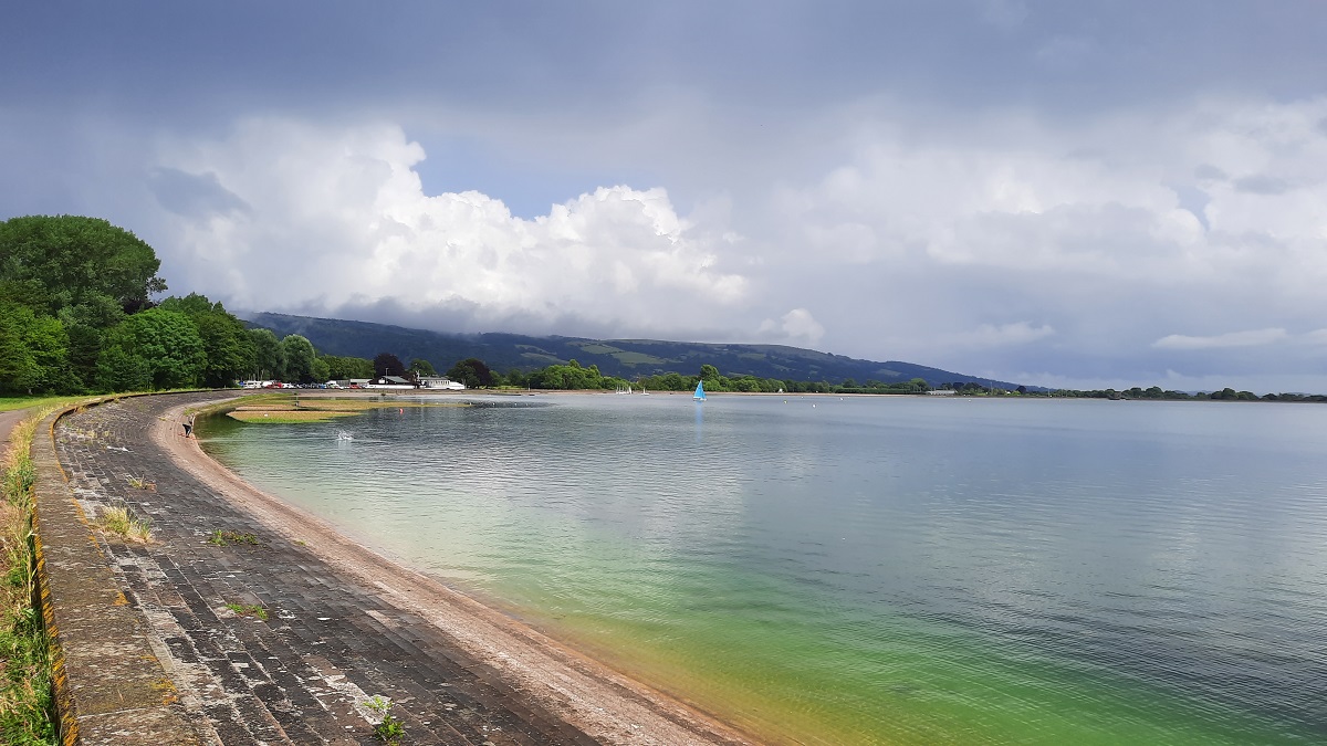
After a wander, I returned to the car and went in search of the nearby Cheddar Reservoir. After some difficulty, I eventually found the narrow lane leading down to the water and car park. Within minutes, the heavens opened and the rain was torrential. Over the next half hour, the rain hammered down and I watched as bedraggled walkers returned to their cars. Eventually, the rain stopped and I ventured out and walked up the slope to the water’s edge. The information board told that the circular path around the reservoir was 2.5 miles, but since the pathway was brimful of standing rainwater puddles, I gave up on the idea of a bike ride and settled for a stroll along the tarmac road leading to the Yacht club.. Which was fortunate, because very soon, the rain was back again. I called it a day and returned to the site.
And the rain continued throughout the night, and most of the Sunday. Which was a shame, because the Monday was the day that I had to set off for the drive home.
